
Highlighted Activity
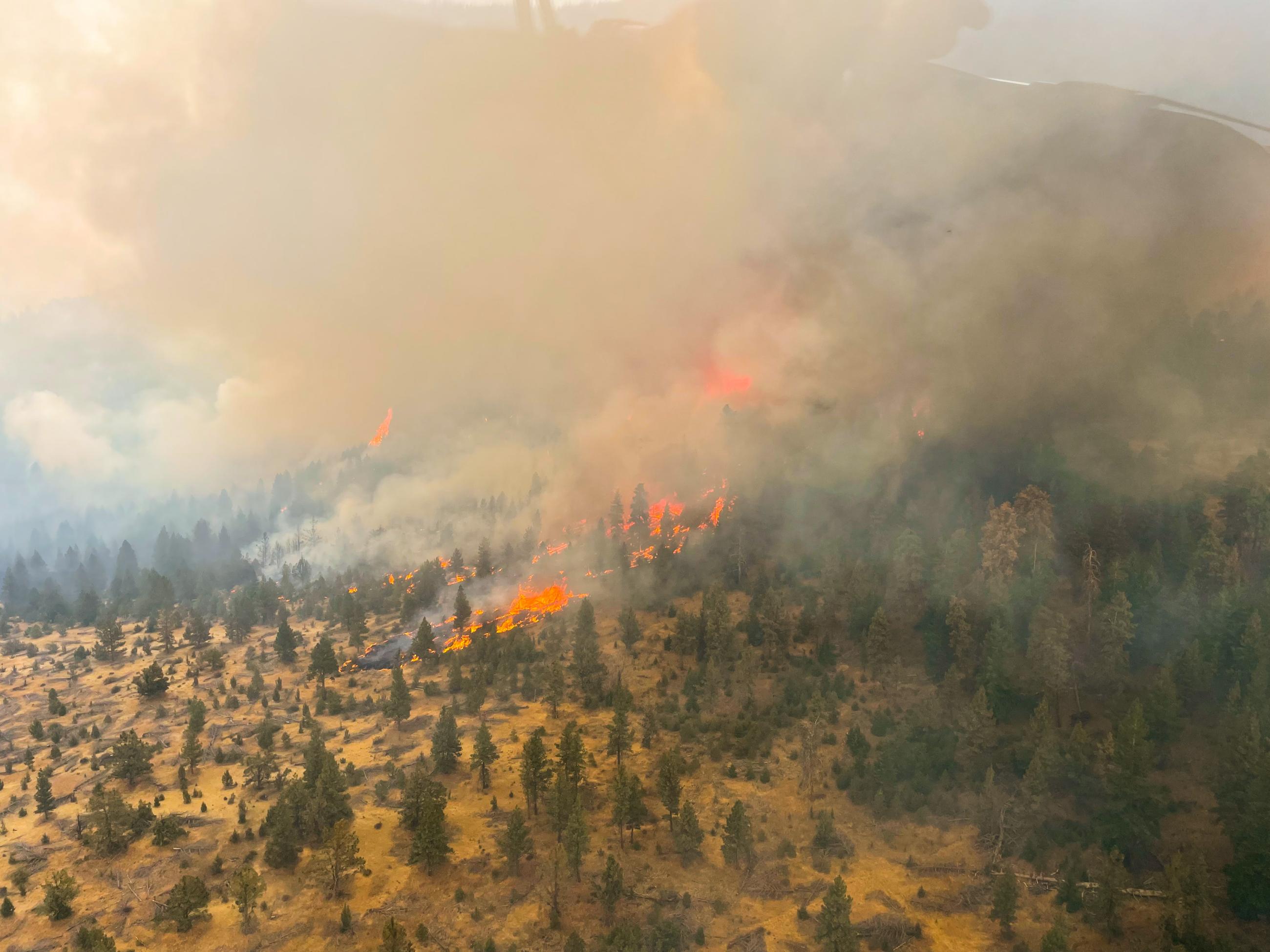
The Wiley Flat Fire started September 2, about 10 miles southeast of Post, Oregon. This incident was caused by lightning and is burning grass and shrubs in lower elevations and timber in higher elevations. The fire is burning Ochoco National Forest, Bureau of Land Management and private lands.
California Complex Incident Management Team (CIMT) 1 assumed command of the fire on Friday, September 6th. Prior to the California CIMT 1, the Central Oregon Type 3 Incident Management Team managed the fire.
Evacuations are in effect near the fire. An evacuation map is available online through the Crook County Emergency Management Office website. The Red Cross evacuation shelter is in the Carey Foster Hall at Crook County Fair Grounds SE Lynn Blvd. Prineville, OR 97754. Information number: 1-800-RED-CROSS.
Fire Restrictions and Closures: The Ochoco National Forest has implemented temporary closures for the Paulina and Lookout Mountain Ranger Districts. The Bureau of Land Management has issued a temporary closure for portions of public lands in Crook and Grant Counties.
| Current as of | Fri, 09/13/2024 - 23:31 |
|---|---|
| Incident Time Zone | America/Los_Angeles |
| Incident Type | Wildfire |
| Cause | Lightning |
| Date of Origin | |
| Location | 10 miles southeast of post, Oregon |
| Incident Commander | The incident is being managed by California Team 1, John Goss, Incident Commander as of September 6, 2024 |
| Coordinates |
44° 2' 14'' Latitude
-120° 18' 17
'' Longitude
|
| Total Personnel: | 566 |
|---|---|
| Size | 30,061 Acres |
| Percent of Perimeter Contained | 64% |
| Estimated Containment Date | 09/24/2024 |
| Fuels Involved | Fuels in the fire area are composed of various loadings of grass/shrubs and timber with litter and understory models. Live woody and herbaceous fuels ware seasonally dry and are contributing to rates of spread; grasses are fully cured. Higher elevations are dominated by conifer stands; lower slopes and harsh sites transition to shrubs and grass.
|
| Significant Events | Today's relatively warmer and drier weather will bring a slight increase in fire behavior. The fire area remains dry with rapidly diminishing effects of the trace moisture previously received. Western portions of the fire will continue to be active in timer, grass and shrub fuels until sufficient moisture arrives. Areas of limited upslope fore spread in the Pine Creek drainage and tributaries toward Mule Deer Ridge, along with minimal activity in the headwaters of Shotgun Creek north of Drake Peak. Today's mild weather will likely provide favorable conditions for suppression operations. Other areas of the fire are holding within containment lines with limited fire activity occurring.
|
| Planned Actions |
Secure control lines within Div R and Div A. Repair all indirect control lines. Repair direct control lines in Div E, Div G, and Div K. |
|---|---|
| Projected Incident Activity |
12 hours: Relatively warm ad dry conditions will produce an incremental increase in fire behavior as the day progresses. Expect pockets of limited fire spread on the upper slopes of Pine Creek toward Mule Deer Ridge; otherwise, heavy fuels will continue to smolder, ad limited surface fire spread will be observed. Some interior burning with flare-ups may occur as unburned fuel pockets consume 24 hours: Continued relatively cool temperatures, lower relative humidity, and generally light northwesterly winds. Fairly mild weather will continue to moderate fire behavior which includes pockets of backing, flanking, and limited fire spread within containment lines. Heavy fuels and stump holes will continue to smolder and consume in-place due to their seasonal dryness. Some areas of interior burning may occur as unburned fuel pockets consume. 48 hours: Cooler temperatures and higher relative humidity will continue to moderate fire behavior. Limited drying is likely to maintain smoldering and creeping fire behavior with limited surface fire spread. Heavy fuels will continue to consume and smolder in place due to their seasonal dryness. Some interior burning with flare-ups may occur as unburned fuel pockets consume. 72 hours: Continuing cool weather, increasing relative humidity, and cloud cover will maintain low-to-moderate fire behavior potential. Increasing afternoon northerly winds on ridge tops will be present which may cause interior flare-ups. Fire activity will likely consist of smoldering and creeping with areas of limited fire spread in timber fuels. Heavy fuels will continue to smolder and consume in-place until extinguished or sufficient moisture occurs. Some interior burning may occur as unburned fuel pockets consume. Anticipated after 72 hours: The cool weather pattern will continue bringing elevated relative humidity and partly cloudy sky conditions. Gusty northwest winds are likely to produce some interior flare-ups. Good nighttime relative humidity recovery coupled with higher daytime humidity will continue to moderate potential fire activity. Fire behavior will likely consist of smoldering and creeping with limited fire spread potential. Heavy fuels will continue to smolder and consume in-place until extinguished or sufficient moisture occurs.
|
| Remarks |
Current containment is 64%. |
| Weather Concerns | Synopsis: Warmer and drier conditions today. Max temperature of 65 degrees. Minimum RH 35% with light west winds. Observed: Warm and dry weather today will lower RHs Forecasted: Continued warm and dry conditions with some increase in cloud cover in the afternoon which will slightly limit how warm and dry, likely 5 degrees cooler and wetter. Northwest winds will develop in the afternoon with gusts of 10-15 mph. |
|---|