
Highlighted Activity
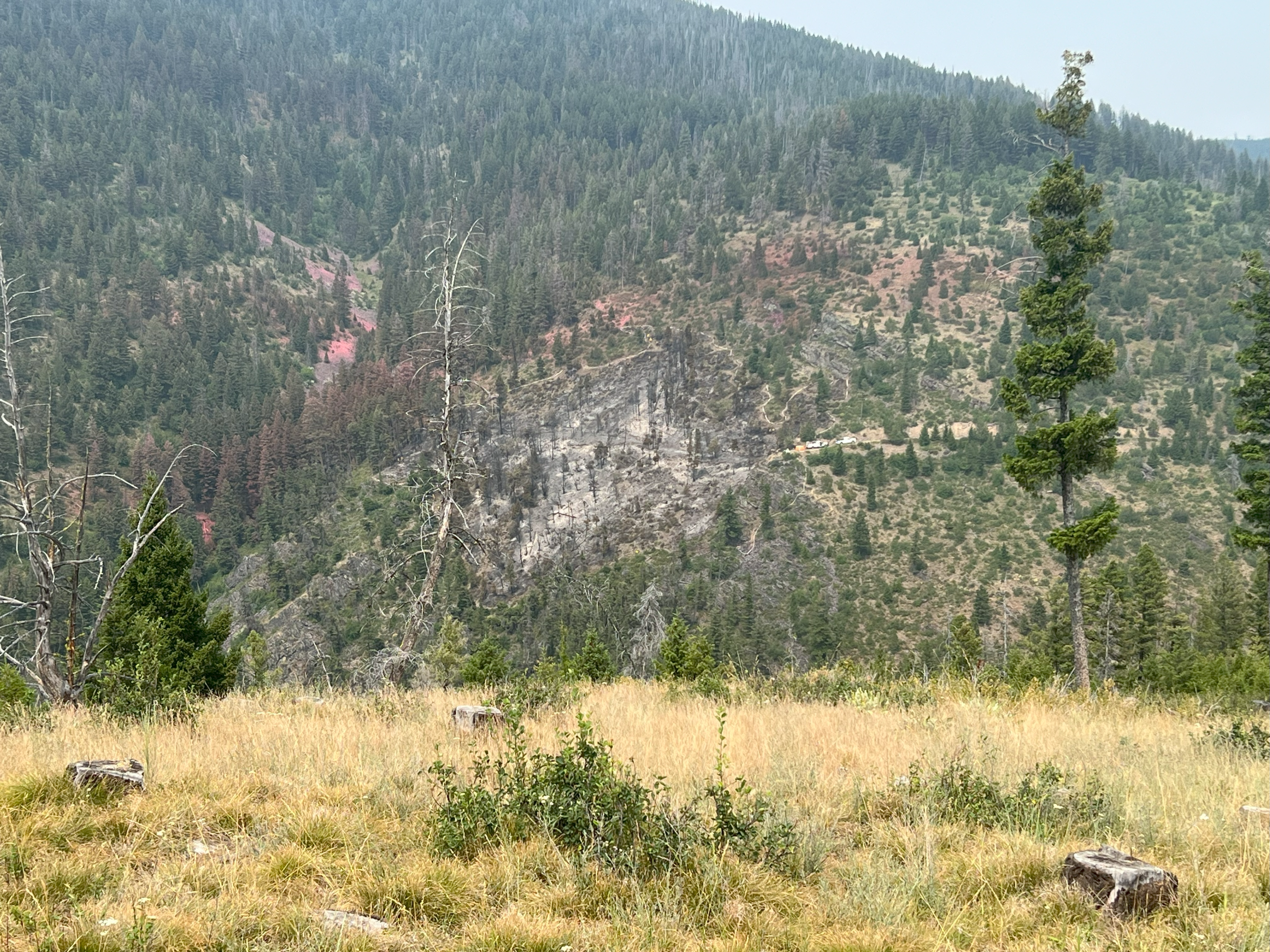
The Miller Peak Fire was first reported the afternoon of July 14, 2024. The fire is located about 8 miles southeast of Missoula in the Plant Creek drainage of Miller Creek. The Lolo National Forest takes over command of the fire Sunday, August 11, 2024 from Northern Rockies Incident Management Team 9. Sunday August 11 will be the final daily update moving forward at this time.
An area and road closure around the fire is in effect due to hazardous conditions resulting from fire activity and to allow crews to finish their work on steep, single lane roads. Specific closure information and maps are posted on the Lolo National Forest webpage at https://www.fs.usda.gov/alerts/lolo/alerts-notices.
| Current as of | Wed, 08/14/2024 - 09:17 |
|---|---|
| Incident Time Zone | America/Denver |
| Incident Type | Wildfire |
| Cause | Undetermined |
| Date of Origin | |
| Location | 7 miles southeast of Missoula |
| Incident Commander | Type 4 Incident Commander, Tyler Rowe |
| Coordinates |
46° 43' 52'' Latitude
-113° 51' 59
'' Longitude
|
| Total Personnel: | 52 |
|---|---|
| Size | 2,724 Acres |
| Percent of Perimeter Contained | 86% |
| Fuels Involved | Timber (grass and understory) |
| Significant Events | Minimal fire activity as interior green islands and heavy dead and down fuels continue to be consumed. Fire behavior is backing, creeping and smoldering. |
| Planned Actions |
Crews will hold and monitor containment lines. |
|---|---|
| Projected Incident Activity |
Creeping and smoldering. Potential exists for thunderstorm development with gusty outflow winds. |
| Remarks |
The incident transitioned back to the home unit, Type 4 Incident on Sunday August 11, 2024 at 6:00 am. |
| Weather Concerns | Low pressure currently whirling its way across central Idaho is the driving force for developing shower and thunderstorm activity across central Idaho and southwest Montana. Wetting rain chances increase (near 50%) with multiple rounds of showers and thunderstorms likely with storms capable of moderate to heavy rain. Aside from thunderstorms, winds will be relatively light and diurnally driven with afternoon gusts into the teens. Watch for gusty outflow winds to near 40 mph near any thunderstorms. |
|---|