
Highlighted Activity
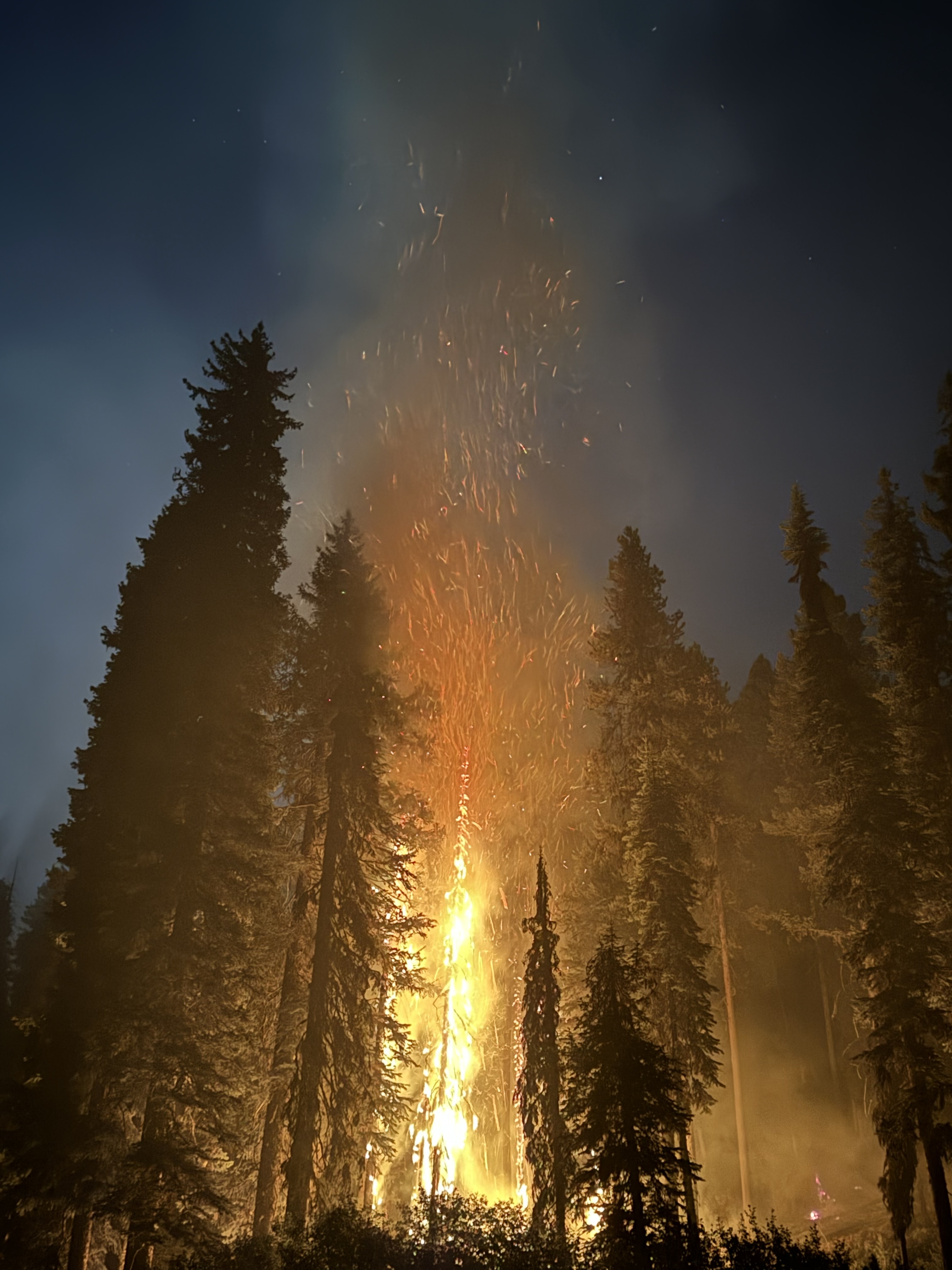
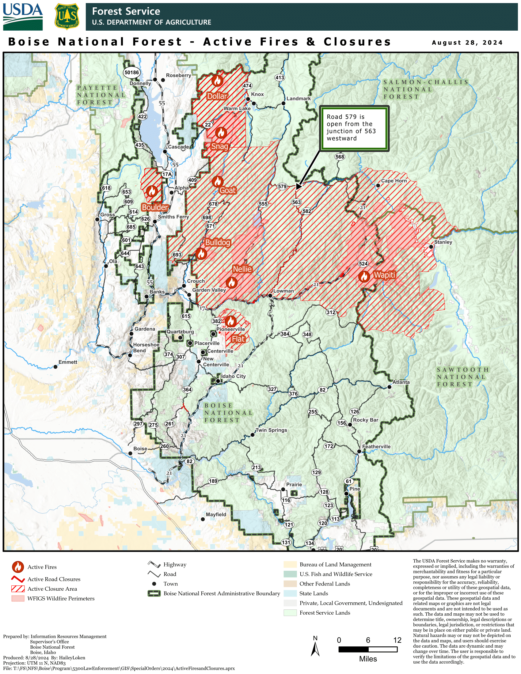
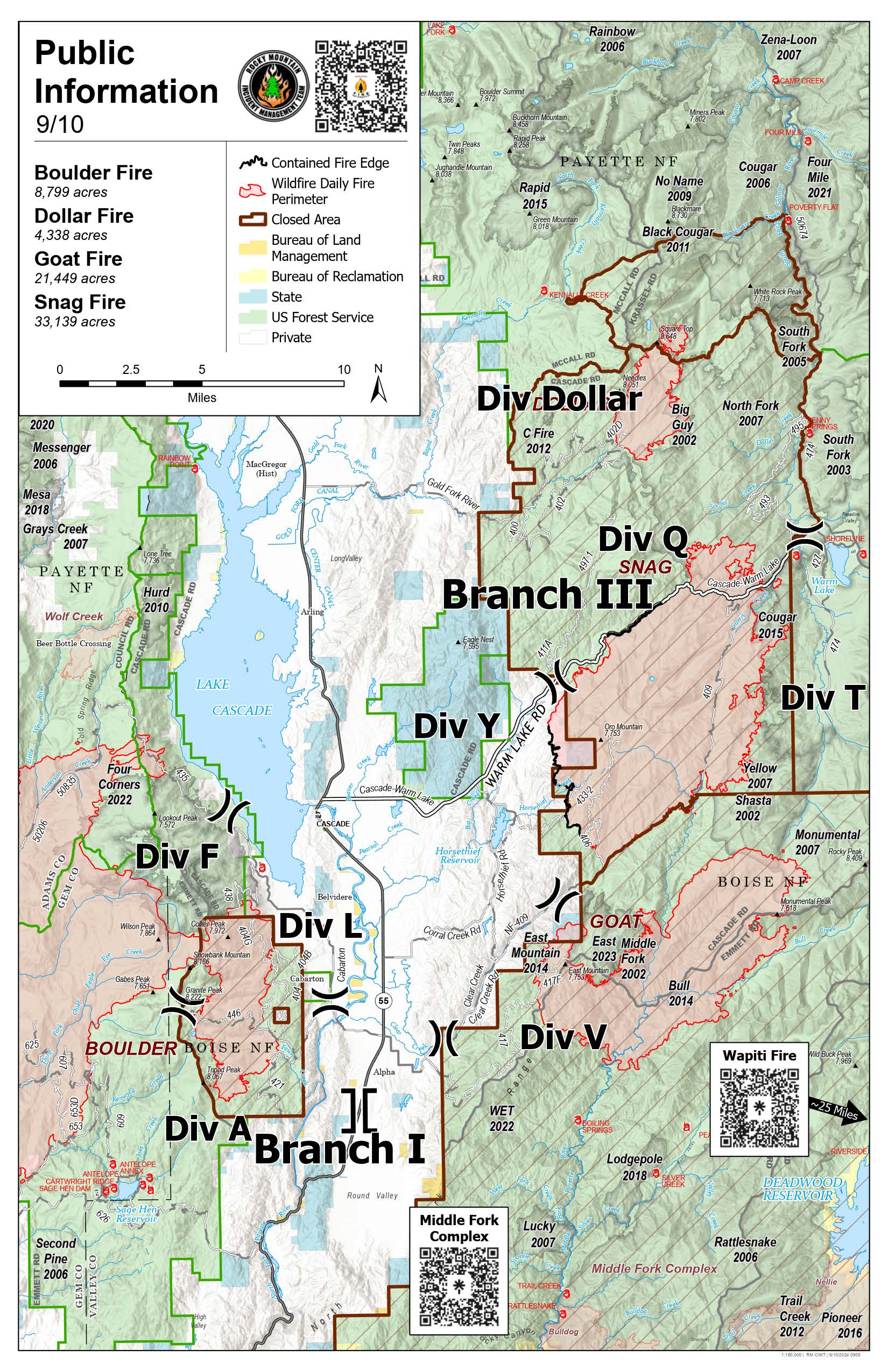
The Snag Fire was started by lightning on the evening on August 5, 2024, 9.5 miles east of Cascade, ID. At 6 a.m. on August 8, 2024, Great Basin Complex Incident Management Team 7 assumed command of the fire. At the time, Great Basin Team 7 was already in command of four other fires in the area as the West Mountain Complex. Transfer of command to Rocky Mountain Complex Incident Management Team Two occurred at 6 a.m. on August 23, 2024. Rocky Mountain Complex Incident Management Team Two transfered command to Rocky Mountain Complex Incident Management Team Three on September 6, 2023. The incident is now being managed along with three other incidents (Boulder, Dollar, and Goat).
The Valley County Sheriff’s Office has reopened Warm Lake Highway to residents and contractors only. There are certain windows daily that the pilot car is able to escort residents and contractors through Warm Lake Highway, so be sure to follow the Valley County Sheriff's Facebook page for more details and how to sign up for access.
To learn more about the Ready, Set, GO evacuation system click this link.
The Boise National Forest, Idaho Department of Lands, and Bureau of Land Management are in Stage 1 fire restrictions on state, endowment, private and federal lands within the West Central Mountains Fire Restrictions Zone. For more information, visit the Idaho fires Restrictions website at: https://www.idl.idaho.gov/fire-management/fire-restrictions-finder/
| Current as of | Tue, 09/10/2024 - 13:09 |
|---|---|
| Incident Time Zone | America/Boise |
| Incident Type | Wildfire |
| Cause | Lightning/Natural |
| Date of Origin | |
| Location | 9.5 miles East of Cascade, Idaho |
| Incident Commander | Bill Waln IC, Rocky Mountain CIMT3 Dylan Rader IC(T) |
| Coordinates |
44° 32' 54'' Latitude
-115° 50' 25
'' Longitude
|
| Total Personnel: | 368 |
|---|---|
| Size | 33,084 Acres |
| Percent of Perimeter Contained | 15% |
| Estimated Containment Date | 10/15/2024 |
| Fuels Involved | Timber (Grass and Understory) Closed Timber Litter Timber (Litter and Understory) Fuels in the upper elevation primarily consist of Subalpine fir, Lodgepole pine, grass and sage meadows with moderate to heavy dead and down. Sage meadows are beginning to support fire spread. Recent bug kill timber has contributed to numerous snags. Middle elevation fuels consist of mixed conifer stands of Douglas-fir, Ponderosa pine, and Western larch. Moderate loading of dead and down. Alder and Mountain maple are abundant and act as a heat sink. Both 100-hour and 1000-hour fuels are near seasonal average, which are the lowest typically observed during the year. ERC and BI are near the 90th percentile. |
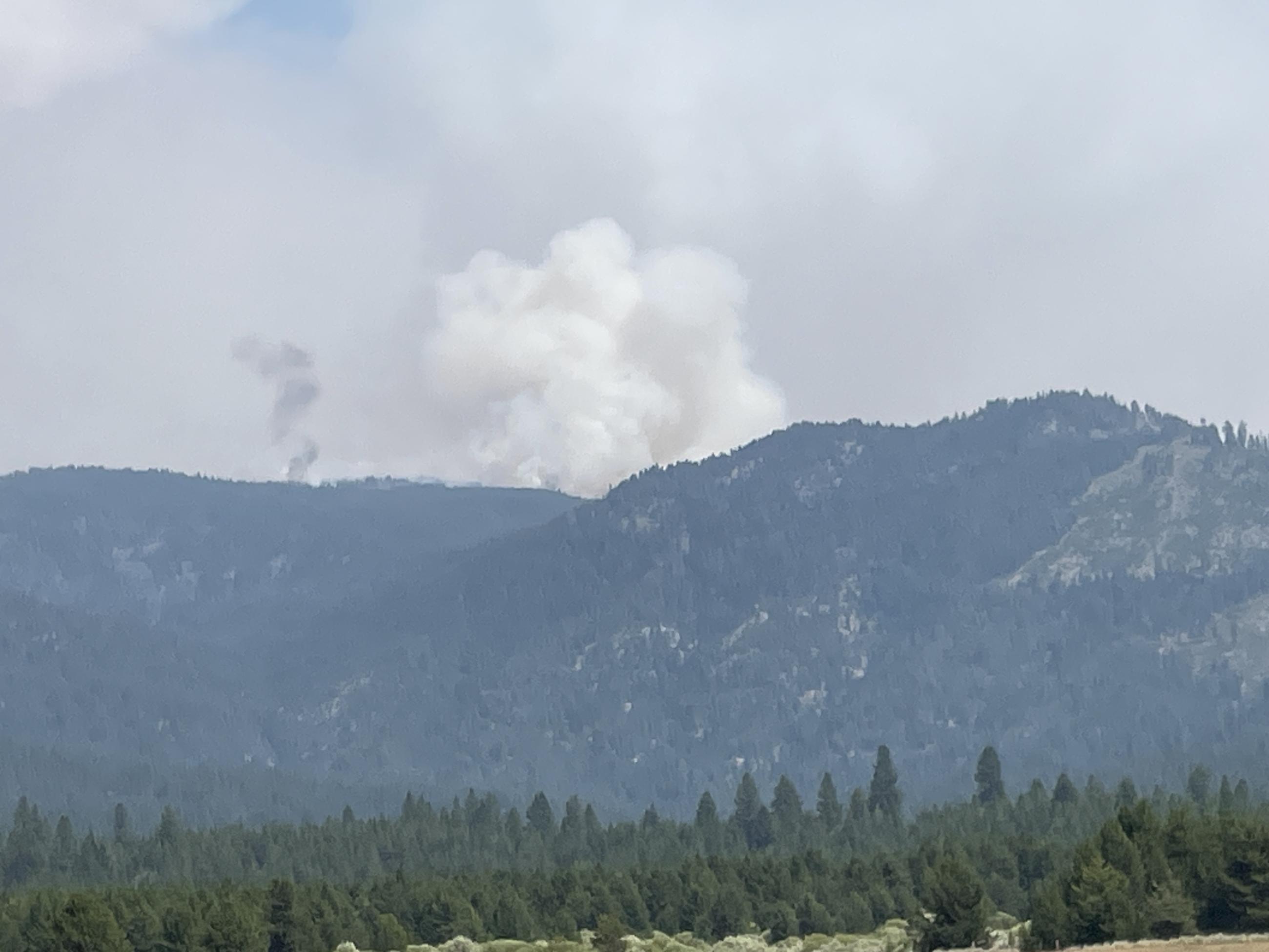
| Significant Events | Moderate Backing Group Torching Spotting Warm temperatures, low humidity, breezy conditions caused active fire condition. Observed fire behavior includes moderate rates of spread, backing, flanking, with occasional torching and spotting. The open fire line between Warm Lake and Clear Creek Summit continues to creep in surface fuels to the east. The fire was also active north of Warm Lake Road east of the Big Creek Summit with group torching and spotting occurring near Six Bit. The north end of the fire continues to threaten structures along Warm Lake. |
| Planned Actions |
Crews will continue to secure and mop-up areas in the Clear Creek drainage. Heavy equipment will continue working south in Division Tango to reinforce containment lines on the eastern perimeter of the fire. |
|---|---|
| Projected Incident Activity |
12 hours: Continued warm temperatures and very low relative humidity will allow for continued moderate to occasional active fire behavior. Overnight relative humidity recovery will be poor. The fire will remain active until around 23:00 then subside except in the thermal belt where it will remain active. The fire will continue to grow to the north towards Warm Lake. 24 hours: The warm and dry conditions will continue with breezy winds. Fire behavior will remain moderate. Portions of the fire perimeter without barriers to spread will actively grow. Structures that are threatened along Warm Lake remain threatened. 48 hours: Cooler temperatures and higher humidity are forecast to occur which should moderate fire activity and limit potential growth. 72 hours: Cooler temperatures and higher humidity are forecast to occur which should moderate fire activity and limit potential growth. Anticipated after 72 hours: Cooler temperatures and higher humidity are forecast to occur which should moderate fire activity and limit potential growth. |
| Remarks |
This incident is being prioritized with three other incidents (Boulder, Dollar, and Goat). Differences in resource numbers listed on the ICS-204s and reported in the ICS-209 are a result of sharing resources through lend/lease across all incidents being managed by Rocky Mountain CIMT3. |
| Weather Concerns | Lighter winds and lower instability associated with a ridge of high pressure today have allowed smoke to remain settled into valleys and drainages. On the mid-slopes and ridges, a few cumulus clouds have developed. Early afternoon temperatures ranged from the 70s on the mid-slopes and ridges to the middle 80s at lower elevations. Relative humidity values ranged from the lower 20s to lower 30s across the fire area. Winds ranged from west to southwest at 5 to 10mph with gusts approaching 15mph in exposed areas and ridges.
Forecast for Tuesday, 9/10/24 Ridging will continue across the area for one more day before a significant pattern shift takes place on Wednesday. Ahead of that system, winds will increase. Afternoon temperatures will range from middle 60s to lower 70s on the mid-slopes and ridges to the mid-70s to lower 80s at lower elevations. Winds will become upslope/up drainage by early afternoon between 8 and 13mph. Gusts to 25mph will be possible in exposed areas along the ridgetops.
|
|---|