
Highlighted Activity
***Bridge Fire Community Meeting: Come join us for an overview of the Bridge Fire and current situation on Wednesday, October 9, 2024, from 6:00 p.m. - 8:00 p.m., at the Wrightwood Community Services Building, 1275 Highway 2, Wrightwood, CA
INITIAL SITUATION: On Sunday, Sept. 8, at 2:40 p.m., Angeles National Forest firefighters responded to a reported wildfire in the San Gabriel Mountains National Monument in the East Fork area by Cattle Canyon Bridge along Camp Bonita Road.
CURRENT INFORMATION: On Saturday, Oct. 5, the incident was lowered to a Type 4 incident. This means complexity and needs of this incident are going down.
As temperatures continue to heat up and stay very warm in the coming days and conditions remain dry, pockets of unburned fuel may flare up and smoke could be visible from within the fire. At this time, there is no threat to the containment lines. Firefighters continue to investigate smoke, extinguish isolated heat sources, and remove hazardous trees to improve public and crew safety.
Damage inspection teams completed their inspections. Residents affected by the Bridge Fire can find information on the following websites:
For San Bernardino County: prepare.sbcounty.gov/bridge-fire/
For Los Angeles County: recovery.lacounty.gov/bridgefire/
For emergency alerts, please register here:
- Los Angeles County:
https://ready.lacounty.gov/emergency-notifications/ - San Bernardino County:
https://wp.sbcounty.gov/sheriff/alerts/
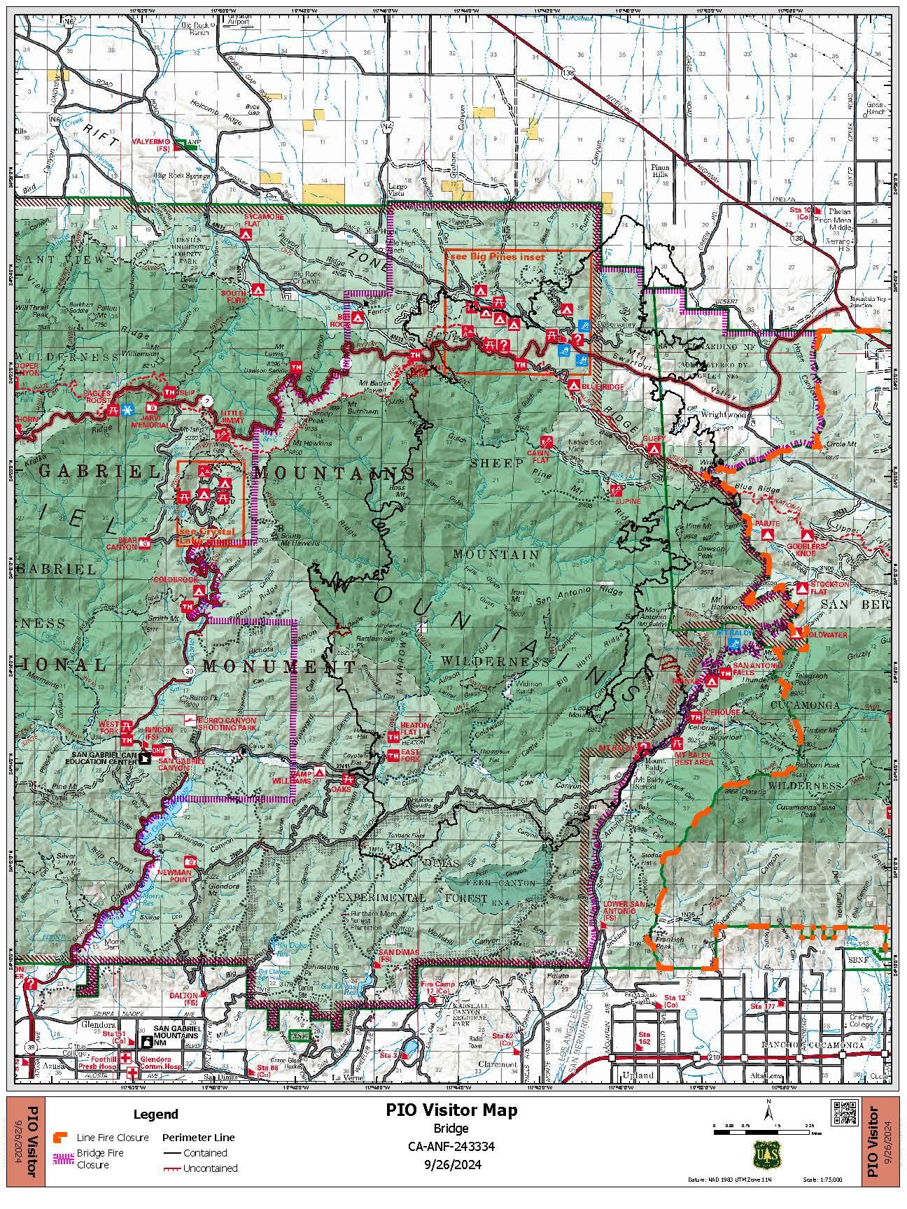
FOREST CLOSURE ORDERS: The Angeles National Forest has issued a Bridge Fire Area Closure Order from September 21, 2024, through December 31, 2025. This closure order covers only National Forest System roads, trails, and other facilities impacted by the Bridge Fire within the Angeles National Forest.
ROAD CLOSURES:
- Eastbound Big Pines Highway at Largo Vista Road (residents only)
- SR-2 at Flume Canyon Road westbound
- Mescal Creek Road at Mescal Canyon Road
- Glendora Mountain Road north of Big Dalton Canyon Road
- Glendora Ridge Road from Mt. Baldy to Glendora Mountain Road
Additional closures may still be in place on roads managed and maintained by other agencies inside the forest. Most major roads in the Angeles National Forest are not managed or maintained by the Forest Service. We recommend also checking Caltrans (https://roads.dot.ca.gov/), the Los Angeles County Road Closures list (https://dpw.lacounty.gov/roadclosures/) and the San Bernardino County Road Conditions (https://dpw.sbcounty.gov/operations/road-closures/) list for updates.
IF YOU FLY, WE CAN’T!
Drones pose a serious risk to firefighting and can cause air operations to cease. When drones interfere with firefighting efforts, a wildfire has the potential to grow larger and cause more damage. A FAA Temporary Flight Restriction (TFR) is in effect and any private aircraft or drone that violates the TFR could face serious criminal charges. For more information on drones the public can visit the FAA’s website at www.KnowBeforeYouFly.org.
| Current as of | Wed, 10/09/2024 - 12:27 |
|---|---|
| Incident Type | Wildfire |
| Cause | Under Investigation |
| Date of Origin | |
| Location | East Fork of San Gabriel Canyon, 6 miles NE of Glendora, CA; Sheep Mountain Wilderness, San Gabriel Mountains National Monument |
| Incident Commander | Angeles National Forest |
| Coordinates |
34° 13' 49.9'' Latitude
-117° 45' 28.8
'' Longitude
|
| Total Personnel: | 64 |
|---|---|
| Size | 54,878 Acres |
| Percent of Perimeter Contained | 99% |
| Fuels Involved | Chaparral, brush, short grass, dead and down trees |
| Planned Actions |
Mitigate hazard trees along roadways to provide safety for firefighters and the public. Repair direct and indirect control lines and other repair points to meet the level identified in the Suppression Repair Plan. Tactically patrol, mop up and mitigate all smoke and heat sources to the depth necessary to produce a low probability of escape. |
|---|
| Weather Concerns | For information on smoke impacts and an interactive map, visit fire.airnow.gov. |
|---|