
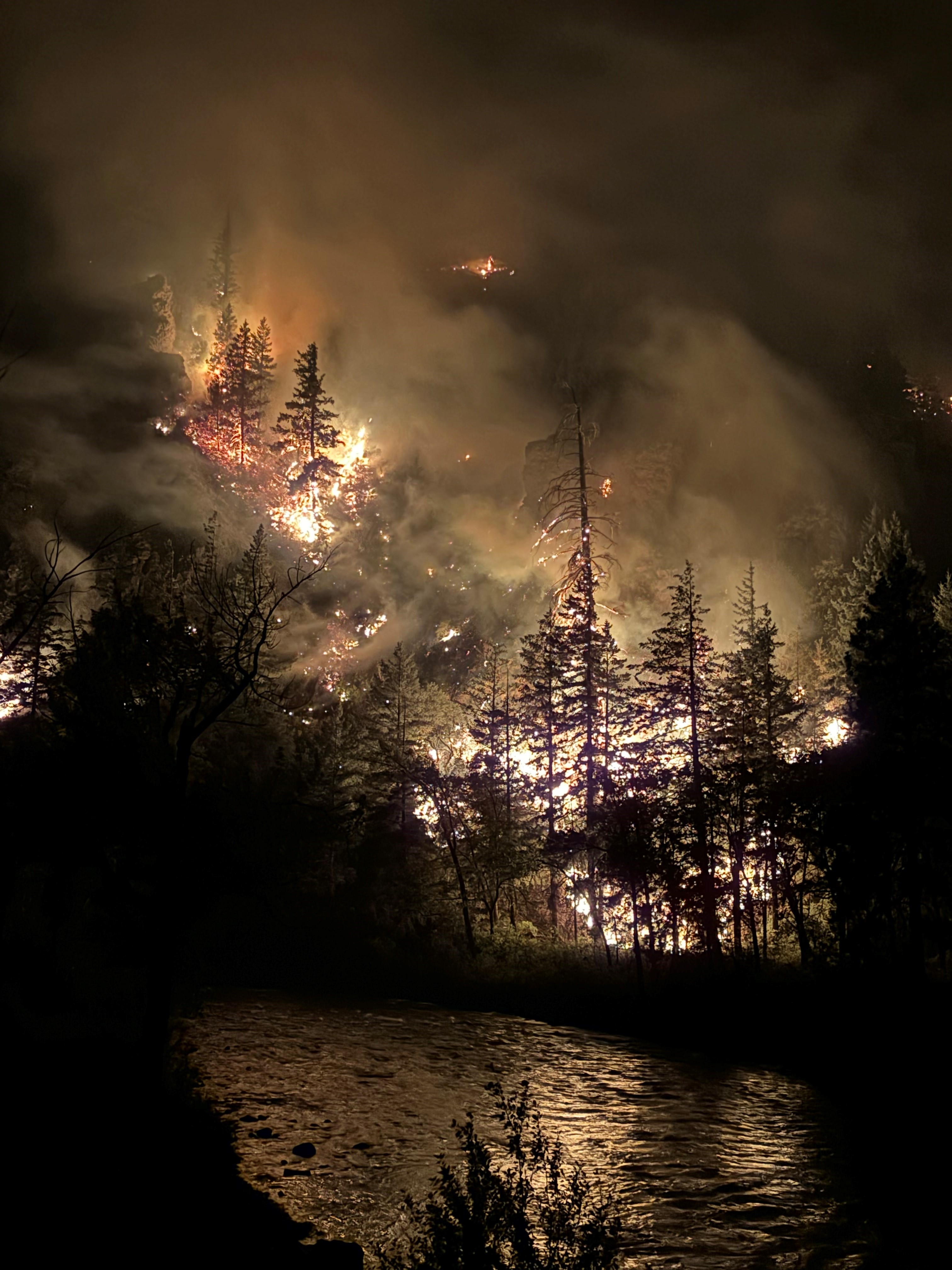
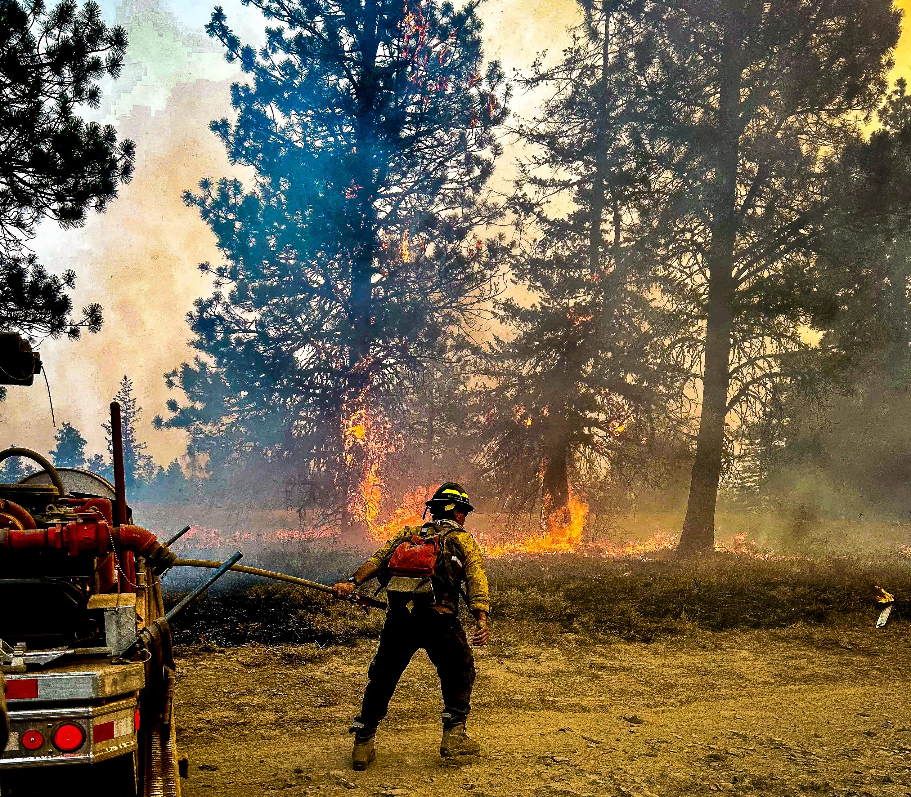
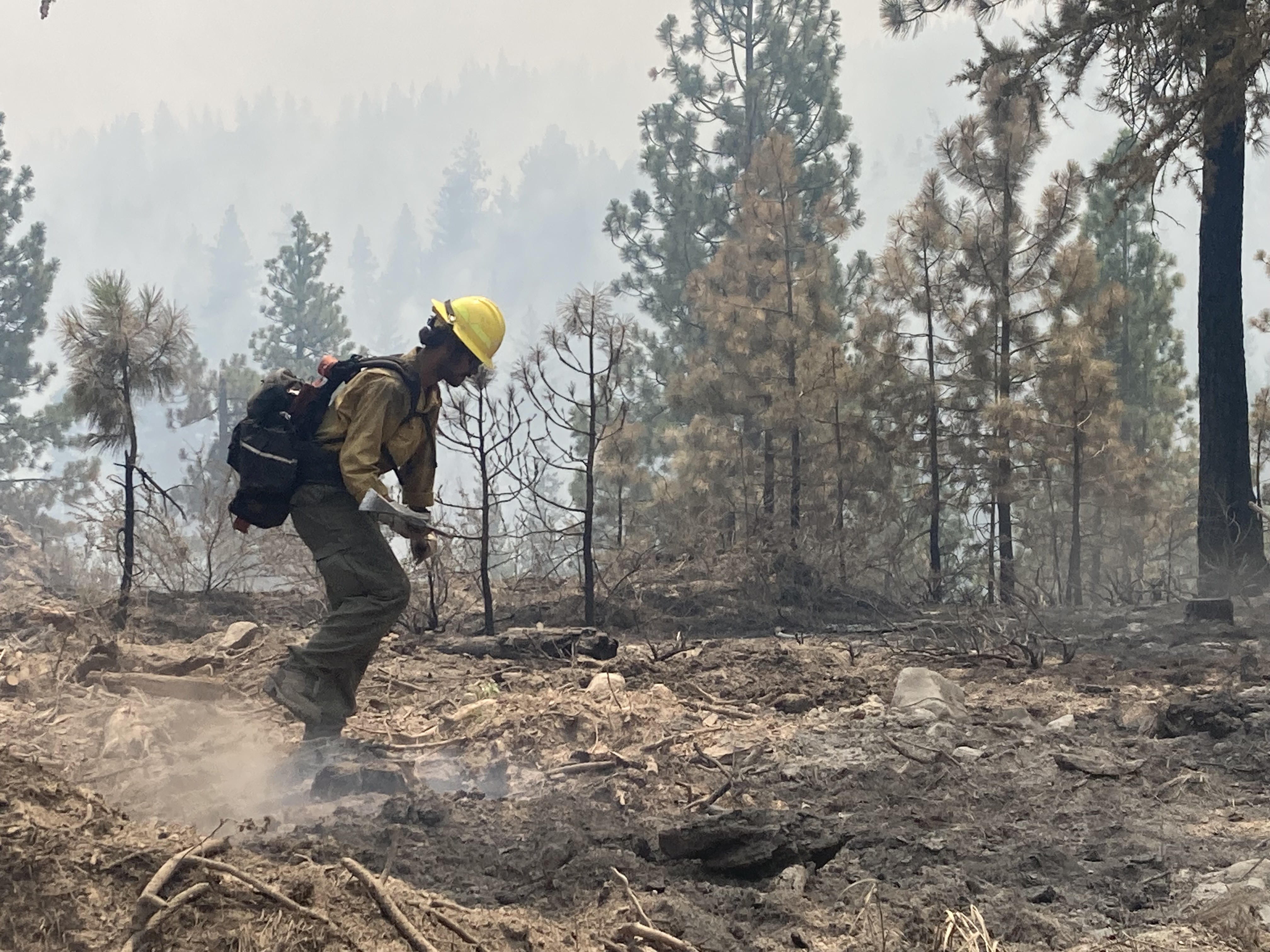
The Retreat Fire is approximately 14 miles SW of Naches. The fire is being managed under a full suppression strategy with public and firefighter safety as the number one priority.
California Interagency Incident Management Team 14 will transition command of the incident back to the local units at the end of shift on August 19, 2024. If there are any significant changes regarding the Retreat Fire, the local units will share pertinent information on their websites and social media platforms.
Southeast Region - Department of Natural Resources:
Ryan Rodruck
ryan.rodruck@dnr.wa.gov
360-584-3916
Naches Ranger District - Okanogan-Wenatchee National Forest:
10237 Highway 12
Naches, WA 98937
(509) 653-1401 (Hours: Monday through Friday 8 a.m. to 4:30 p.m. Closed for lunch 12 to 12:30 p.m.)
Fire Closures (as of 8-19-2024):
- Okanogan-Wenatchee National Forest Retreat Fire Closure: www.fs.usda.gov/alerts/okawen/alerts-notices/?aid=89192
- The Washington State Department of Natural Resources (DNR) Southeast Region has temporarily closed the Ahtanum State Forest due to the adjacent Retreat Fire burning near Rimrock Lake. The public can access the most up-to-date closure information at www.dnr.wa.gov/ahtanum.
- Washington Department of Fish and Wildlife has closed the majority of the Oak Creek Wildlife Area to public access due to the Retreat Fire until Aug. 23 to ensure public safety and facilitate firefighting efforts. More information can be found at Wildlife Areas | Washington Department of Fish & Wildlife.
| Current as of | Wed, 08/28/2024 - 13:01 |
|---|---|
| Incident Time Zone | America/Los_Angeles |
| Incident Type | Wildfire |
| Cause | Under investigation/Undetermined |
| Date of Origin | |
| Location | 14 miles WSE of Naches, WA |
| Incident Commander | California Interagency Incident Management Team 14, Incident Commander James Snow |
| Coordinates |
46° 40' 14.9988'' Latitude
-120° 59' 30.1806
'' Longitude
|
| Total Personnel: | 228 |
|---|---|
| Size | 45,601 Acres |
| Percent of Perimeter Contained | 85% |
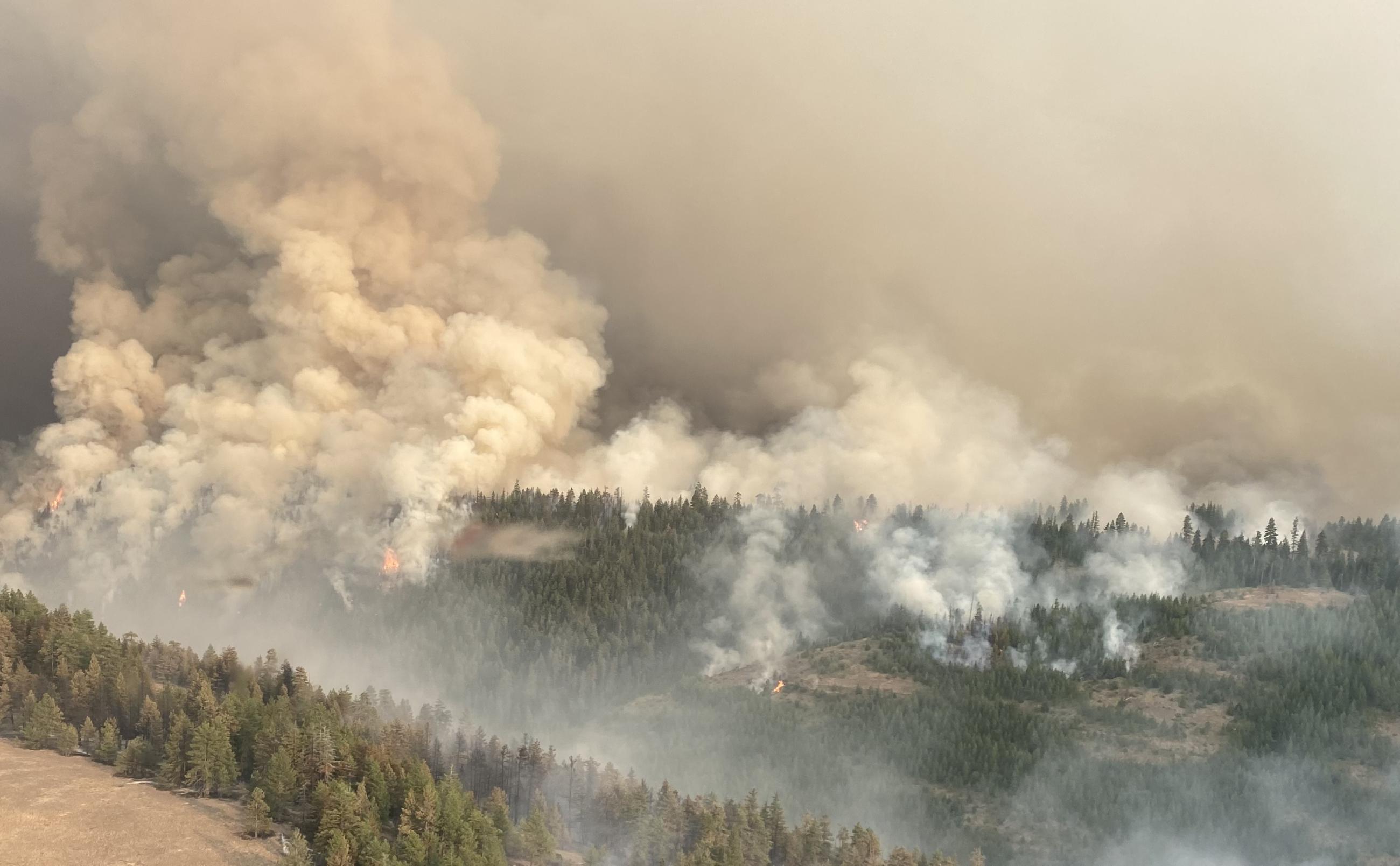
| Fuels Involved | Three main fuel types exist: sage/grass, oak/ grass, mixed conifer and sub alpine fir forests. Sage/grass fuels at the 4200-foot elevation and below are mostly cured and can carry active fire spread. At higher elevations sage and grass are partially cured and burn in isolated patches. Timber litter above 5000-foot elevation is dry and contributing to active fire spread with group torching. |
| Significant Events | ERCs and BI's continue to show signs of lowering with the influx of moister air and a rain event. Very little active fire was observed, most activity is smoldering and creeping in deep duff layers. In the lower elevations unburned islands continue to be of concern. |
| Planned Actions |
Assigned resources will Patrol and mop up to the extent necessary to meet control objectives in all divisions
|
|---|---|
| Projected Incident Activity |
12 hours: Heavy fuels are likely to continue smoldering as they slowly burn down. Higher daytime relative humidity continue. 24hours: Conditions will remain moderate overnight. Expect minimal fire behavior in all divisions.
|
| Weather Concerns | Showers and thunderstorms on Saturday night led to gusts to 45 to 60 mph both on the fire and at base camp, along with wetting to heavy rains from 1900 Saturday night until 0100 Sunday. Rainfall was mostly 0.10 to 0.35 of an inch storm total, but some locations received more on the order of 0.75 of an inch. Humidity recovery of 85+ percent lowered by afternoon in the dry air behind the Saturday night front to 28 to 38 percent. Temperatures were cooler, 65 to 77. Light showers during the late afternoon and evening on the Cascade crest were possible. Mostly cloudy skies will partially clear on Monday, with afternoon highs 68 to 80 and afternoon humidity of 25 to 35 percent. Evening wind will be the strongest wind, northwest with gusts to 23 mph. |
|---|