
Highlighted Media
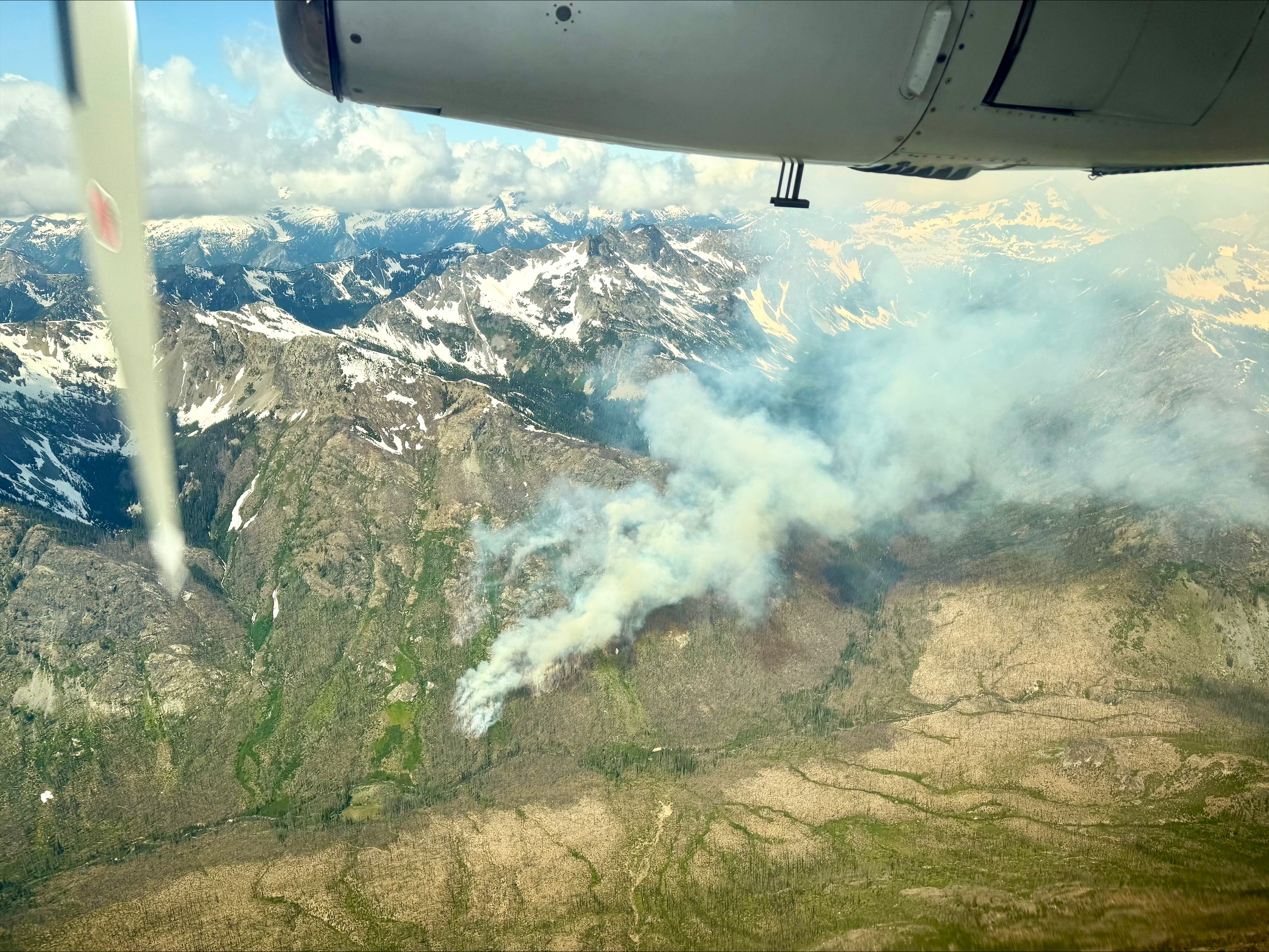
An air attack platform coordinates the multiple scoopers and helicopter working the Pomas Fire on June 14, 2025
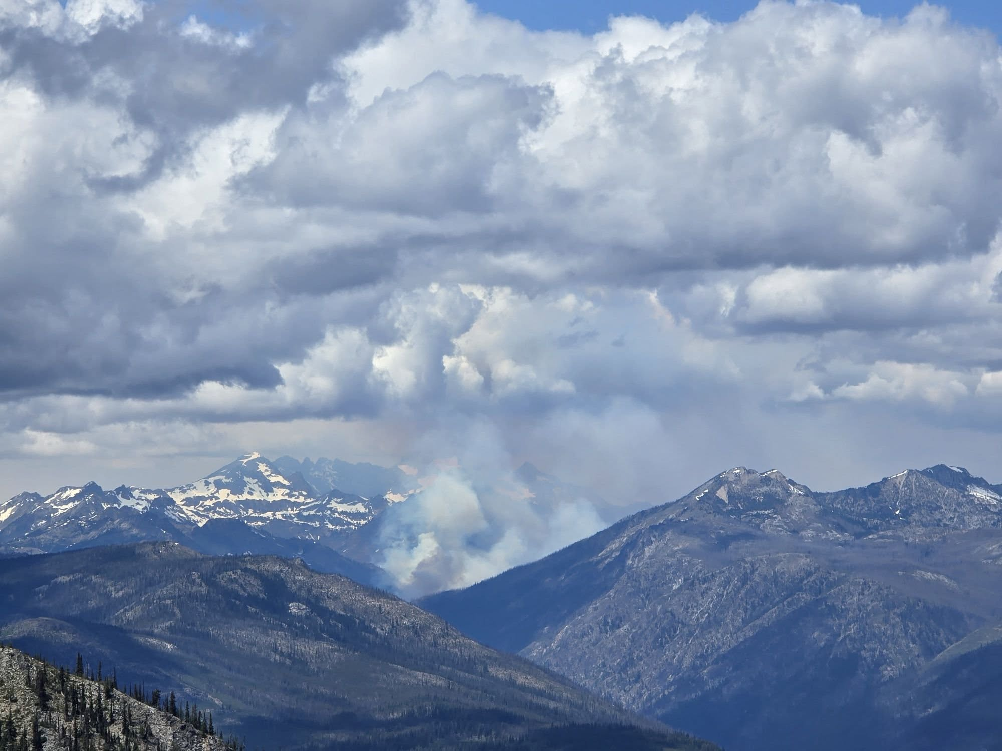
The Pomas Fire, as seen from Tyee Lookout on June 14, 2025.
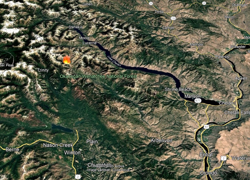
June 14, 2025 map of the Pomas Fire burning in the Glacier Peak Wilderness of the Okanogan-Wenatchee National Forest approximately 36 air miles northwest of Entiat, WA
The Pomas Fire is located in the Glacier Peak Wilderness and was first reported on the morning of June 13, 2025. Smokejumpers responded within an hour of the report. Inaccessible by road, the fire is burning mid-slope at over 5,000 feet in elevation in heavy dead and down timber from the 2015 Wolverine Fire.
There will not be regular updates on this fire unless significant changes occur.
| Current as of | Sun, 06/15/2025 - 16:17 |
|---|---|
| Incident Time Zone | Pacific Standard Time |
| Incident Type | Wildfire |
| Cause | Lightning |
| Date of Origin | |
| Incident Time Zone | Pacific Standard Time |
| Location | Approximately 36 miles northwest of Entiat, WA |
| Incident Commander | Anders Johnson, Okanogan-Wenatchee National Forest |
| Coordinates |
48° 5' 29'' Latitude
-120° 43' 23
'' Longitude
|
| Size | 100 Acres |
|---|---|
| Fuels Involved | Heavy slash, brush, and dead and down timber. |