
Highlighted Media
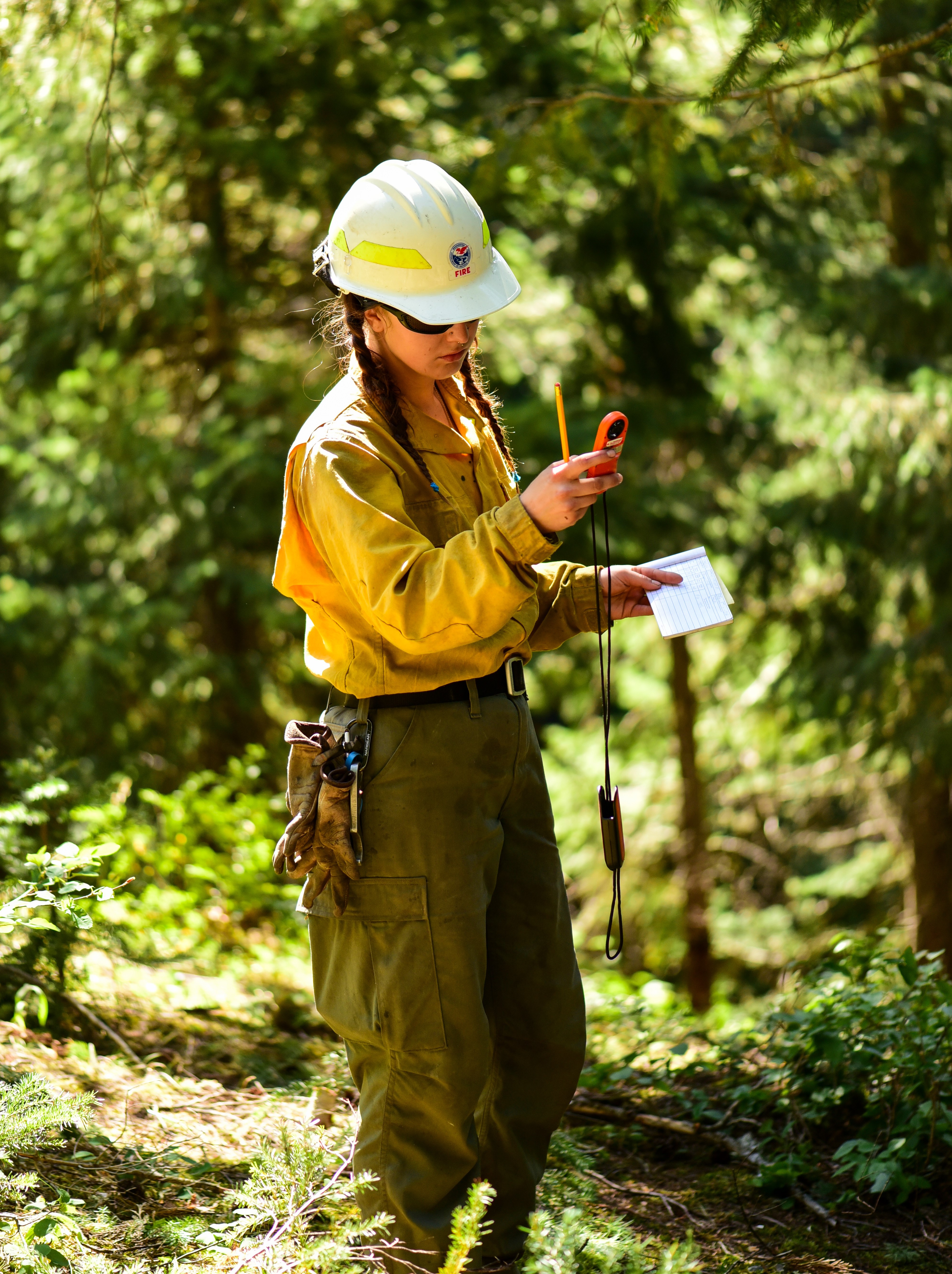
Throughout the day firefighters on the line take regular weather measurements. Weather fluctuations are forecasted on the Easy and Pioneer fire areas over the next couple days followed by warming and drying later in the week. The field measurements are shared with the incident meteorologist and this local data is used to refine the forecasts for each fire area. Localized weather forecasts, including predicted changes in wind or relative humidity, provide firefighters on the ground with information to help them anticipate changes in fire activity.
Taken on the Easy Fire; Photo credit: Landen Napier
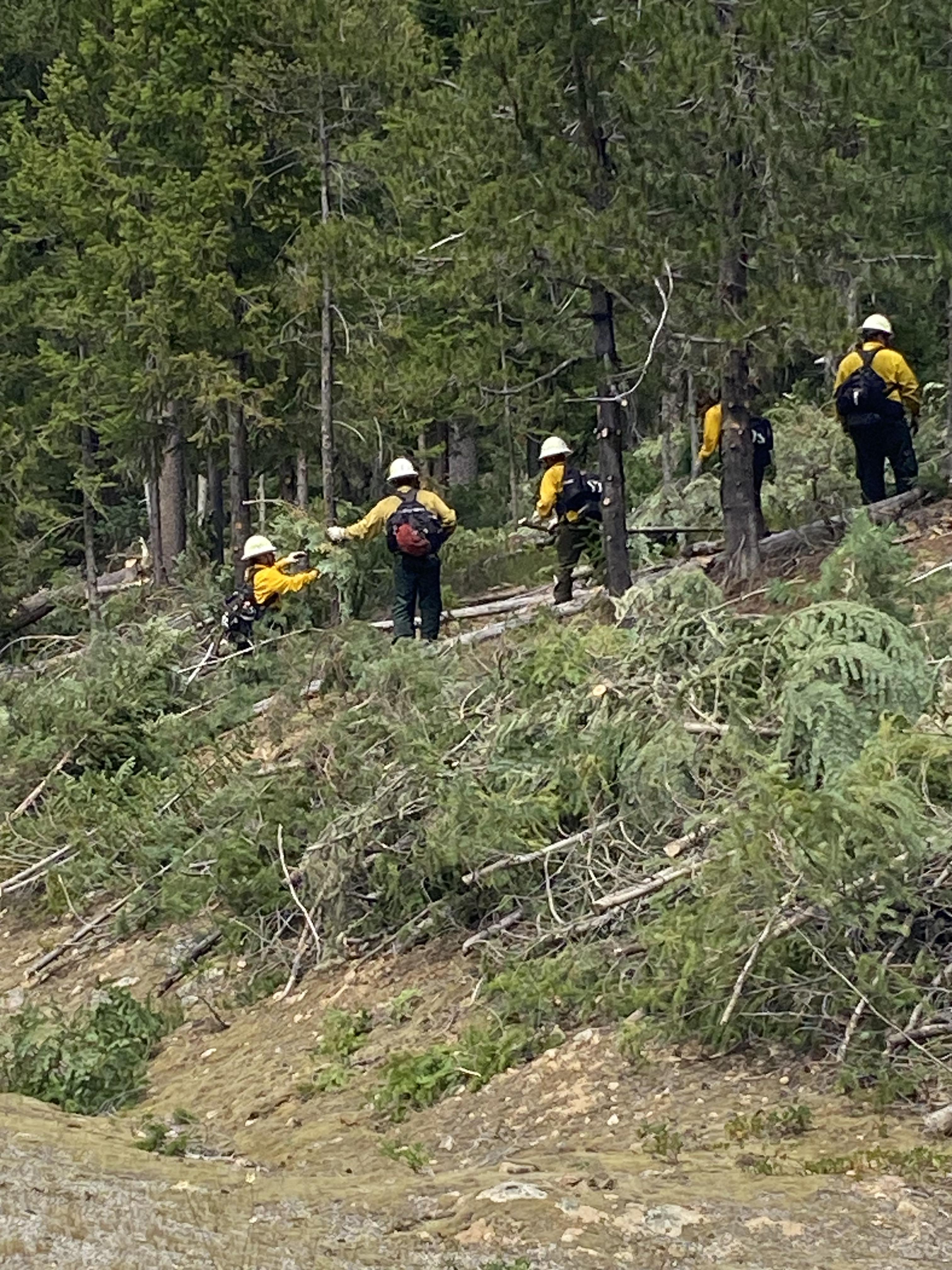
Crews clearing roadside areas of vegetation July 25
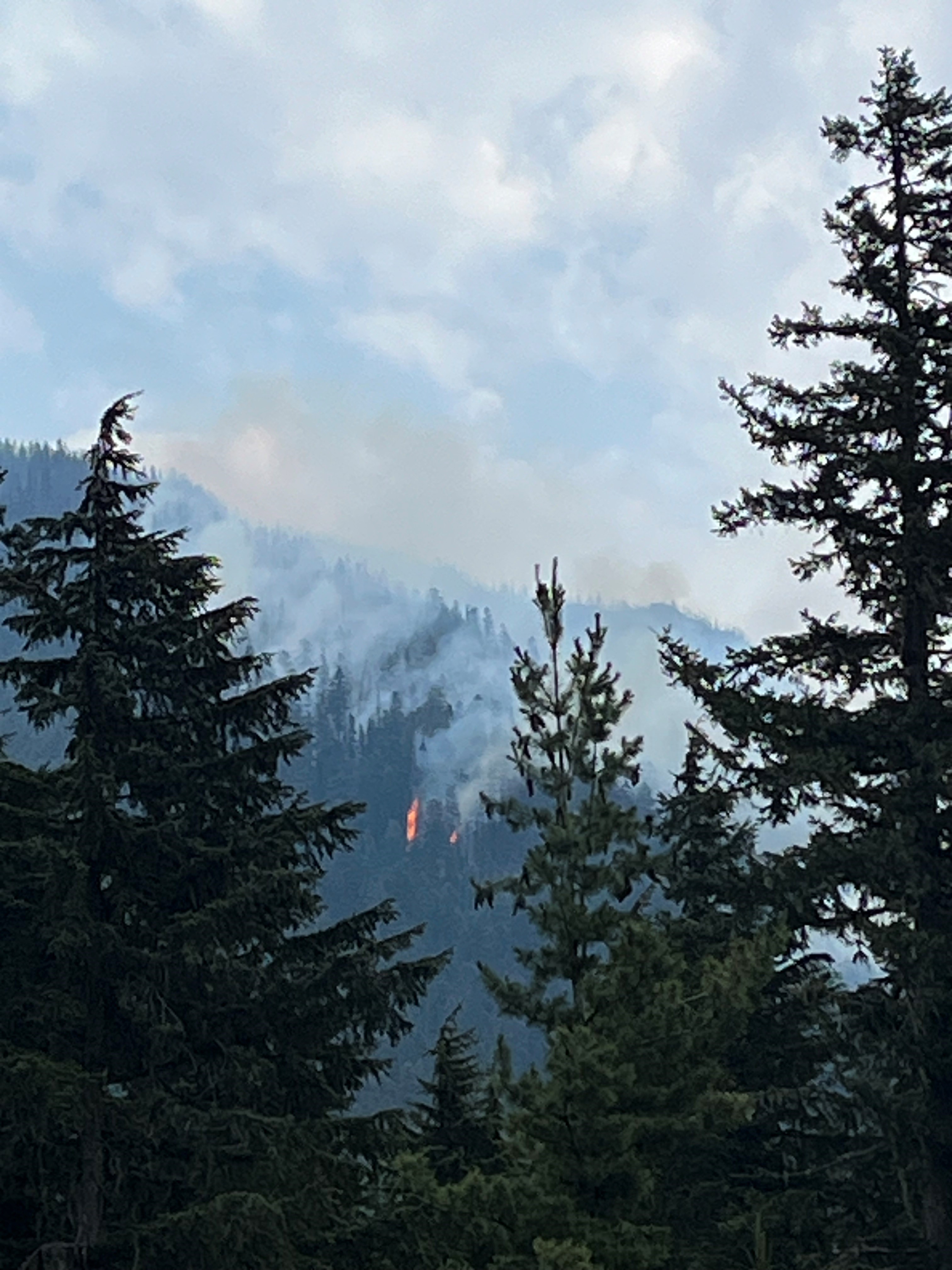
The Easy Fire, burning in dense timber in the Methow Valley Ranger District, 17 air miles west of the Mazama community, was sparked by dry lightning storms on the evening of July 17, 2024. Crews responded and immediately reported explosive fire growth and running crown fire into the evening. Crews stayed on the fire overnight but weeks of extreme temperatures, record dry conditions, and dangerous terrain with no road access hampered initial response efforts.
Natural features on the north and south are being used to limit fire spread on the Easy Fire. Fire managers are using a combination of ground crews to put in containment lines where possible and air resources to cool off hotspots with water. Steep drainages and ridgelines limit the ability of ground crews to access the fire directly and air tanker pilots to safely fly the fire area. Recent weather has elevated fuel moisture content and reduced the intensity of what active fire remains. Incident management will continue to monitor the fire to ensure that any heat stays within the current fire footprint.
| Current as of | Wed, 08/28/2024 - 13:39 |
|---|---|
| Incident Time Zone | America/Los_Angeles |
| Incident Type | Wildfire |
| Cause | Lightning |
| Date of Origin | |
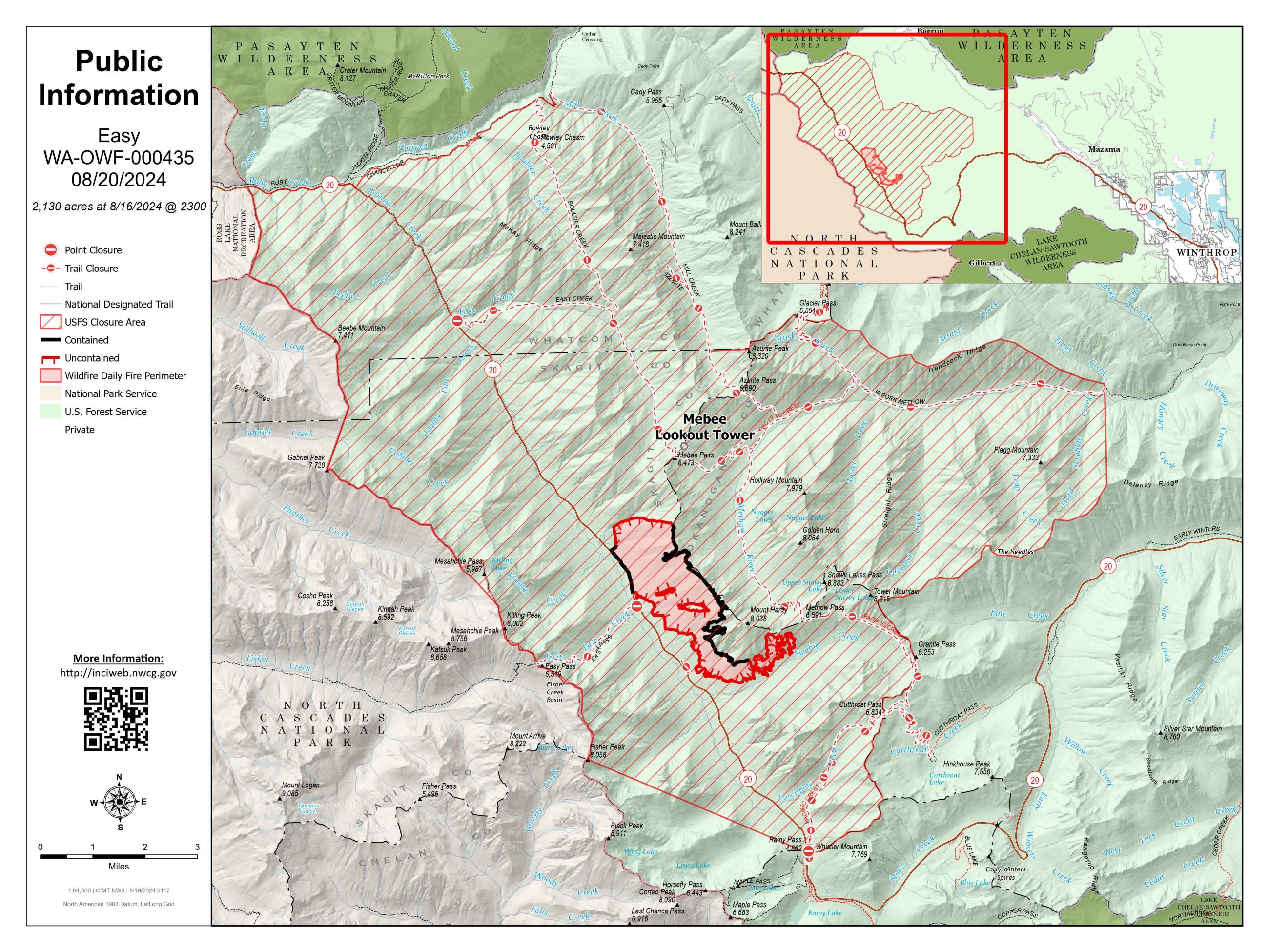
| Location | North Cascades Hwy 20 Corridor, 17 air miles west of Mazama, WA |
| Incident Commander | Lonnie Click, ICCI James Osbourne, ICCI (t) Noel Livingston, Deputy ICCI Randy Johnson, Deputy ICCI |
| Incident Description | The Easy Fire is burning in dense timber in the Methow Valley 17 air miles west of the Mazama community. It was sparked by dry lightning storms on the evening of July 17, 2024. |
| Coordinates |
48° 35' 49'' Latitude
-120° 47' 25
'' Longitude
|
| Total Personnel: | 63 |
|---|---|
| Size | 2,130 Acres |
| Percent of Perimeter Contained | 36% |
| Estimated Containment Date | 9/1/2024 |
| Fuels Involved | Timber (Litter and Understory) Fuels in the area are timber litter and timber understory in mixed conifer. The fire is mainly burning in compact timber litter with abundant snags and heavy down woody material throughout the area. Timbered areas are closed canopy with low crown base height; moss and bearded lichen is present throughout the area. |
| Significant Events | Observed fire behavior: Minimal Creeping Smoldering
Minimal fire behavior observed with mostly smoldering and creeping. Downed logs continue to hold heat. The fire remains north of Highway 20, burning in timber fuels on extreme slopes between Mebee Pass and Mount Hardy. |
| Planned Actions |
DIV F/0: Patrol fire by air using UAS. Where possible and necessary, implement strategic plan to protect the Highway 20 corridor, and natural resource values, and Forest Service infrastructure using indirect tactics. |
|---|---|
| Projected Incident Activity |
12 hours: Little to no fire behavior through the night. Measurable precipitation over the fire area. Heavy fuels and duff will continue to smolder and consume. 24 hours: Measurable precipitation forecasted over the fire area. Heavy fuels and duff will continue to retain heat where sheltered by dense canopy. 48 hours: Measurable precipitation forecasted over the fire area. Heavy fuels and duff will continue to retain heat where sheltered by dense canopy. 72 hours: Measurable precipitation forecasted over the fire area. Heavy fuels and duff will continue to retain heat where sheltered by dense canopy. Anticipated after 72 hours: FueI conditions will require an extended drying period before becoming readily available. |
| Remarks |
Team is also managing IA responsibilities within the delegated IA boundary along with managing the Pioneer Fire and the Flat Creek Fire; while providing additional IA support to local agencies. |
| Weather Concerns | Friday (8/23): Rain showers entered the fire area midday and persisted through the afternoon with only minimal breaks. Intensity increased late afternoon leading to concerns with excessive runoff. Breezy outflow winds along with lightning were the additional threats associated with the passing storm cells. Temperatures sat in the 50s for the day under increasing cloud cover. Rain continues into the overnight hours with temperatures falling into the 40s overnight. Saturday (8/24) and Sunday (8/25): Rain is expected for a good portion of Saturday, but the main threat for heavy rain that may trigger debris flows is likely behind us. Some snow may even fall on the higher terrain early Saturday given the lower snow levels due to the cold air associated with the weather system. While the rain Saturday will not be as heavy as Friday, it will be rather persistent through the morning and afternoon hours. Temperatures will be cooler with high elevations struggling to get out of the 40s. Breezy winds will also be expected n the ridgelines and prominent west to east oriented valleys adding a wind chill factor to the da . The rain finally starts to taper off late Saturday into Sunday with clouds breaking late in the day. Sunday high temperatures are up several degrees from the cool conditions on Saturday and winds die off substantially. |
|---|