
Highlighted Media

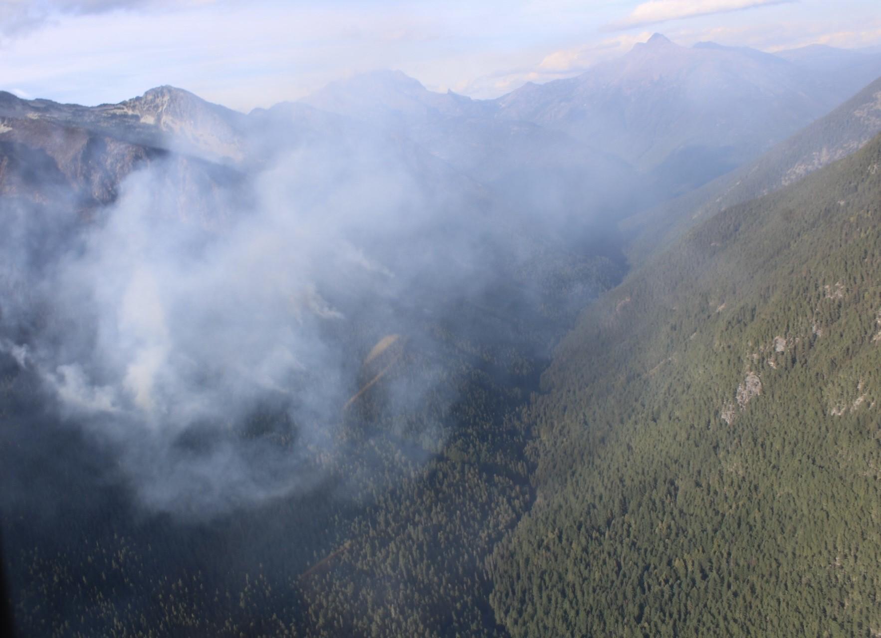
09092024 Helicopter view of Ruby Fire above Panther Creek. Photo by PIO Daniel R. Patterson.
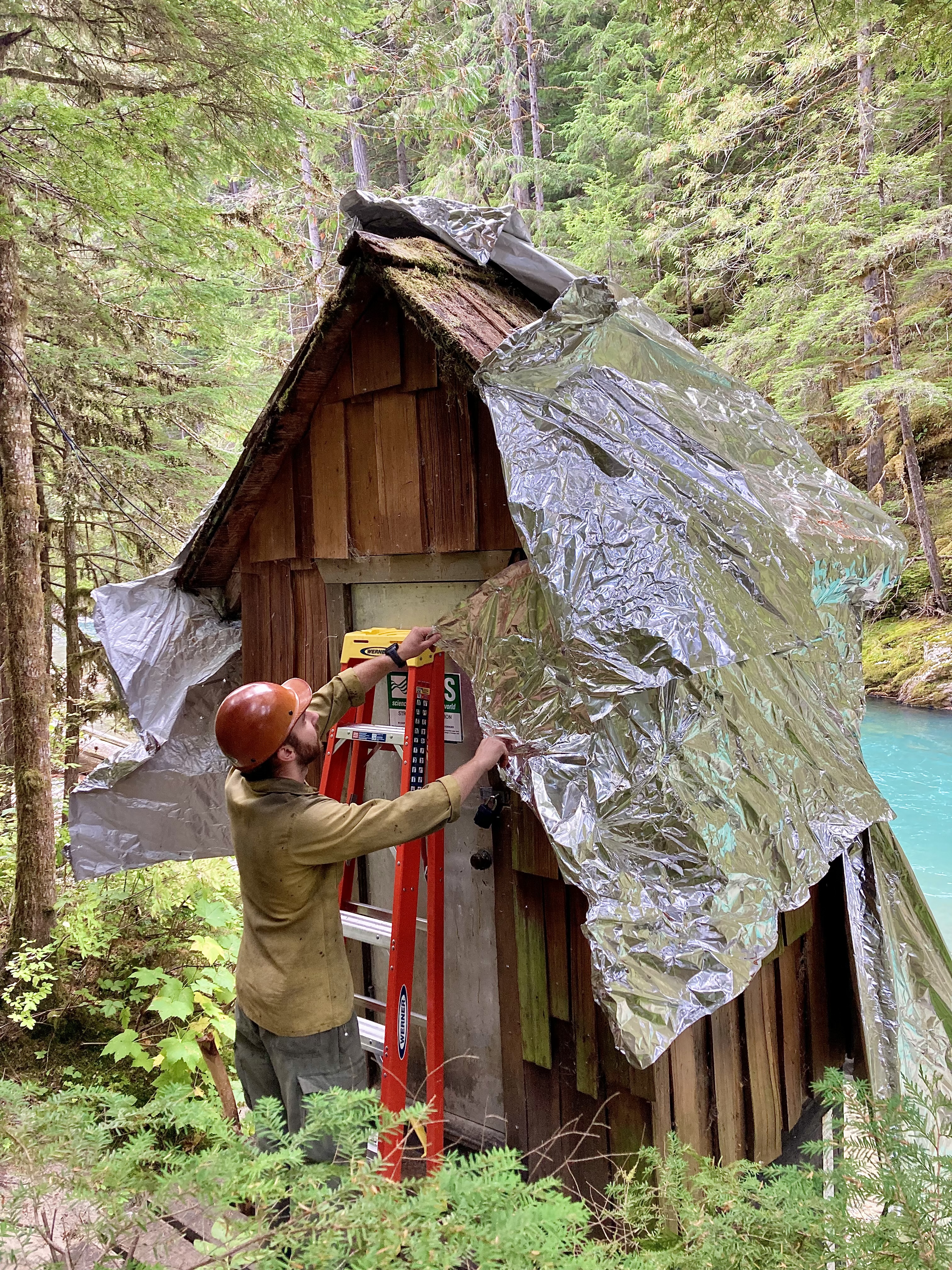
Whiskeytown Engine Crew remove structure wrap on September 17, 2024. Photo by PIO Emilee Franklin.
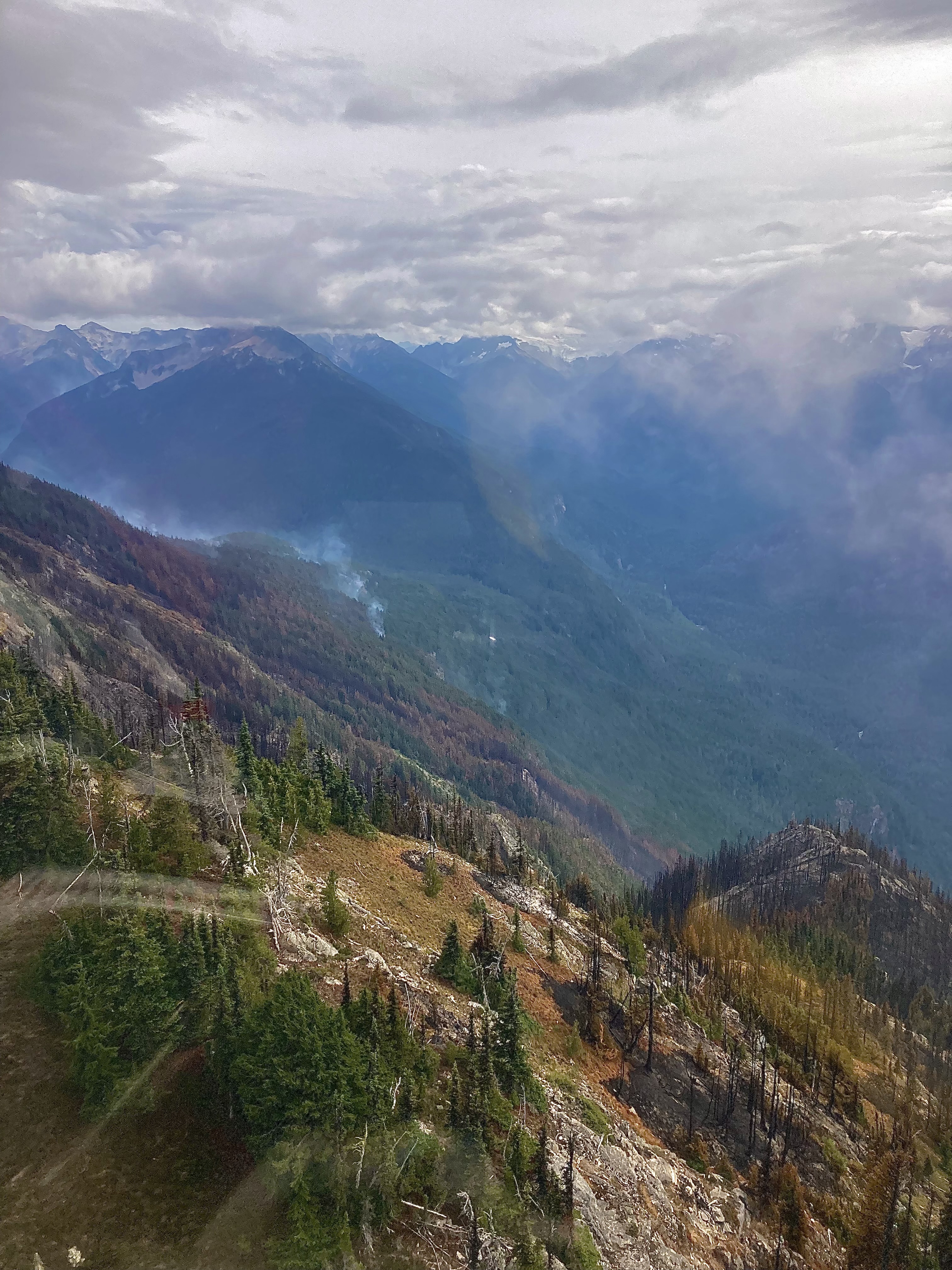
Helicopter Flight Over Ruby Mountain shows burned area on September 13, 2024. Photo by Emilee Franklin.
The Ruby Fire was caused by lightning, and is burning on the slopes of Ruby Mountain, in North Cascades National Park in Whatcom County, Washington USA
| Current as of | Mon, 09/23/2024 - 11:15 |
|---|---|
| Incident Time Zone | America/Los_Angeles |
| Incident Type | Wildfire |
| Cause | Lightning/Natural |
| Date of Origin | |
| Location | On Ruby Mountain in North Cascade National Park by Diablo and Ross Lake, 9 miles East of Newhalem |
| Incident Commander | Michael Hansen, IC - NPS |
| Incident Description | Lightning-caused fire on Ruby Mountain. |
| Coordinates |
48° 40' 44'' Latitude
-121° 2' 54
'' Longitude
|
| Total Personnel: | 12 |
|---|---|
| Size | 1,336 Acres |
| Percent of Perimeter Contained | 0% |
| Estimated Containment Date | 10/31/2024 |
| Fuels Involved | Timber (Grass and Understory) |
| Significant Events | Observed Fire Behavior or Significant Events for the Time Period Reported: Light, active fire behavior including smoke. Access to the fire on the rugged slopes of Ruby Mountain is difficult due to steep terrain and hazards. |
| Planned Actions |
Firefighters are positioned for protection of values and infrastructure around the Ruby Fire. Possible helicopters water drops depending on weather and fire behavior. |
|---|---|
| Projected Incident Activity |
A thick cloud cover in the morning followed by a chance of showers in the afternoon. Tomorrow brings warmer and drier weather. |
| Weather Concerns | Cooler temperatures and a chance of precipitation continues. |
|---|