

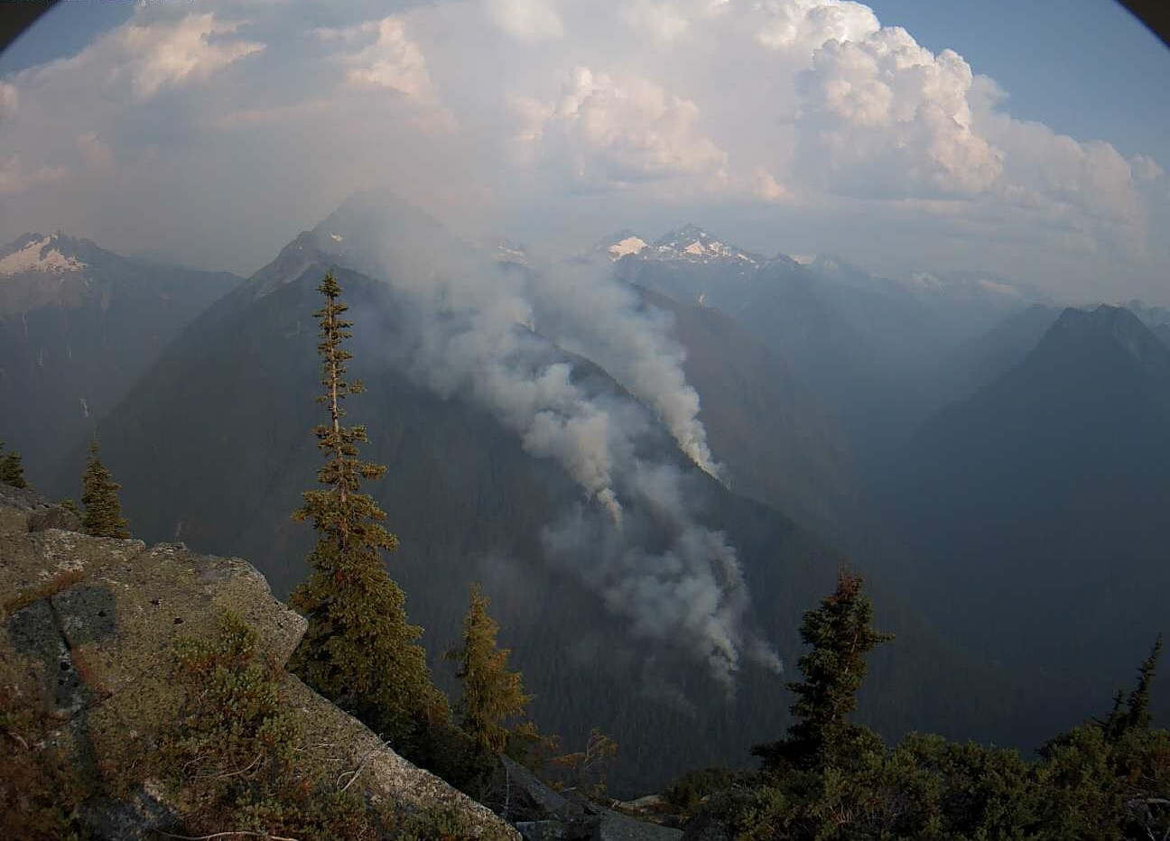
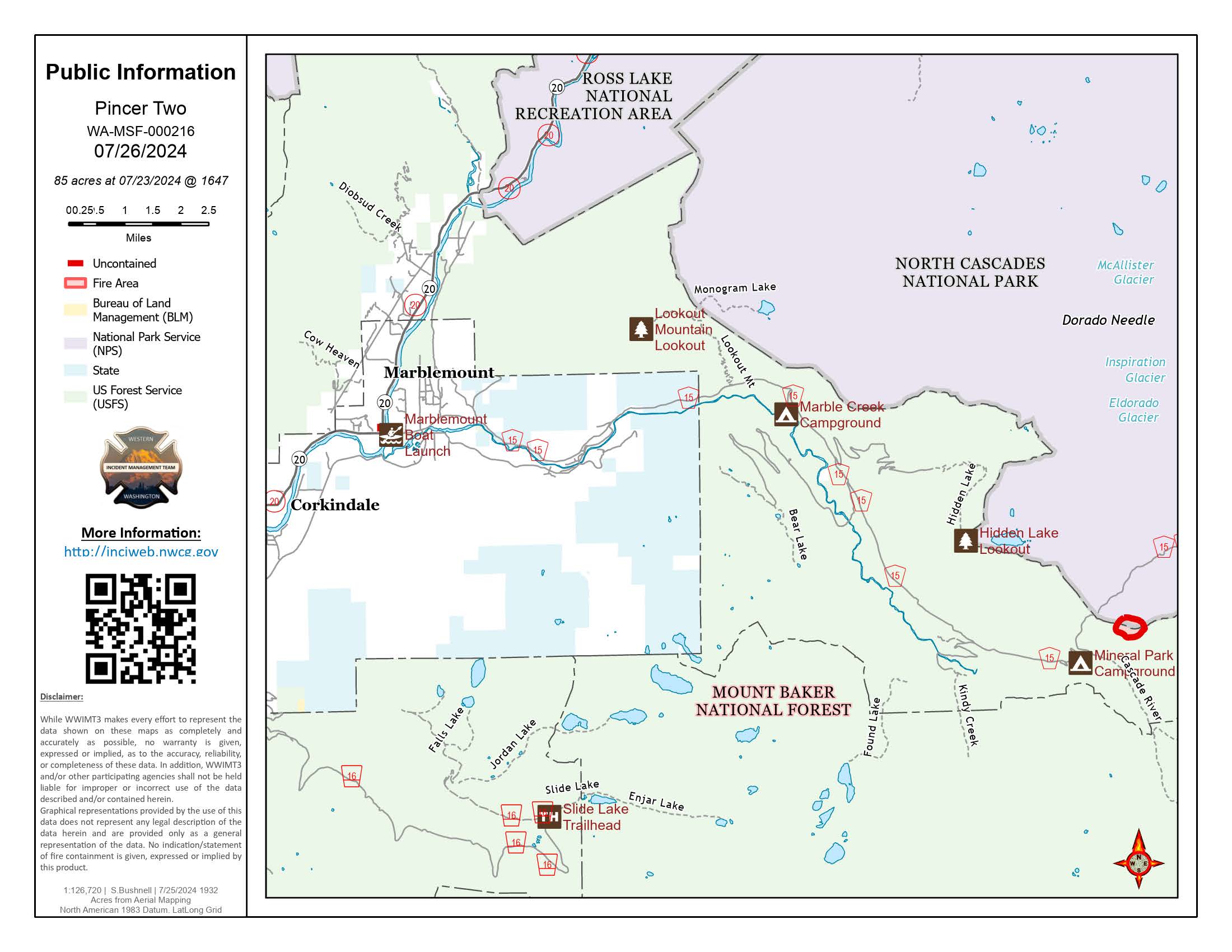

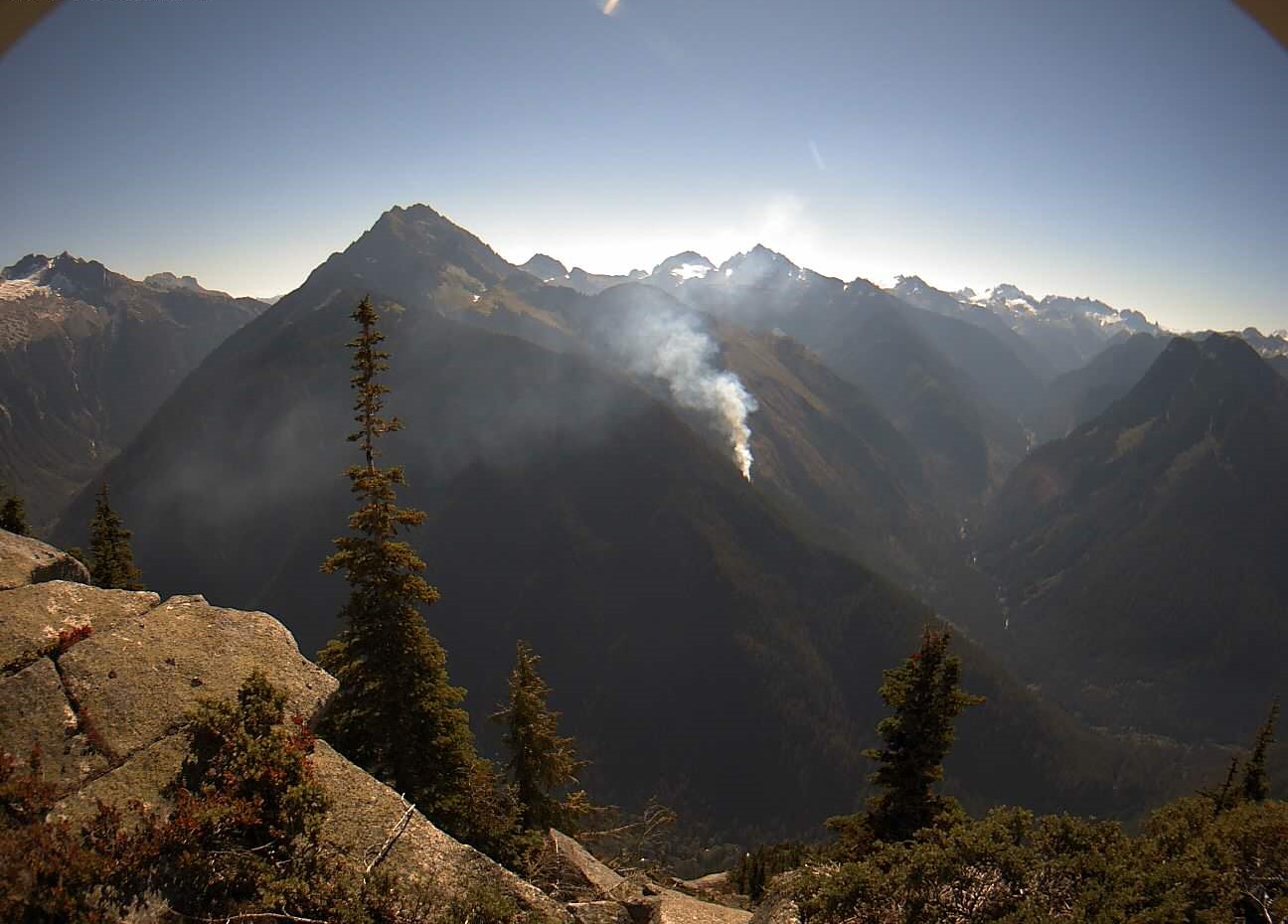
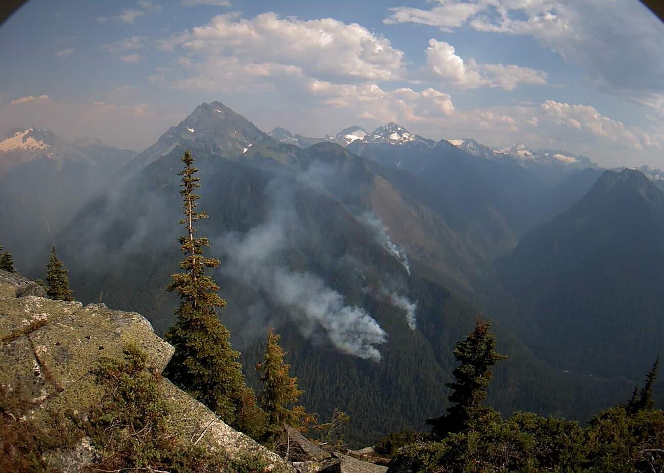
The Pincer Two fire is a lightning caused fire that started on July 17, 2024. It is burning on Johannesburg Mountain in timber and rugged terrain 1 Mile East of Mineral Park Campground.
| Current as of | Fri, 09/20/2024 - 13:56 |
|---|---|
| Incident Type | Wildfire |
| Cause | Lightning |
| Date of Origin | |
| Location | Johannesburg Mountain. 1 Mile East of Mineral Park Campground |
| Coordinates |
48° 28' .24'' Latitude
-121° 8' .63
'' Longitude
|
| Total Personnel: | 15 |
|---|---|
| Size | 211 Acres |
| Percent of Perimeter Contained | 0% |
| Estimated Containment Date | 10/31/2024 |
| Fuels Involved | Timber, rugged terrain |
| Significant Events | The closure on the Cascade River Road and all tributary roads, trailheads and trails has officially been lifted as of Friday, September 20th. The fire does not pose any risk to visitors, trails, structures or roads at this time, but please be aware that the fire is still burning at 3,500 feet. If you are in the area, you may see or smell smoke that is coming from the interior of the fire. It is anticipated that the fire will burn until there is a significant amount of rain received in the fire area. Firefighters will be in the area continuing to monitor until the fires are officially determined to be out. Please consider the following safety tips for recreating in fire impacted areas:
|
| Remarks |
The incident email and fire information phone will no longer be monitored after 5pm on Friday, September 20th. The incident Inciweb page will continue to be active until the fires are out. |
|---|