

.jpg)

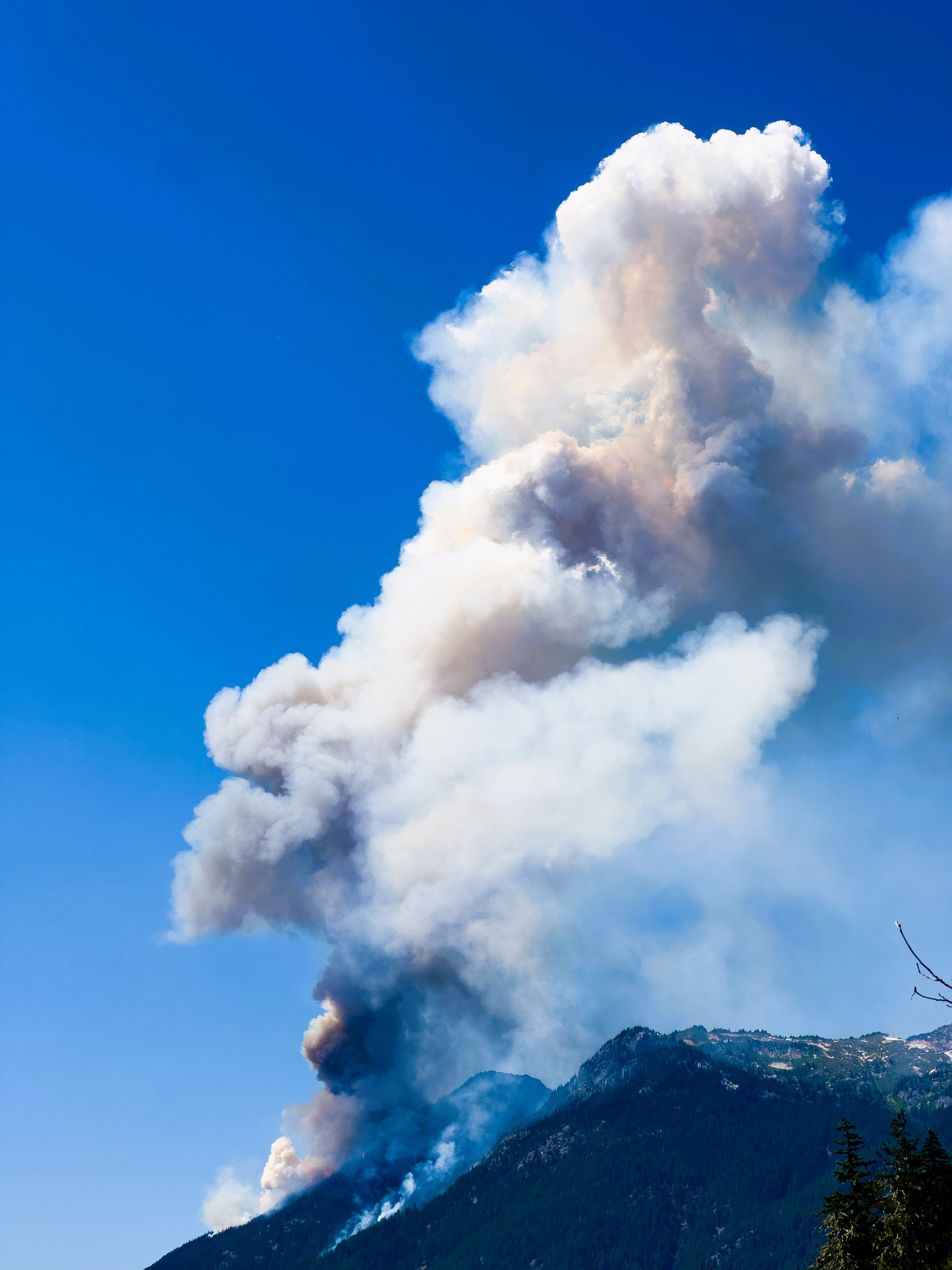
The Miners Ridge lookout reported several potential wildfires on the evening of July 17th following a large dry lightning storm that moved through the Pacific Northwest. In total, nearly 1,000 lighting strikes hit Oregon and Washington in the period between July 17th and 18th, 2024. Fire managers began reconnaissance flights to determine the severity of the lightning storm including three new potential wildfire starts reported on July 18th. Smokejumpers were ordered and began immediate work on one of the numerous fires. Additional new lightning starts may continue to be found as winds and record-breaking dry timber fuel fire growth.
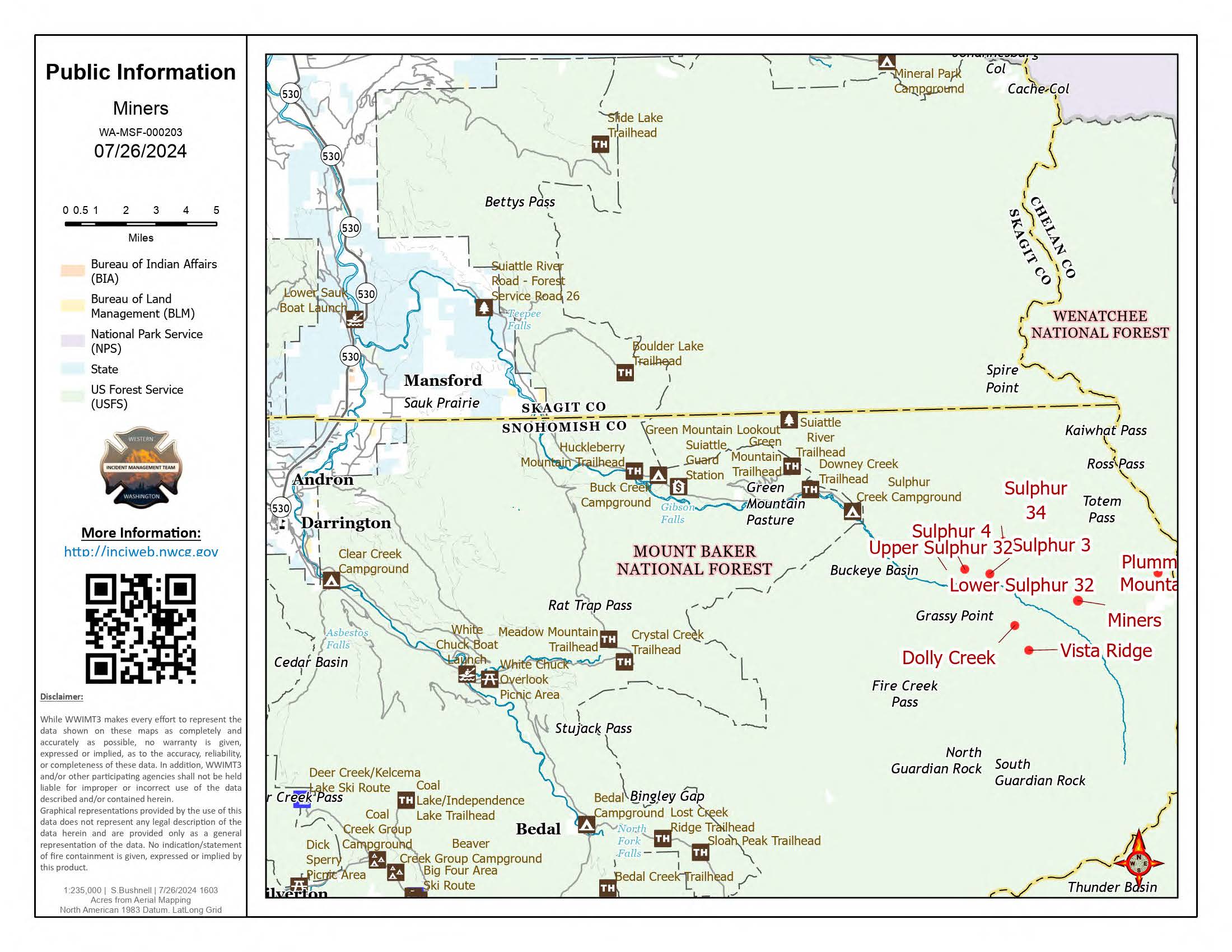
The Miners Complex consists of eight wildfires caused by lightning strikes in the Mt. Baker-Snoqualmie National Forest. The fires included in the complex are Miners Fire, Vista Ridge Fire, Dolly Creek Fire, Sulphur Three Fire, Sulphur Four Fire, Sulphur Thirty-Four Fire, Plummer, and Middle Ridge Fire.
The Miners Ridge lookout reported several potential wildfires on the evening of July 17th following a large dry lightning storm that moved through the Pacific Northwest. In total, nearly 1,000 lighting strikes hit Oregon and Washington in the period between July 17th and 18th, 2024. Fire managers began reconnaissance flights to determine the severity of the lightning storm including three new potential wildfire starts reported on July 18th. Smokejumpers were ordered and began immediate work on one of the numerous fires. Additional new lightning starts may continue to be found as winds and record-breaking dry timber fuel fire growth.
The Miners Complex consists of eight wildfires caused by lightning strikes in the Mt. Baker-Snoqualmie National Forest. The fires included in the complex are Miners Fire, Vista Ridge Fire, Dolly Creek Fire, Sulphur Three Fire, Sulphur Four Fire, Sulphur Thirty-Four Fire, Plummer, and Middle Ridge Fire.
| Current as of | Fri, 09/20/2024 - 18:58 |
|---|---|
| Incident Type | Wildfire |
| Cause | Lightning |
| Date of Origin | |
| Location | 21 air miles east of Darrington, WA |
| Coordinates |
48° 12' .16'' Latitude
--121° 2' .03
'' Longitude
|
| Size | 1,098 Acres |
|---|---|
| Percent of Perimeter Contained | 0% |
| Estimated Containment Date | 10/31/2024 |
| Fuels Involved | Timber |
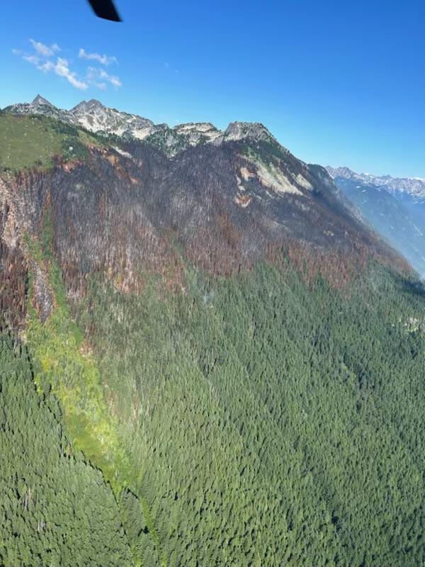
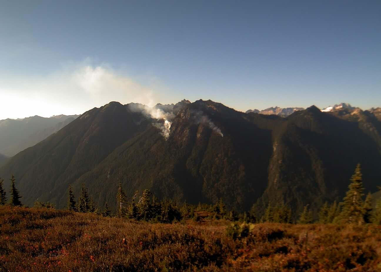
| Significant Events | Update: Effective 9/20/2024, the Pacific Crest Trail between Mica Lake and Suiattle Pass is now open. The Suiattle River Road closure has been lifted, and all trails are open besides the Suiattle River Trail #784 and Sulphur Mountain Trail #794, which remain closed due to fire activity. The Sulphur Fires remain active at high elevations, and fire debris roll-out has been seen near the Suiattle River Trail. It is anticipated that the fires will continue to burn at high elevations until the area receives a significant amount of rain. Little to no activity has been seen on the Miners, Middle Ridge, Dolly, and Plummer fires. Smoke was seen recently on the Vista fire after several weeks without activity. The Middle Ridge fire burned over ~0.2 miles of the PCT. While hiking on the PCT, please note that the fire does not pose any active safety risks, but fire weakened trees can be a safety hazard. If you are in the area, you may see or smell smoke. Please consider the following safety tips for hiking in fire impacted areas:
|
| Remarks |
The incident email and fire information phone will no longer be monitored after 5pm on Friday, September 20th. The incident Inciweb page will continue to be active until the fires are out. Please follow the Mt. Baker-Snoqualmie National Forest on Facebook and the Mt. Baker-Snoqualmie National Forest website Alerts & Notices page for updates on any further trail openings. |
|---|