
Highlighted Activity

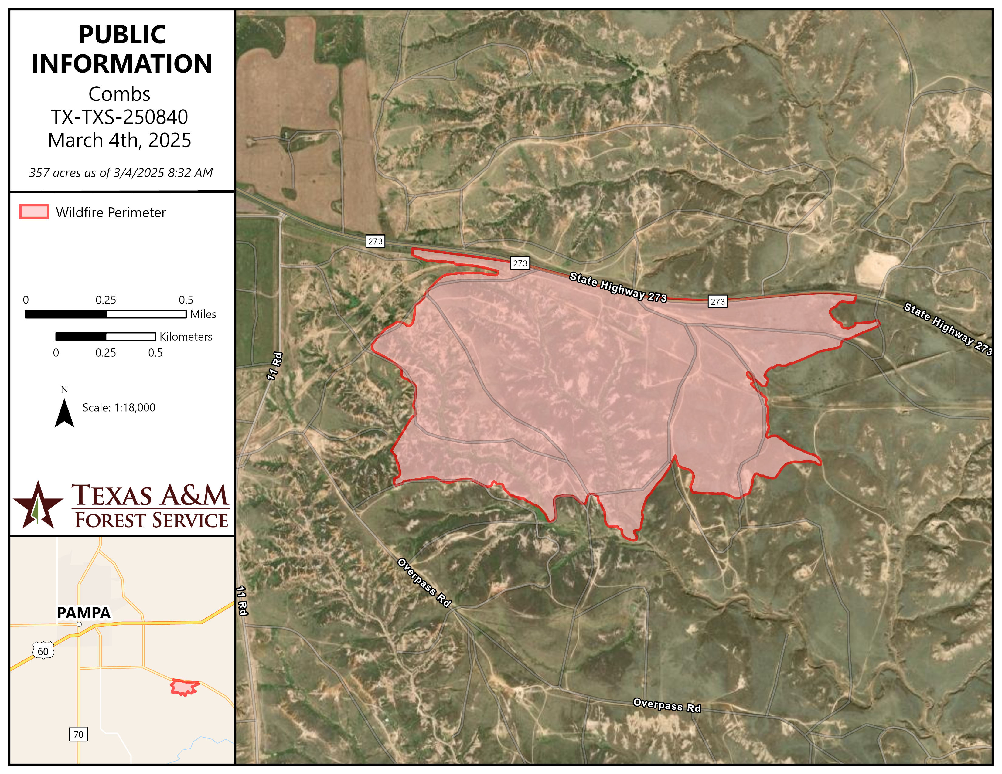
At approximately 8:00 PM, a wildfire started in Gray county off of Highway 273 just southeast of Pampa. There are road closures on Hwy 273 for north and south bound traffic with heavy smoke conditions affecting visibility. Southwest winds are driving the fire northeast through rough topography. Due to terrain, fire fighters are having difficulty directly engaging the fire. There are currently no evacuations and no structures threatened at this time. Texas A&M Forest Service was requested at approximately 8:20 PM and is working in unified Command with Gray County Emergency Management. Departments on scene are Texas A&M Forest Service, Pampa FD, Lefors VFD, Hoover VFD, Miami VFD, Skellytown VFD, McLean VFD, Groom VFD, Wheeler VFD along with Gray County Motor Graders. Motor graders are creating fire breaks where they can and Texas A&M Forest Service equipment is improving county motor grader lines for efficient holding.
| Current as of | Tue, 03/04/2025 - 12:48 |
|---|---|
| Incident Type | Wildfire |
| Cause | Unknown |
| Date of Origin | |
| Location | Gray County |
| Incident Commander | Texas A&M Forest Service- Incident Commander, Maynard Williams Gray County Emergency Management- Emergency Management Coordinator, Troy Schwiegerath |
| Coordinates |
35° 29' 51.4098'' Latitude
-100° 54' 2.196
'' Longitude
|
| Size | 357 Acres |
|---|---|
| Percent of Perimeter Contained | 100% |
| Significant Events | Forward progression of the fire has been stopped. Crews are having difficulty navigating through rough terrain in night conditions. With anticipated cold front and wind shift coming in tomorrow, the south flank of the fire is main concern for this operational period and command is creating a plan to secure that end of the fire. |