
Highlighted Activity
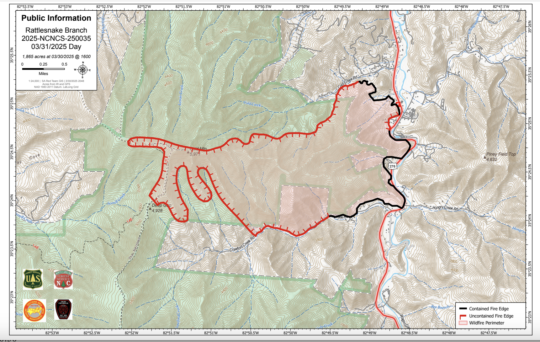
The Rattlesnake Branch Fire began on March 26, 2025, near Cruso, North Carolina, about 11 miles southeast of Waynesville. The fire rapidly spread, fueled by dry conditions in the hardwood leaf litter, and extended into the Shining Rock Wilderness Area within the Pisgah National Forest. Fire activity and spread have subsided following rainfall on March 30 and 31. The cause of the fire is under investigation.
| Current as of | Mon, 03/31/2025 - 15:40 |
|---|---|
| Incident Time Zone | America/New_York |
| Incident Type | Wildfire |
| Cause | undetermined |
| Date of Origin | |
| Location | Cruso Community, approximately 11 miles SE of Waynesville |
| Incident Commander | Steve Parrish/Jay Mickey, USFS |
| Coordinates |
35° 24' 50'' Latitude
-82° 48' 52
'' Longitude
|
| Total Personnel: | 107 |
|---|---|
| Size | 1,865 Acres |
| Percent of Perimeter Contained | 21% |
| Fuels Involved | Hardwood Litter Dormant Brush, Hardwood Slash Narrative: The primary carrier of fire is hardwood litter (FM9) with excessive 10 hour storm debris. Secondary fuel is shrub understory of Laurel and Rhododendron thickets. Live fuel moistures have been below critical levels. |
| Significant Events | Moderate Creeping Backing Smoldering Narrative: Fire is creeping, backing and low surface fire spread with minimal torching in brush fuels. Uphill runs on slopes. |
| Planned Actions |
Div A/Z: Point protection, strategic firing, protect values at risk, and mop up around structures. Establish containment lines using existing roads and areas adjacent to wilderness area. DIV D/G: Establish containment/point protection lines around values at risk in the Burnett Cr drainage. Structure Protection Group: Conduct structure assessment, develop a structure protection plan for the fire area. DIV J/M/R: Will remain unstaffed. |
|---|---|
| Projected Incident Activity |
12 hours: Continued surface fire growth, running and backing. Burnout opportunities good through the burn period. 24 hours: Minimal fire growth due to forecast rain. 48 hours: Minimal fire growth due to forecast rain. 72 hours: Minimal fire growth due to wetting rain. |
| Weather Concerns | Increased cloud cover today along a trace of rain. Humidity recovery was near 100% this morning. Forecast for Monday 3/31: Showers and thunderstorms are expected in the morning with up to 0.30" of rainfall as a weather disturbance moves across the fire area. Highs 60-65F, south ridgetop wind 8-12mph with gusts to 26mph, shifting to the west and northwest by the end of the day. |
|---|