
Highlighted Activity
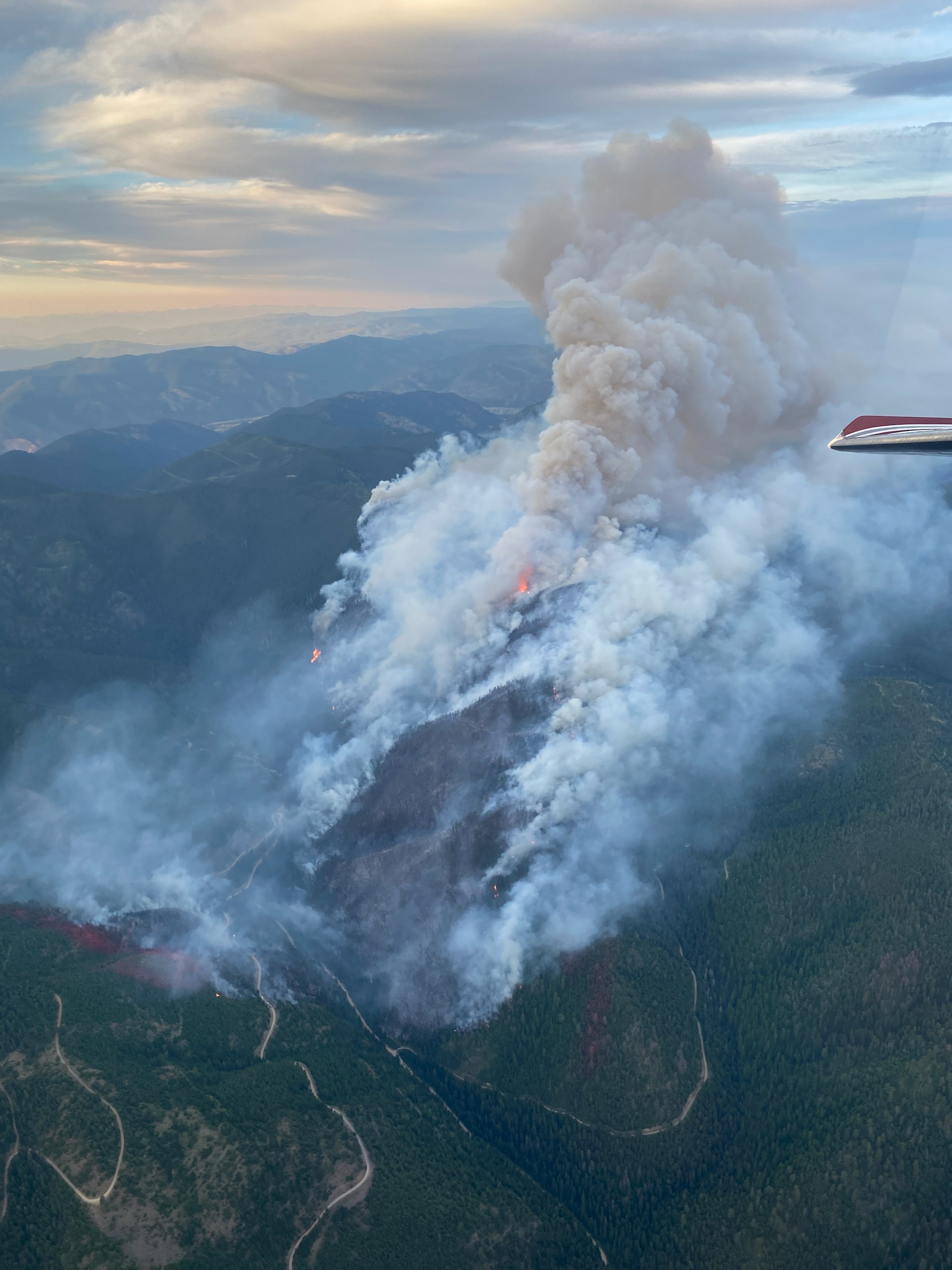
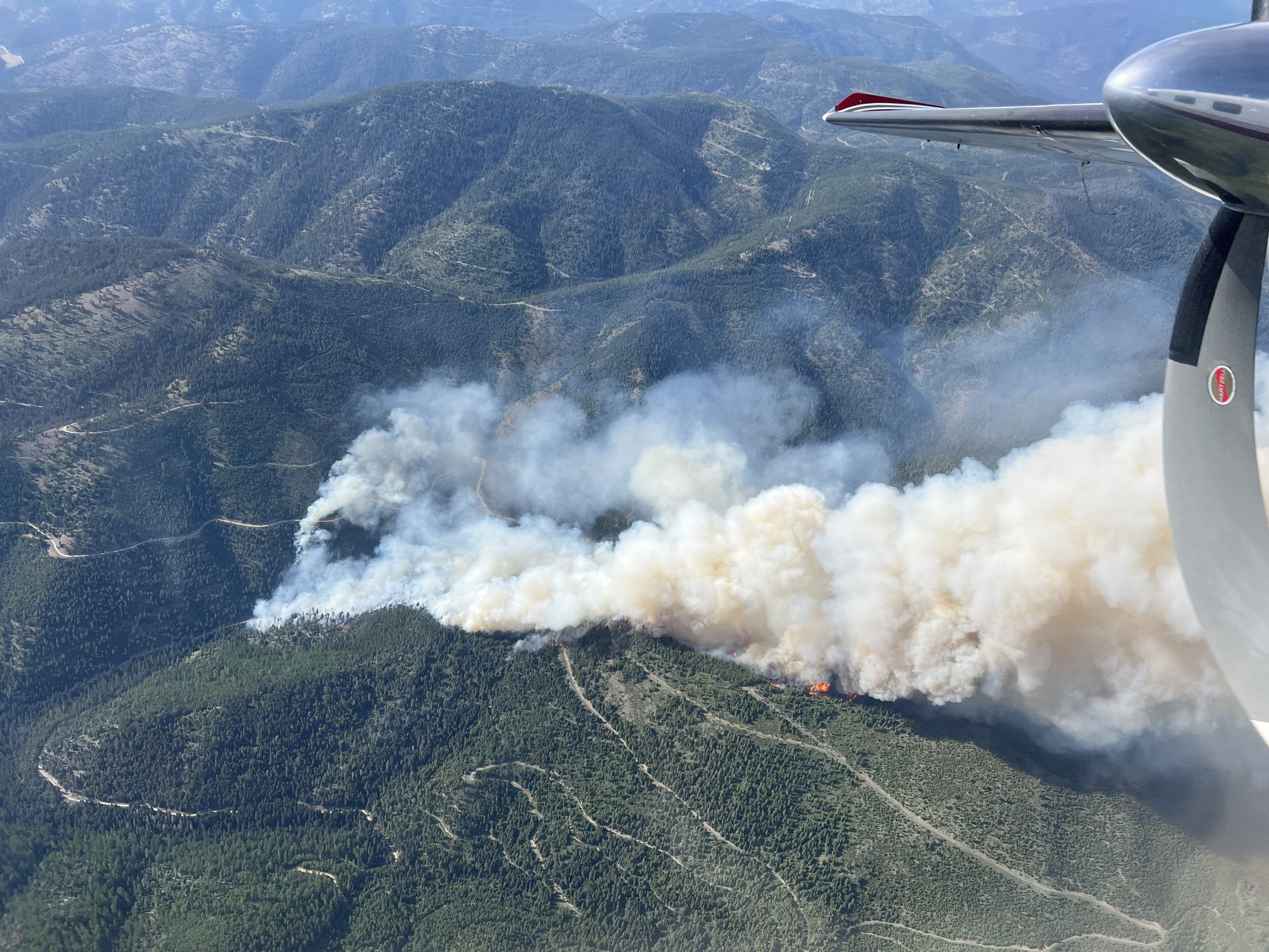
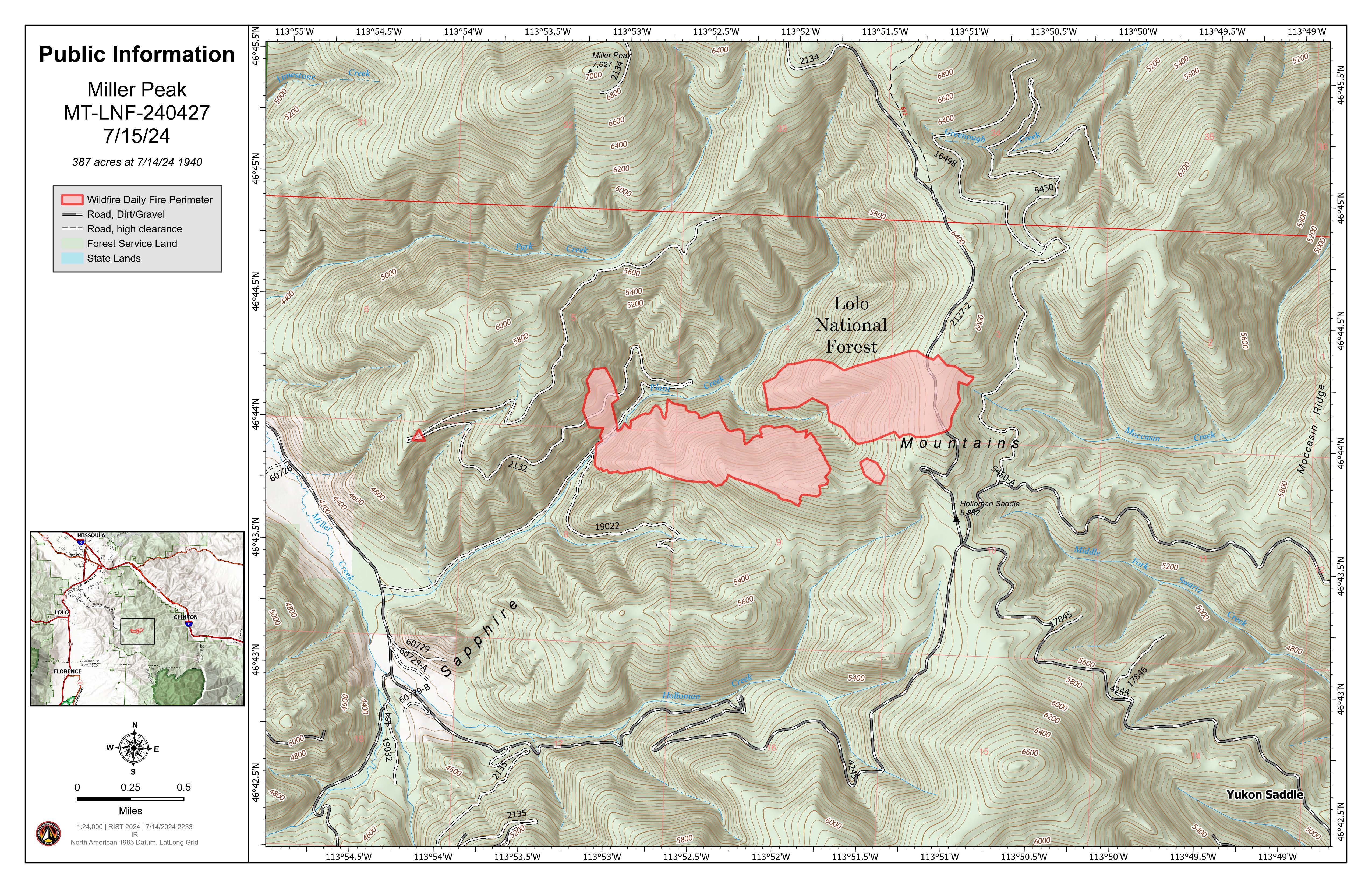
The Miller Peak Fire was first reported the afternoon of July 14, 2024. Growth continues to be driven by wind and topography. The fire is located about 8 miles southeast of Missoula in the Plant Creek drainage of Miller Creek. Fire behavior has been very active and is in dense mixed conifer. Northern Rockies Incident Management Team 5 has been ordered.
The Missoula County Sheriff's Office has issued evacuation warnings due to this fire. Please visit their Facebook page for the latest information: Missoula County Sheriff's Office
| Current as of | Mon, 07/15/2024 - 15:46 |
|---|---|
| Incident Type | Wildfire |
| Cause | Under Investigation |
| Date of Origin | |
| Location | 8 miles southeast of Missoula |
| Incident Commander | Lolo National Forest, Missoula Ranger District |
| Coordinates |
46° 43' 52'' Latitude
-113° 53' 08
'' Longitude
|
| Total Personnel: | 62 |
|---|---|
| Size | 500 Acres |
| Fuels Involved | Timber (grass and understory) |
| Weather Concerns | Hot and dry conditions will persist over the fire location for the next several days. Monsoonal moisture will be moving through the ridge causing partly cloudy conditions, but do not see any storms impacting the fire. Gusty westerly winds will redevelop Monday afternoon. The winds are expected to significantly lighter on Tuesday |
|---|