
Highlighted Activity
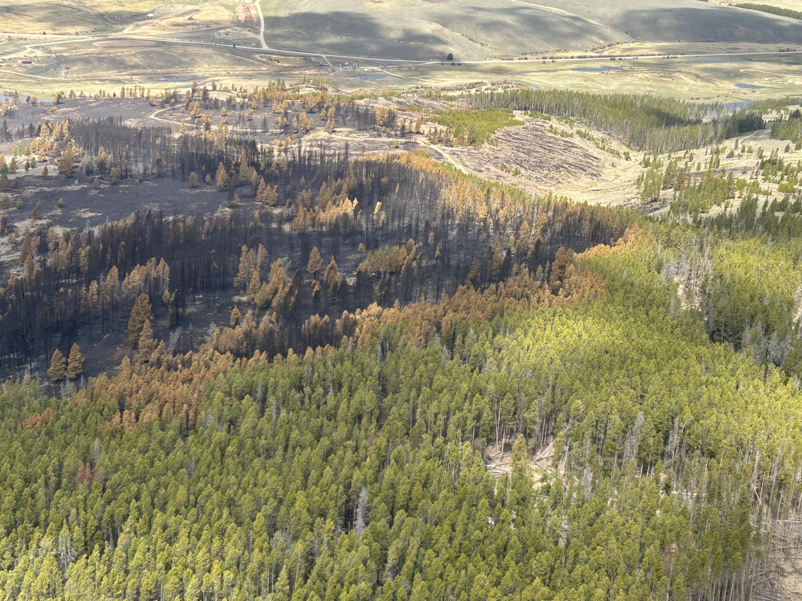
The Sawlog Fire was reported on the afternoon of May 1st. Forest Service fire officials from the Beaverhead-Deerlodge National Forest responded to the area, located west of Wise River and northeast of Wisdom in the Sawlog Creek drainage. The fire was initially estimated at 50-70 acres, burning on the south side of the Big Hole River. Immediate access to the fire area was somewhat limited, given the time of year with the snow melt and high water conditions in the river. Upon arriving at the fire's location, firefighters observed the fire burning actively in sagebrush and Lodgepole pine timber. A large "dead and downed" component of fuels exists on the north-facing slopes in the area.
The fire is located between the Sawlog Creek and Toomey Creek drainages, on the south side of the Big Hole River. The fire footprint from the 2021 Christensen Fire is located to the south, and the fire footprint from the 2021 Alder Fire is located to the east.
Fire investigators are working to determine the exact cause of the fire. Neither the Forest Service nor the BLM had any prescribed fires (commonly referred to as “controlled burns”) in that area.
| Current as of | Tue, 05/20/2025 - 10:46 |
|---|---|
| Incident Time Zone | Mountain Standard Time |
| Incident Type | Wildfire |
| Cause | Undetermined |
| Date of Origin | |
| Incident Time Zone | Mountain Standard Time |
| Location | 15 miles northeast of Wisdom, MT |
| Incident Commander | Nate Decker, ICT4 USDA Forest Service |
| Coordinates |
45° 49' 41'' Latitude
-113° 15' 10
'' Longitude
|
| Total Personnel: | 40 |
|---|---|
| Size | 2,030 Acres |
| Percent of Perimeter Contained | 100% |
| Fuels Involved | Timber, sagebrush, and short grass. The fire burned mainly in sagebrush and Lodgepole pine timber. The north-facing slopes in the area consist of a high “dead and downed” fuel component in a mixed conifer forest, and numerous “snags” or hazard trees are present. This fuel combination poses additional hazards for firefighters and affects on-the-ground progress. |
| Significant Events | The Type 3 Incident Management Team has transferred command of the Sawlog fire to a Type 4 organization. Most resources no longer needed have demobilized and returned to home units. The fire is 100% contained.
|
| Planned Actions |
The remaining resources will patrol the perimeter when presented with an opportunity to safely enter the fire area, given the recent weather and muddy access conditions.
|
|---|---|
| Remarks |
Working in cooperation with local and interagency partners, fire managers have identified and prioritized values at risk of the Sawlog Fire. Their planning is strategic in nature, focusing available resources and current efforts on protecting critical values at risk (CVAR) while decreasing the potential for negative impacts and resource damage. |
| Weather Concerns | The fire area has received steady precipitation, including snow and rain, for several days. Measurable amounts over half an inch were reported in some locations. A warming and drying trend will enter the area, potentially resulting in a slight increase in smoke interior to the fire's edge.
|
|---|