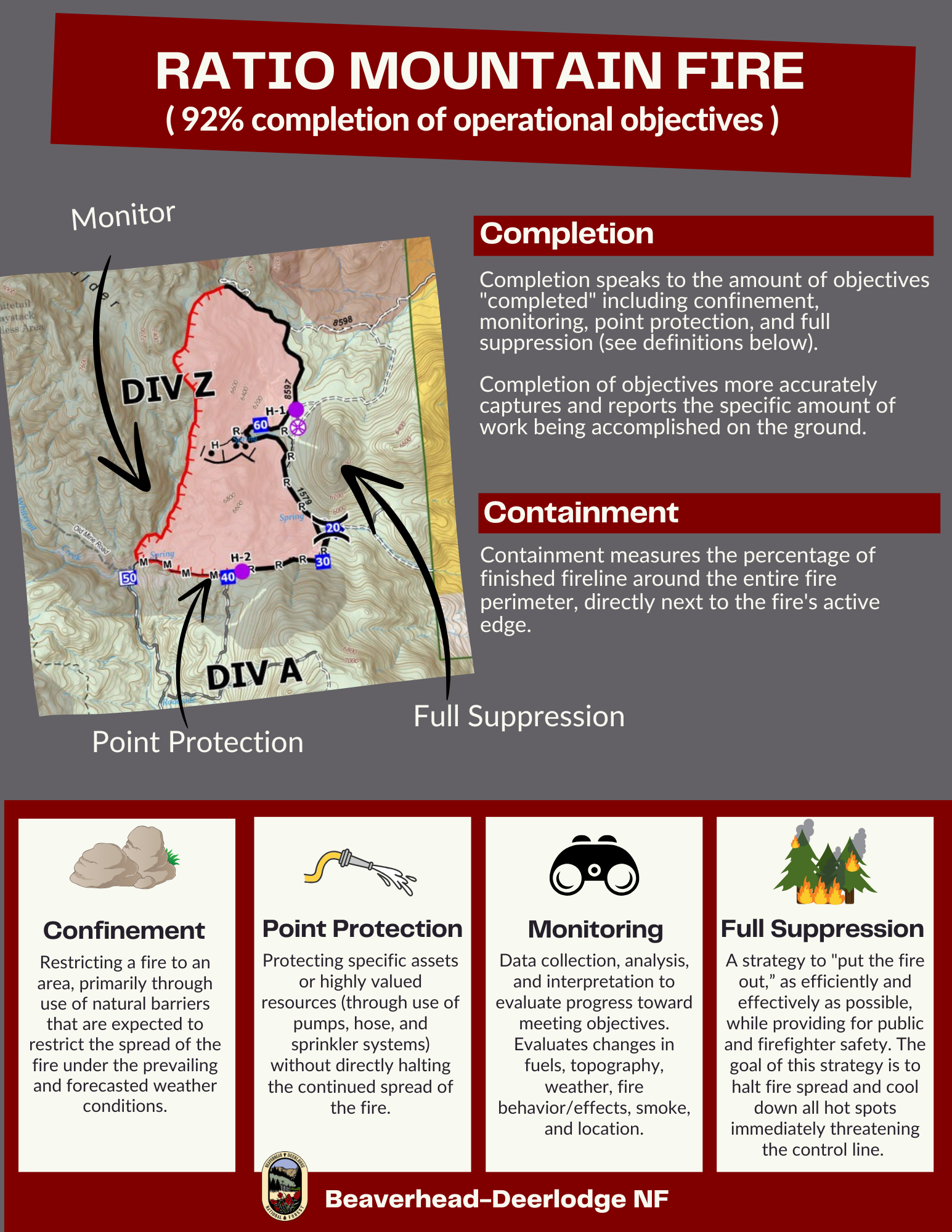
Given our success with firefighting operations on the Ratio Mountain Fire, fire managers are reporting progress in terms of % completion of operational objectives.
Firefighters have successfully achieved 92% completion of operational objectives on the Ratio Mountain Fire. As a measure of progress, percent completion of objectives more accurately captures and reports the specific amount of work accomplished on the ground to manage fire spread and reduce the negative impacts to identified critical values at risk.
Crew have completed firing operations along previously constructed firelines along the eastern flank of the fire, extending from the fire footprint from the State Creek fire on the north and along Hay Canyon Road to its junction with Lower Whitetail Road in the southeast corner. The objectives to keep the fire west and north of these lines, accomplishing a full suppression strategy on this section (accounting for 60% of the perimeter) are 100% complete.
The objective on the southern flank (accounting for 10% of the perimeter), near identified critical values at risk on private land below the St. Anthony mine site, is to implement structure protection measures. All the structure prep work is 100% complete, and the objective to strategically guide fire around the structure is also 100% complete. Collectively, the point protection objective is 100% complete.
The west and northwest portions of the fire are in remote, rugged terrain with little to no access for firefighting resources. These areas pose challenges in responding to potential medical emergencies, jeopardizing the safety and well-being of firefighters and other responders. Located four miles from the nearest identified critical value at risk, this section of the fire (accounting for 30% of the perimeter) will be monitored until significant weather results in a fire season-ending event.
| Current as of | Mon, 11/04/2024 - 08:51 |
|---|---|
| Incident Time Zone | America/Denver |
| Incident Type | Wildfire |
| Cause | Lightning |
| Date of Origin | |
| Location | 15 miles northwest of Whitehall, MT. |
| Incident Commander | BDNF Fire Personnel |
| Coordinates |
46° 2' 43'' Latitude
-112° 11' 46
'' Longitude
|
| Total Personnel: | 2 |
|---|---|
| Size | 2,466 Acres |
| Fuels Involved | The entire area, including the previous fire footprints and the area immediately surrounding the Ratio Mountain fire, contains a large concentration of standing dead trees (“snags”) that pose challenges to ensuring firefighter safety and in responding to potential medical emergencies, jeopardizing the well-being of firefighters and other responders. |
| Significant Events | There is still residual heat and subsequent fire activity in the more remote sections of the fire along the northern and western flanks. These active areas pose no concerns to critical values nor previously constructed firelines.
Operational objectives are 92% complete.
|
| Planned Actions |
Crews will continue to monitor and engage fire as needed near the identified critical value at risk on private land below the St. Anthony mine site..
|
|---|---|
| Projected Incident Activity |
Fire activity is limited to smoldering and creeping, due to recent precipitation over the fire area. |
| Remarks |
Fire managers from the Forest, working in collaboration with local Jefferson County officials and cooperating agency representatives from the DNRC and BLM, have identified, mapped, and prioritized critical values at risk in and around the fire area. These inter-agency, values-based discussions are critical in fire management, informing the decision-making process for incident management. The northern, eastern, and southern edges of the fire are currently where fire managers want them, preventing forward progression of the fire toward critical values at risk. Recent strategic firing operations have been successful at protecting these values identified by local Jefferson County officials and cooperating agency representatives, by keeping the fire on Forest Service land west of the Hay Canyon Road and north of Little Whitetail Creek. |

 InciWeb