
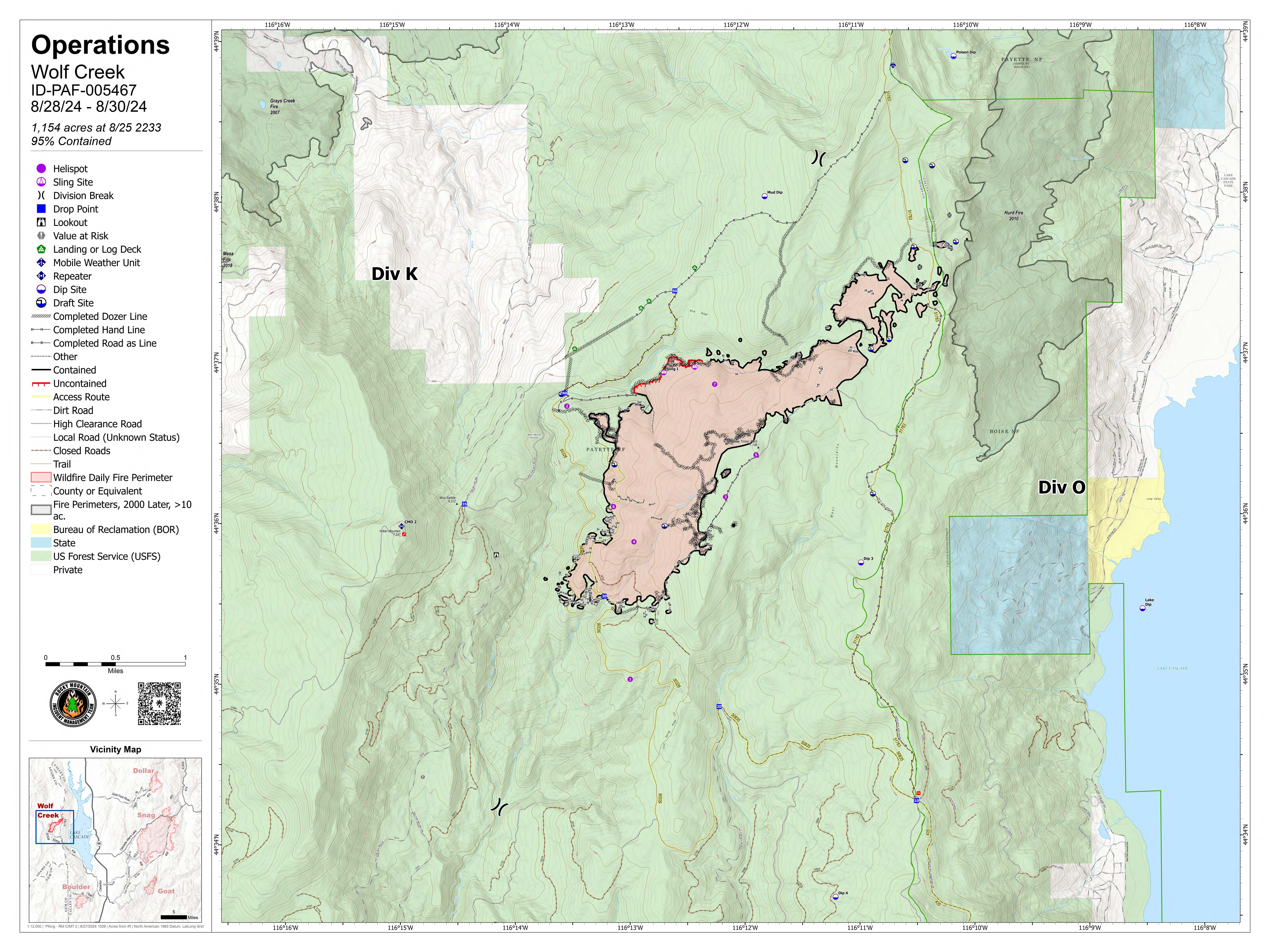
The Wolf Creek fire transferred command back to the Payette National Forest as August 28, 2024, under a Type 4 Incident Command organization assembled to continue work on the Fire. Please contact the Payette National Forest Fire Hotline for information about the Wolf Creek Fire at 208-634-0820.
As this fire is 100% contained, this Inciweb page will remain static until additional information is available to be shared.
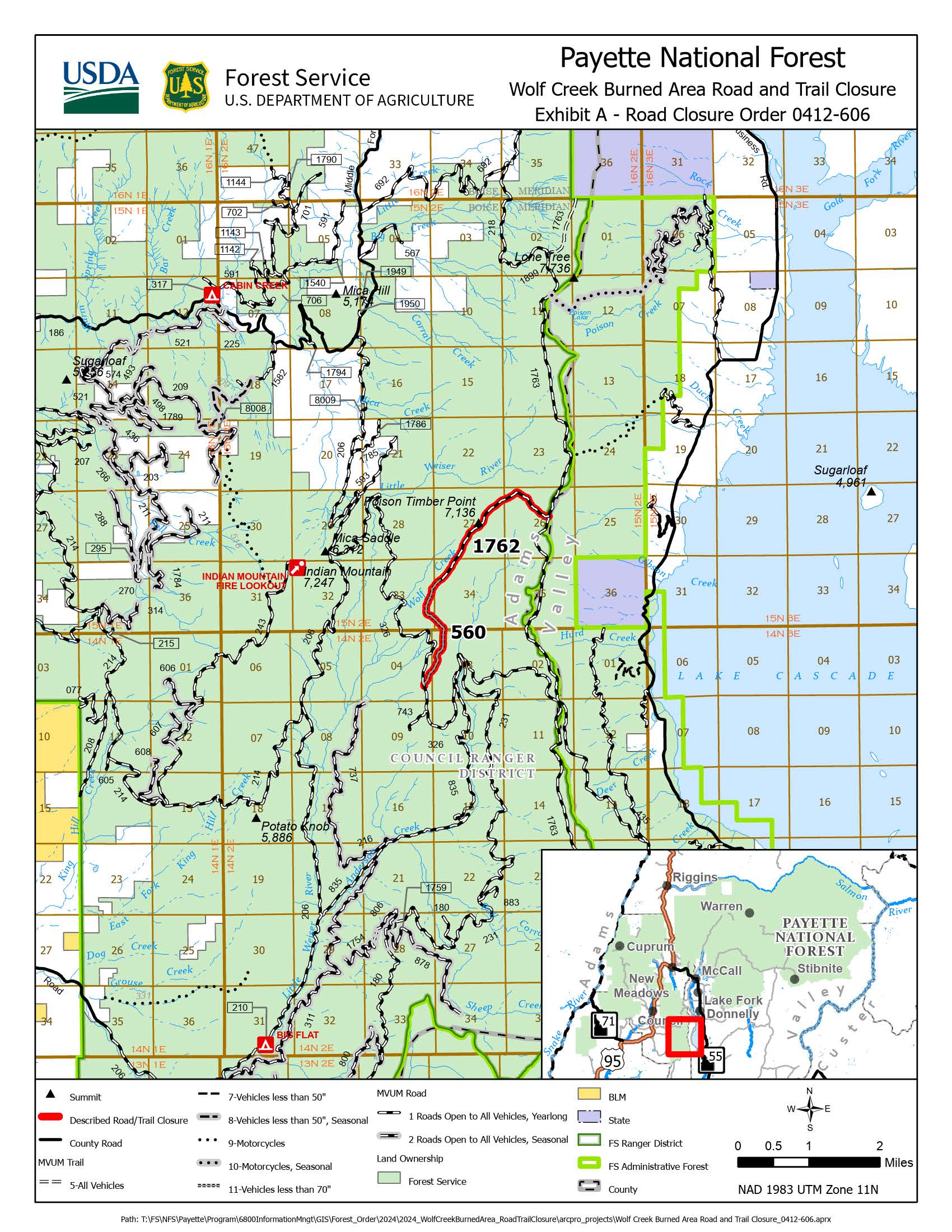
The Wolf Creek Fire area is now under a larger Fire Closure Order from the Lava Fire with no access permitted. For information on this closure visit this link: https://www.fs.usda.gov/Internet/FSE_DOCUMENTS/fseprd1204358.pdf
The Wolf Creek Fire was detected on the evening of July 24, 2024, approximately 5 miles southwest of Donnelly, ID, after a lightning storm passed through the area. Local resources immediately responded to the incident.
| Current as of | Thu, 10/03/2024 - 15:45 |
|---|---|
| Incident Time Zone | America/Boise |
| Incident Type | Wildfire |
| Cause | Lightning/Natural |
| Date of Origin | |
| Location | 11 Miles NW of Cascade, ID |
| Coordinates |
44° 36' 10'' Latitude
-116° 12' 37
'' Longitude
|
| Total Personnel: | 65 |
|---|---|
| Size | 1,154 Acres |
| Percent of Perimeter Contained | 100% |
| Estimated Containment Date | 8/31/24 |
| Planned Actions |
Resources continue to mop up remaining heat in the Little Weiser River drainage on the north flank and interior to reduce the potential for torching of trees. Suppression repair work continues in priority areas. |
|---|