The Payette National Forest has taken command back to the Forest level as of Saturday, October 19th - updates to this Inciweb page will be made as needed. For answers to questions, please call the Payette Fire Information line at 208-634-6945.
Weather: Last week the Logan Fire area received about 0.5 inches of rain with a trace of snow across the fire area. This weather event helped to slow and moderate fire spread to a point that the fire is now being managed as a Type 4 Incident with a focus on fire line suppression repair in the Edwardsburg area. There is very limited potential for additional fire growth and only in the northeastern and east flanks of the fire. Another weather system is expected to provide moisture to the fire over this coming weekend that will further reduce the potential for fire spread and the need for fire suppression activities.
Current Situation: A hand crew and one engine remain assigned to the fire with a focus on fire line suppression repair and patrolling for potential hotspots and removing fallen trees on the roadways in the Edwardsburg area. Chipping and burning of piles of woody materials continues to take place.
Evacuations: Valley County Sheriff's Office has lifted the evacuation level and opened the county roads - the Warren-Profile Gap Road (referred to locally as the Big Creek Road and the Elk Summitt Road) are open. If traveling the roadways use caution and watch for rolling debris and fallen trees throughout the burned area.
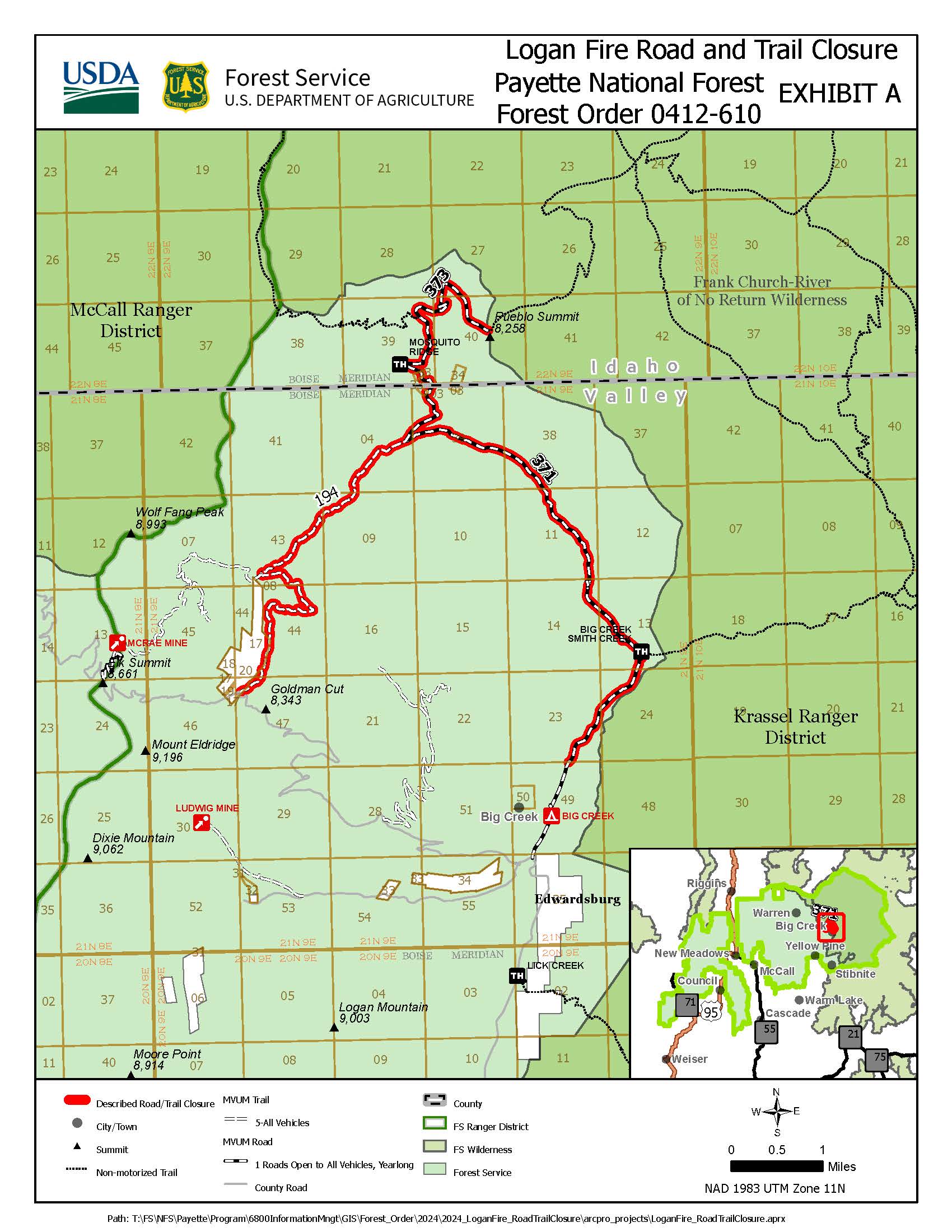
Closures: The Logan Fire has a Forest Service road and trail closure in effect - these are only for Forest Service roads and trails. The map and description are located at https://www.fs.usda.gov/alerts/payette/alerts-notices.
| Current as of | Tue, 10/22/2024 - 16:04 |
|---|---|
| Incident Time Zone | America/Boise |
| Incident Type | Wildfire |
| Cause | Lightning |
| Date of Origin | |
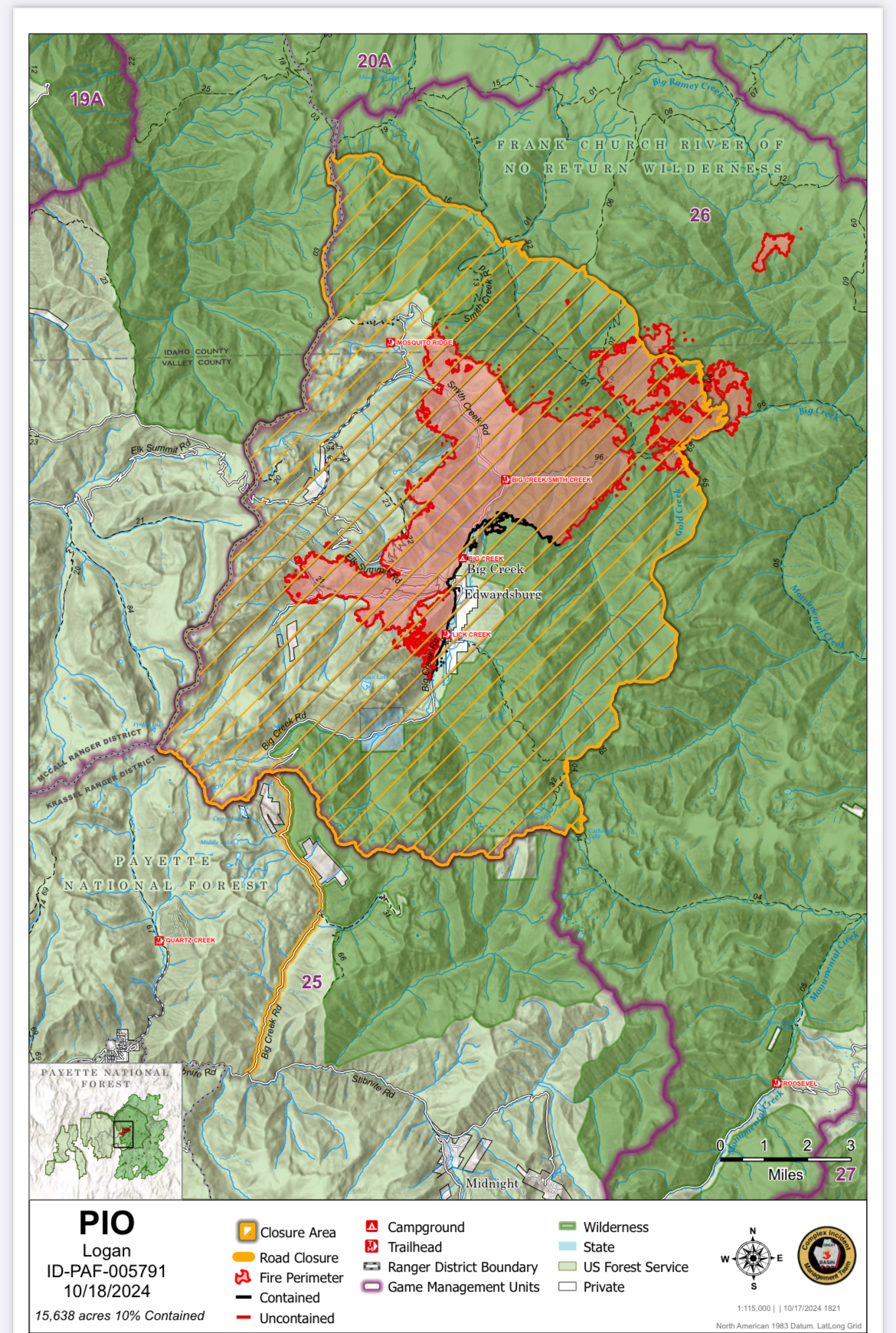
| Location | The fire is centered around Edwardsburg, but has burned north, east, west and south of the community. It has moved into the Wilderness area. Krassel Ranger District, Payette National Forest |
| Coordinates |
45° 7' 29'' Latitude
-115° 22' 84
'' Longitude
|
| Total Personnel: | 85 |
|---|---|
| Size | 15,638 Acres |
| Percent of Perimeter Contained | 10% |
| Estimated Containment Date | 11/01/2024 |

 InciWeb

