
The project aims to reduce slash hazards associated with previous logging operations.
The project aims to reduce slash hazards associated with previous logging operations.
| Current as of | Mon, 05/05/2025 - 18:41 |
|---|---|
| Incident Type | Prescribed Fire |
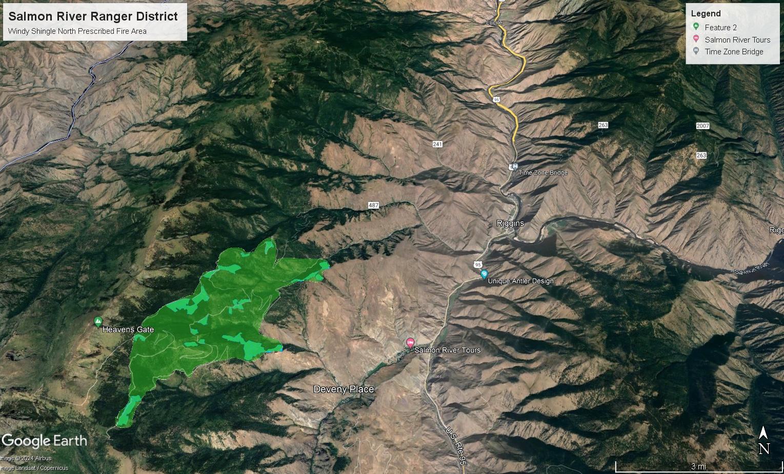
| Location | Four miles southwest of Riggins, ID, along National Forest Road #2109, off of the NFSR #517 |
| Incident Commander | Salmon River Ranger District Fire and Fuels staff |
| Incident Description | The project area is located on National Forest System (NFS) lands in Township 24 North (T24N), Range 1 West (R1W), Sections 9-17, 20-29, 32-35; T23N, R1W, Sections 1-10, 12, 13, 24, 25, 36; T23N, R1E, Sections 7, 19, 30, 31, 32; T22N, R1W, Section 1; and T22N, R1E, Sections 5, 6, Boise Meridian. The project area includes S. Creek, P. Creek, Rough Creek, Shingle Creek, and other tributaries to the Lower Salmon River; and unnamed tributaries from Windy Ridge and Indian Creek to the Little Salmon River. |
| Coordinates |
45° 23' 27.55'' Latitude
-116° 25' 7.43
'' Longitude
|
| Projected Incident Activity |
Ignitions took place last week on the Windy Shingle remaining units. Late Friday afternoon, burning material rolled out of the prescribed burn unit and into a steep, inaccessible area of Shingle Creek. The Prescribed Fire has now been converted to a Wildfire by definition for administrative and resource ordering purposes. Under this declaration, Fire Management has ordered resources and a Type 3 Incident Commander to fully suppress the unplanned ignition outside of the prescribed fire unit. While there is no immediate threat to life or property at this time, Fire Management is taking appropriate actions to suppress this fire before conditions become warmer and drier. |
|---|---|
| Remarks |
Low lying drainages may be impacted by residual smoke or inversions including the Little Salmon River Canyon, Main Salmon River Canyon and their tributaries, during the evening and early morning hours. Visibility along highway corridors including Hwy 95 may be impacted. |