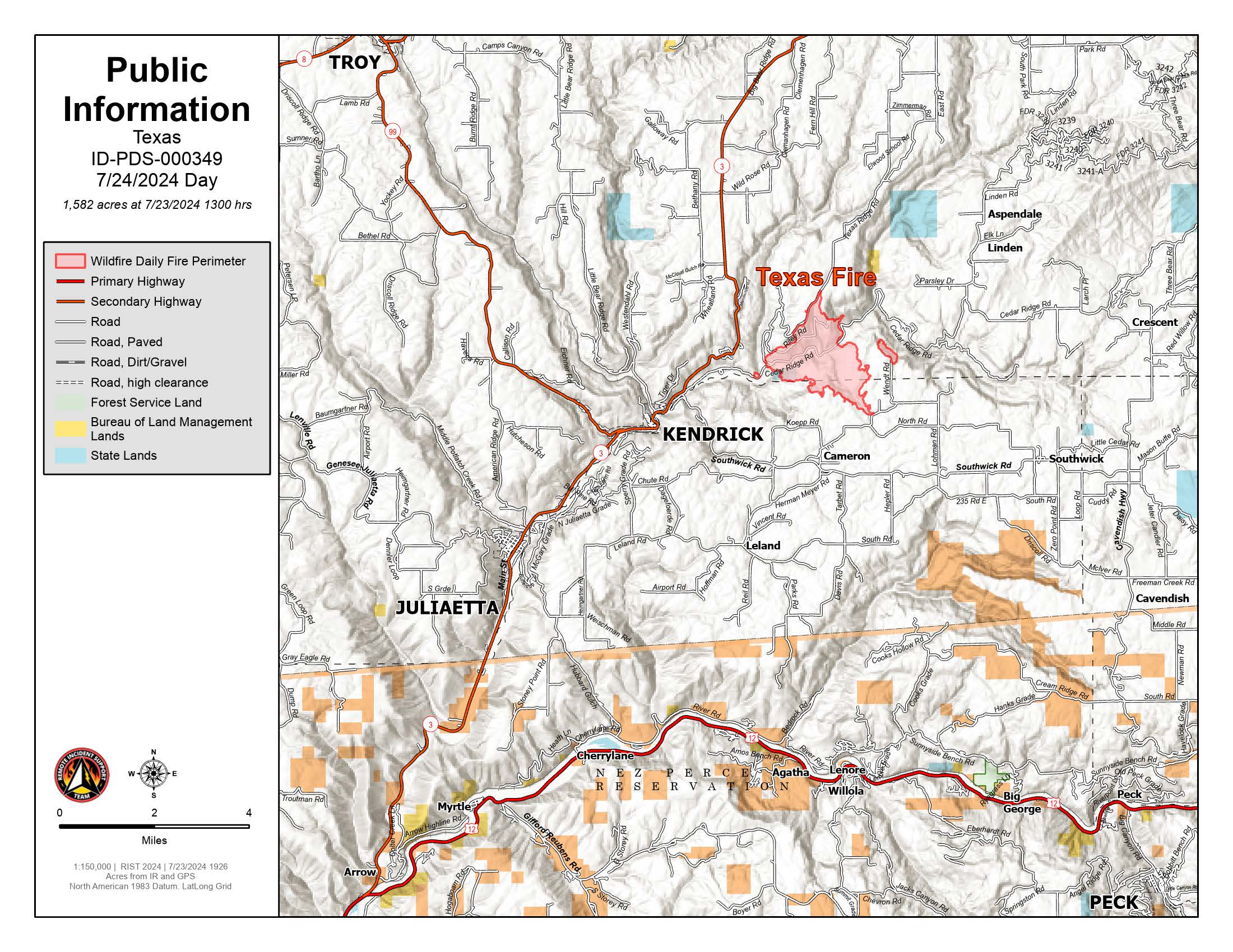
U.S. flag

An official website of the United States government

Here's how you know

Single Incident Information

Zoom to your location
Reset map zoom and position

Could not determine your location.

Texas Fire

Unit Information

300 N. 6th Street 
Boise, 
Idaho 
83702 
300 N. 6th Street 
Boise, 
Idaho 
83702 

Incident Contacts

Texas Fire Information
Email: 2024.texas@firenet.gov
Phone: 208-901-7295
Hours: 7:00 AM - 7:00 PM

On Monday, July 15, 2024 at approximately 4:00 PM, the Texas Fire was detected about three miles northeast of Kendrick, ID, and 12 miles southwest of Deary, ID. 
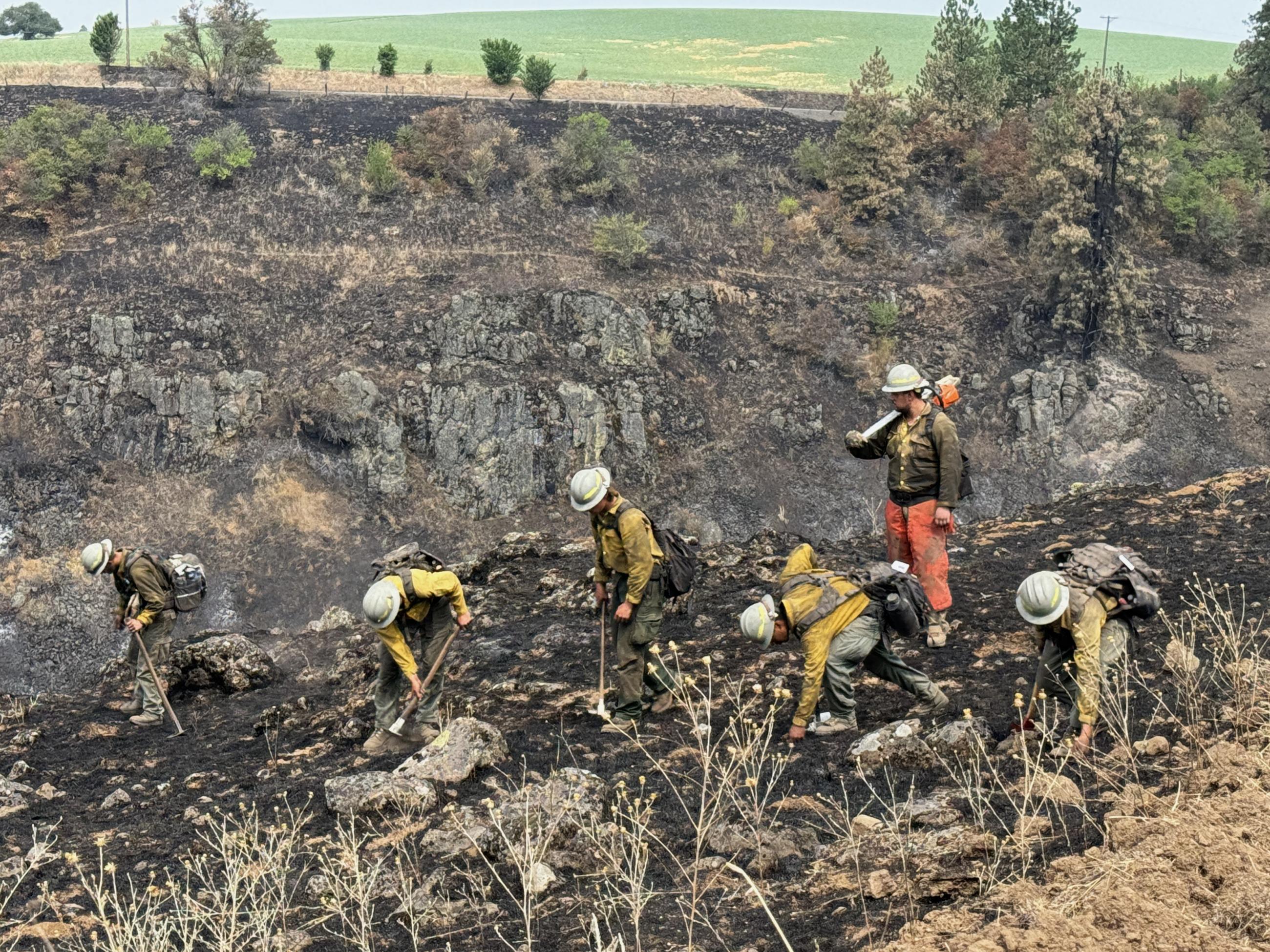
 

Evacuation Statuses:

As per the Latah County Sheriff's Department, the following are current evacuation status:

  • Level 3 Evacuations:
    • Cedar Ridge from Highway 3 to Linden Rd.
    • Linden Rd. to S Park Rd.
    • Texas Ridge Rd and East Rd. to Sundstrom Rd.
  • Level 2 Evacuations:
    • Texas Ridge and Sundstrom Rd to Highway 3
    • Cedar Ridge Rd. at Linden Rd. to Three Bear Rd.
    • All houses west of 1210 Cedar Ridge Rd.
  • Level 1 Evacuation:
    • Any houses 2 miles outside of the listed Level 2 evacuation locations.

As per the Nez Perce County Sheriff's Department, the following areas should be prepared for evacuations:

  • Residents who live on and to the north of Southwick Road should be prepared in case of a mandatory evacuation. This area includes Brothers Ln, Koepp Rd, North Rd, Wendt Rd, and Lohman Rd.

Current Closure Orders:

  • P1 and Texas Ridge remain closed at this time.

Evacuation Center:

  • For those directly impacted by the evacuations due to the Texas Ridge Fire, American Red Cross has established an evacuation center at Kendrick High School.
  • For those with livestock, Lewiston Roundup is offering space for those impacted by the fire.


Basic Information
Current as of Wed, 07/17/2024 - 23:19
Incident Type Wildfire
Cause Unknown; currently being investigated
Date of Origin
Location Approximately three miles northeast of Kendrick, ID and 12 miles southwest of Deary, ID
Coordinates 46° 38' 1.32'' Latitude
-116° 35'
33.00
'' Longitude
Current Situation
Size 1,352 Acres
Percent of Perimeter Contained 0%
Outlook
Planned Actions

The incoming Incident Management Team has arrived and been briefed on the current situation.  They will take command of the fire tomorrow July 18, 2024, at 6:00 A.M. PT.  

Remarks

As of 6:00 P.M. PT, July 17, 2024, four primary residences and six outbuildings have been confirmed lost.

Current Weather
Weather Concerns

There remains a chance of thunderstorms within the fire area this evening.  These storms have yet to materialize and fire crews are monitoring the conditions.