
Highlighted Media
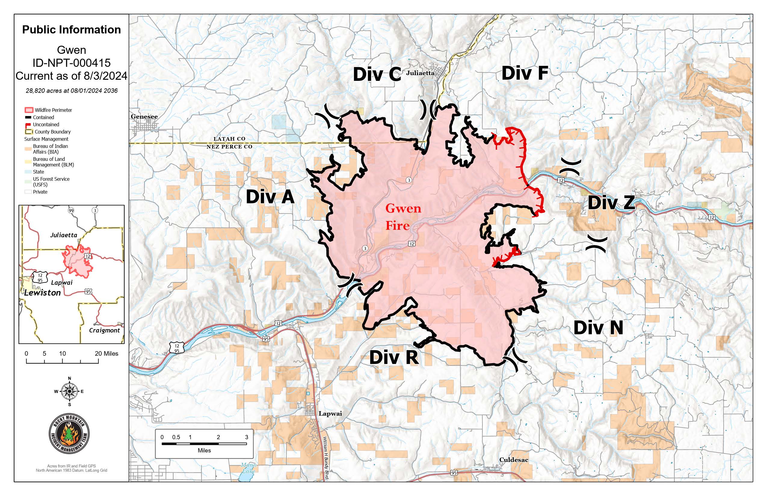
Multiple fires spread northeast of Lewiston, Idaho after a lightning event Wednesday, July 24. The Gwen Fire and River Fire are combined in one incident called the Gwen Fire. Rocky Mountain Complex Incident Management Team 3 (RMCIMT 3) in-briefed Saturday evening July 27 and took command of the fire on Sunday, July 28.
Location: East of Lapwai, Idaho by 5 miles
Communities Impacted: Julietta, Lapwai, and Culdesac
Structures: Primary residences, outbuildings and a commercial building are among the structures lost. Structure assessments are underway to further evaluate the extent of the losses.
Current Situation: Rocky Mountain Incident Management Team Three will transfer command to a local Type 4 organization on Saturday, August 3.
Road closures have been lifted and all evacuation orders have been reduced to Level 1 (Ready Status).
| Current as of | Thu, 08/22/2024 - 14:52 |
|---|---|
| Incident Time Zone | America/Boise |
| Incident Type | Wildfire |
| Cause | Lightning |
| Date of Origin | |
| Location | South of Juliaetta Idaho, about 30 miles outside Lewiston near State Highway 3 in Latah County |
| Incident Commander | Rocky Mountain Complex Incident Management Team Three Bill Waln - Incident Commander |
| Coordinates |
46° 31' 96'' Latitude
-116° 45' 21
'' Longitude
|
| Total Personnel: | 194 |
|---|---|
| Size | 28,820 Acres |
| Percent of Perimeter Contained | 90% |
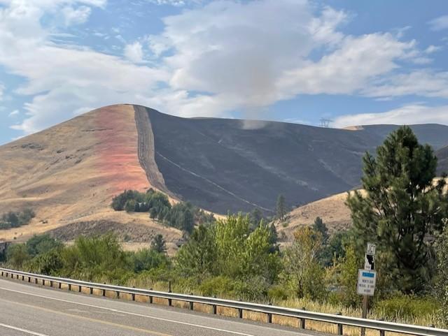
| Fuels Involved | Fuels are very dry, dead grass, steep slopes, and live fuels are very receptive to fire spread with live fuel moistures low; agricultural component of wheat and garbanzo beans. |
| Significant Events | Observed fire behavior: minimal |
| Planned Actions |
Planned operations: mopping up, securing the fire edge, and monitoring the fire line with ground resources. |
|---|---|
| Projected Incident Activity |
12 - 24 hours: Minimal future growth is expected. Any growth is more likely in drainages or within strings of heavy fuels. |
| Weather Concerns | Temperatures will cool several degrees but remain hot over the weekend and into early next week as an upper level ridge shifts east and clouds increase. An Excessive Heat Warning is in effect through Saturday. Light to moderate afternoon breezes are expected Saturday through Monday. Increasing monsoonal moisture will produce a slight chance of showers and thunderstorms Saturday night through Monday. Storms may be capable of lightning, gusty winds, and heavy rainfall, with the burn scar adding to flash flood and debris flow risk. A cold front on Tuesday will bring cooler temperatures by the middle of next week with decreasing shower and thunderstorm chances. The front will also bring breezy northwest winds with gusts to around 25 mph and low humidity. |
|---|