
Highlighted Activity
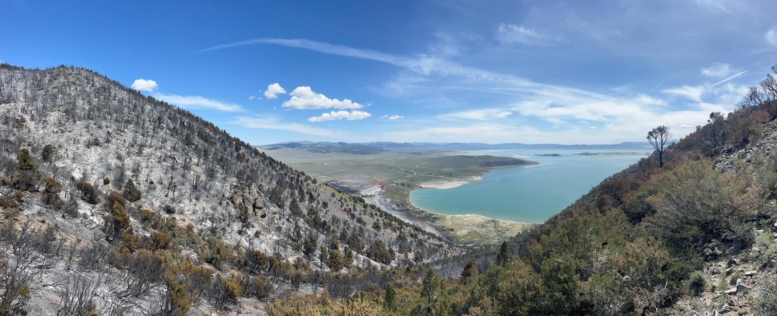
The Inn Fire started on Thursday May 22, 2025 at approximately 3:36 p.m. on the west side of Highway 395, just south of Mono City. Erratic winds caused the fire to grow quickly and spot across the east side of Highway 395. A full suppression response was ordered by fire management, including firefighting aircraft. Highway 395 was immediately closed in both directions for safety and for the threat and impacts to power lines.
Evacuation orders were issued for Mono City, then Lundy Canyon after, with evacuation order downgraded to a warning at 9 p.m. on May 24.
The fire was called 100% contained at 6:00 p.m. on June 4.
Closure information:
- An area closure is in place for the fire: https://www.fs.usda.gov/r05/inyo/alerts/inn-fire-closure-order
- An area closure is in place for Mono Lake County Park. Please contact Mono County Tourism for more information: https://www.monocounty.org/listing/mono-lake-park/1445/
- Highway 395 is fully open.
Evacuations: Download the Genasys Protect App to stay informed about evacuations in Mono or Inyo Counties: https://protect.genasys.com/download
| Current as of | Mon, 06/09/2025 - 17:05 |
|---|---|
| Incident Time Zone | Pacific Standard Time |
| Incident Type | Wildfire |
| Cause | Under Investigation |
| Date of Origin | |
| Incident Time Zone | Pacific Standard Time |
| Location | South of Mono City, CA. North of Lee Vining and Lundy Canyon. West side of Mono Lake. |
| Incident Commander | Phillip Lewis, Bureau of Land Management and David Allen, Inyo National Forest (trainee) |
| Incident Description | Vegetation fire on both sides of Highway 395, south of the town of Mono City, and north of the city of Lee Vining, California. |
| Coordinates |
38° 0' 23.724'' Latitude
-119° 9' 15.948
'' Longitude
|
| Total Personnel: | 2 |
|---|---|
| Size | 728 Acres |
| Percent of Perimeter Contained | 100% |
| Estimated Containment Date | 06/04/2025 |
| Fuels Involved | Sagebrush, timber |
| Significant Events | Minimal, smoldering |
| Planned Actions |
Patrol for any smoldering remaining hot spots, continue to assess effectiveness of completed suppression efforts. |
|---|---|
| Projected Incident Activity |
Minimal smoldering and hot spots may continually put up visible smokes as firefighters work to control this fire in a peat-soil component which continues to hold heat near containment lines. |
| Remarks |
Although the fire is 100% contained as of June 4, 2025, a season-ending precipitation event is needed to call this fire fully out. This may not happen for several months due to the peat-heavy soil component that tends to hold pockets of heat for extended of periods of time. |
| Weather Concerns |
|---|