
Highlighted Media
Brady Fire Map - February 13, 2025
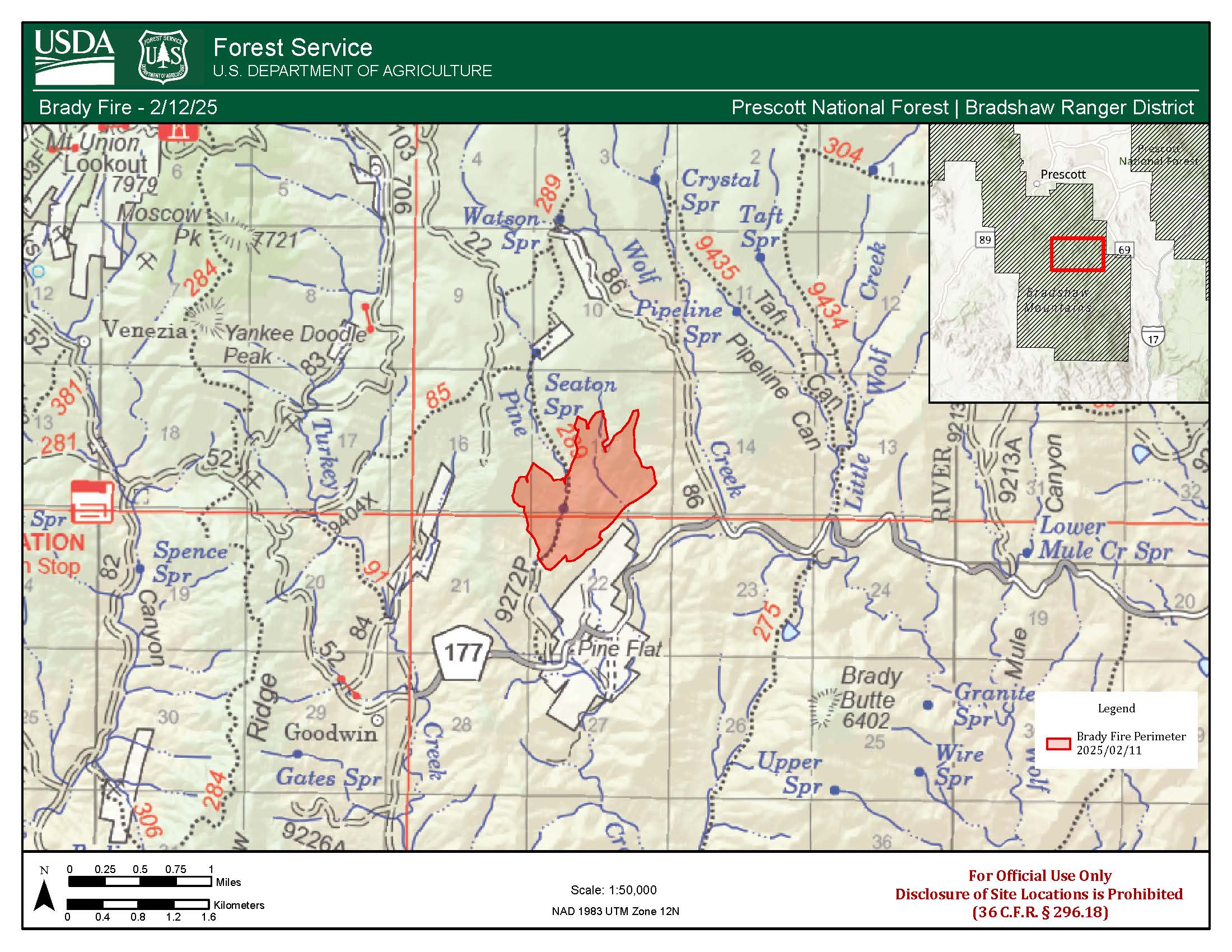
The Brady Fire which started on February 10, 2025, is estimated to be 363 acres and is burning west of Mayer, Arizona near the community of Pine Flats. Reduced acreage is due to more accurate mapping of the fires perimeter. As dry fuels continue to consume, smoke may be visible from surrounding communities.
For the health and safety of firefighters and residents affected, we ask that you please avoid the area around the Brady Fire. Yavapai County Sheriff's Office has closed County Road 177 into Pine Flat.
| Current as of | Fri, 02/14/2025 - 11:59 |
|---|---|
| Incident Time Zone | America/Phoenix |
| Incident Type | Wildfire |
| Cause | Under Investigation |
| Date of Origin | |
| Location | North of the community of Pine Flat |
| Incident Commander | Charles Ebert |
| Coordinates |
34° 22' 15'' Latitude
- 112° 21' 34
'' Longitude
|
| Total Personnel: | 83 |
|---|---|
| Size | 363 Acres |
| Percent of Perimeter Contained | 49% |
| Estimated Containment Date | 03/07/2025 |
| Fuels Involved | Brush and Chaparral |
| Significant Events | Minimal, Backing and Creeping Fire Behavior |
| Planned Actions |
Continue monitoring for increase in fire behavior. |
|---|---|
| Projected Incident Activity |
12 Hours: Minimal spread expected overnight backing, short runs. 24 Hours: Minimal spread expected due to pending precipitation. 48 Hours: Minimal spread expected due to pending precipitation. |
| Weather Concerns | Mosty cloudy with an 80% chance of precipitation today. Snow showers likely this morning changing to rain showers this afternoon as a storm system moves across the fire area today through Saturday morning. The snow level will start out around 4500 feet Thursday morning and then rise to 7500 feet Thursday night.
|
|---|