
Single Publication
Could not determine your location.
 Wildfire
 Prescribed Fire
 Burned Area
Response
Burned Area
Response Other
Other
BDNF Forest-wide Prescribed Fire Operations Notification 04-22-2024
Beaverhead-Deerlodge NF Prescribed Fire Operations
Publication Type: Announcement - 04/22/2024 - 09:10
Firefighters and fuels specialists from the Beaverhead-Deerlodge National Forest may implement prescribed fire operations in several locations across the Forest this week, as weather and fuels conditions allow.
🔥Dillon Ranger District
The Virtual Lost project area (unit 24) is located 10 miles north of Dillon. The project unit is approximately 120 acres in size. Smoke may be visible from Interstate 15 and the Birch Creek drainage.
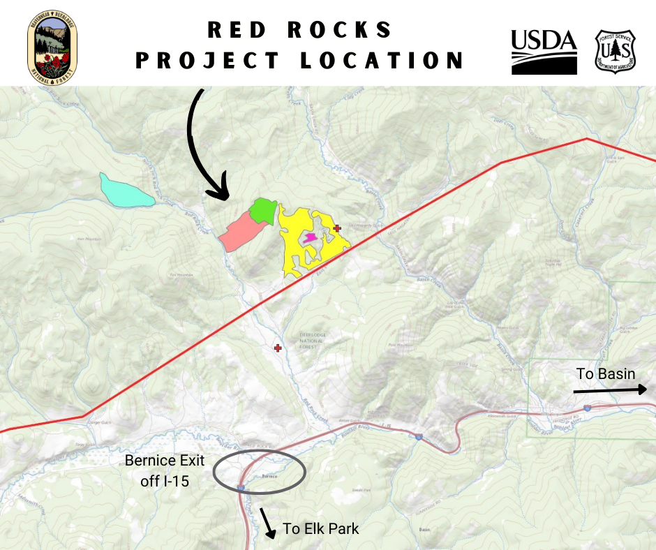
🔥Butte Ranger District
The Red Rocks project area is located north of the Bernice exit off Interstate 15 between Elk Park and Basin. The project unit is approximately 127 acres in size. Smoke may be visible through the I-15 corridor in the Bernice, Basin, and Boulder areas.
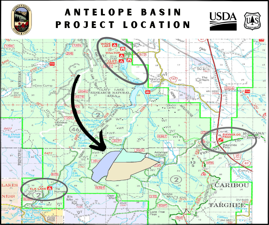
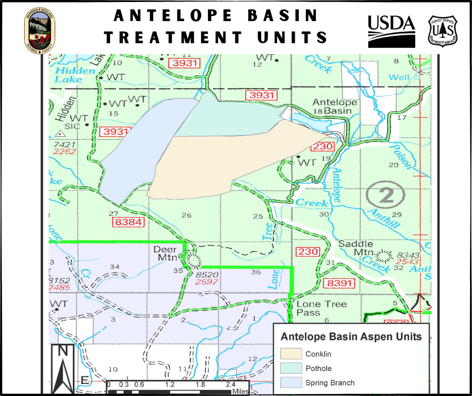
🔥Madison Ranger District
The Antelope Basin project area is located 53 miles south of Ennis in the Antelope Basin area near Conklin Lake and Forest Service Roads 3931 and 230. The Conklin Lake and Spring Branch project units total approximately 1,852 acres in size. Operations within these units may potentially extend into May on an intermittent schedule, as parts of the project area are still under snow. Firefighters will continually monitor conditions and expand operations as fuels become more receptive to ignition. Smoke impacts should be minimal, as smoke is expected to dissipate.
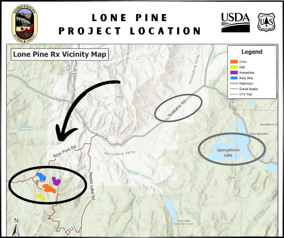
🔥Pintler Ranger District
The Lone Pine project area is located 18 miles southwest of Philipsburg and due west of Georgetown Lake. The Rally Way unit is approximately 144 acres in size and lies between Ross Fork Road and Moose Lake Road. Smoke may be visible from Ross Fork Valley, Moose Lake Road, Georgetown Lake and along Highway 38/Skalkaho Road.
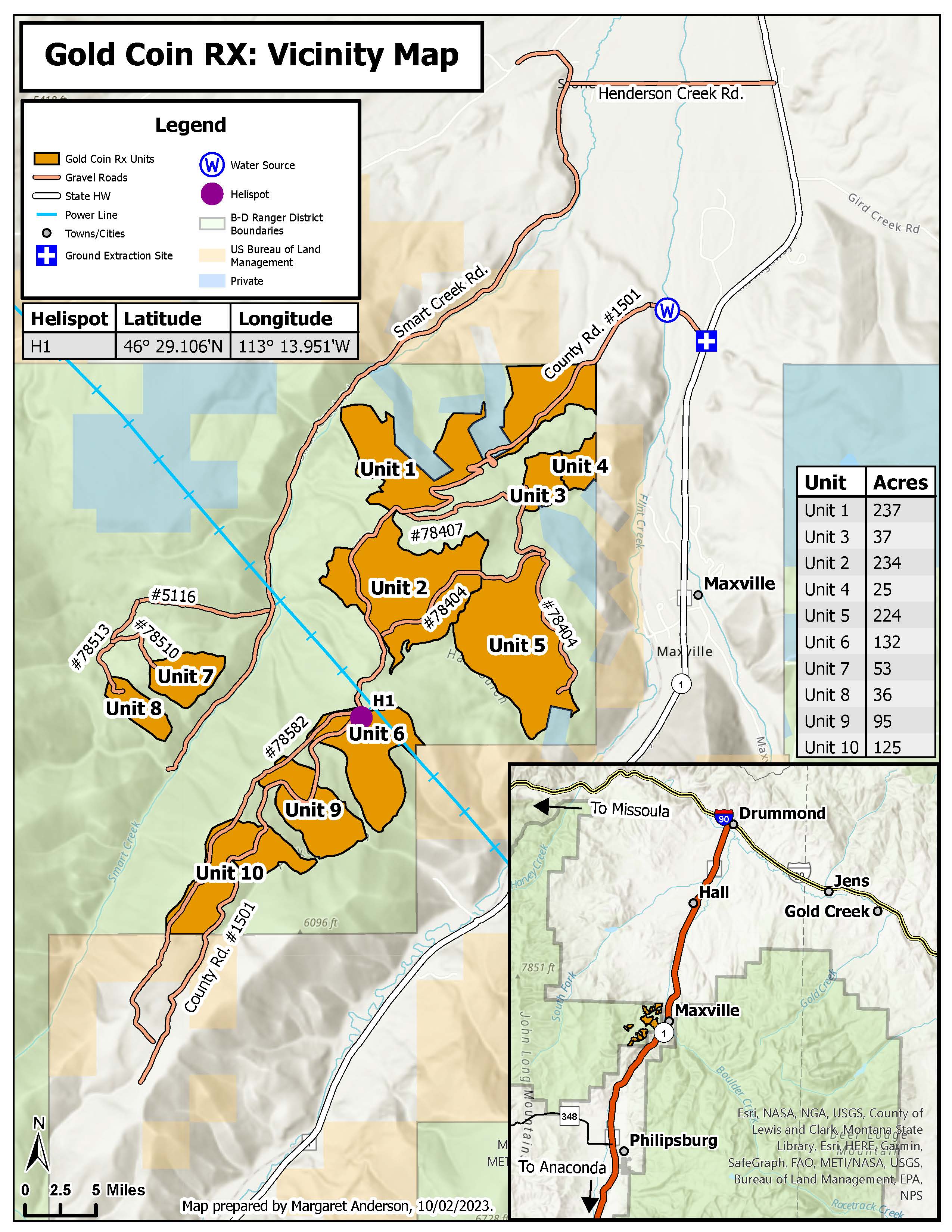
The Gold Coin project (unit 9) is located 3 miles southwest of Maxville. The unit is approximately 95 acres in size. Smoke may be visible from the communities of Hall and Maxville, from Montana Highway 1, and possibly from Interstate 90. Smoke from this unit is likely to disperse over the Flint Mountain Range.
For updates or more information, contact the appropriate Ranger District offices below.
Butte Ranger District (406) 494-2147
Madison Ranger District (406) 682-4253
Pintler Ranger District (406) 859-3211