
With spring approaching, firefighters will be closely monitoring conditions for potential burn windows. Please continue to check this page for the latest information.
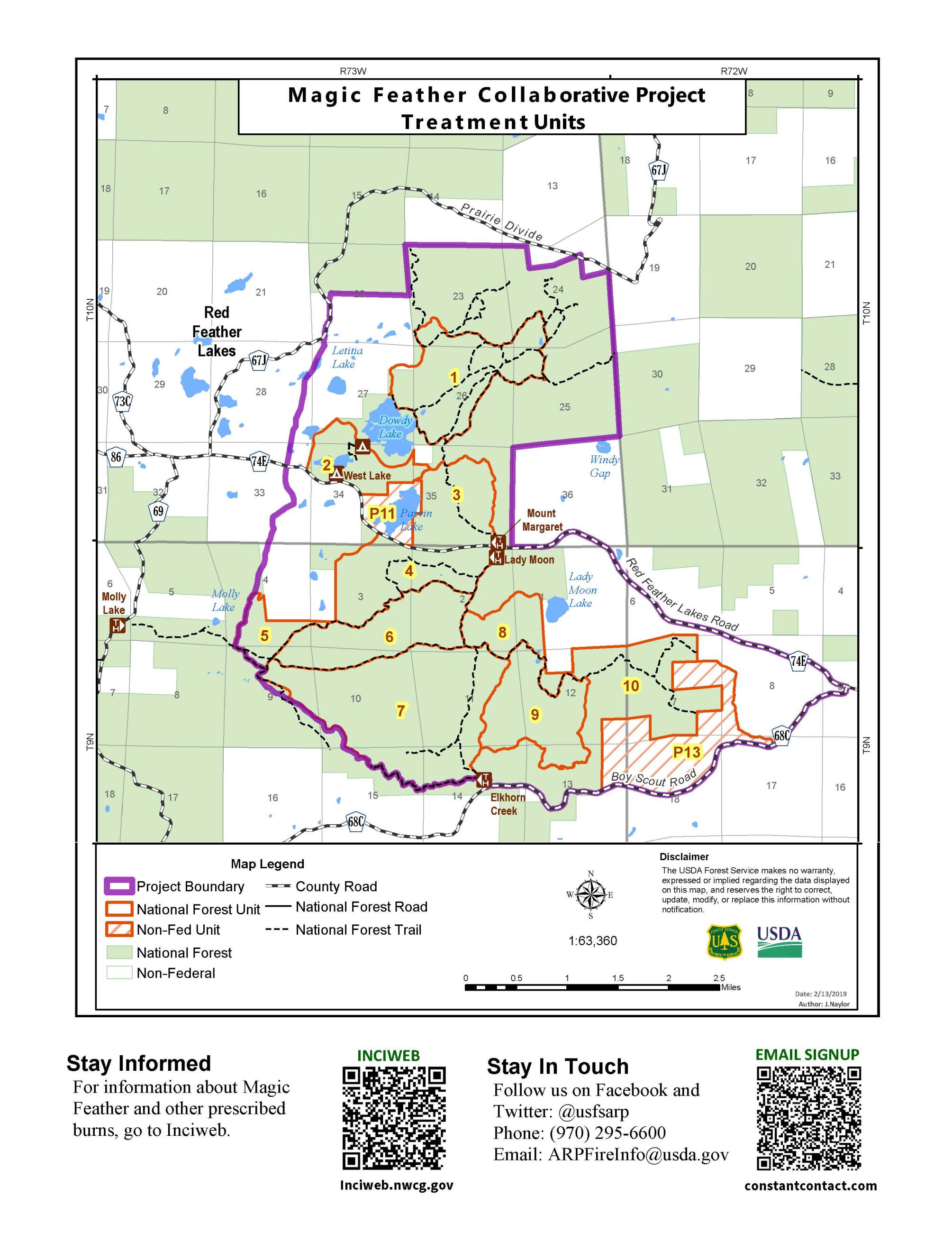
The burn is located east and southeast of Red Feather Lakes. Firefighters successfully burned 775 acres in 2023, with over 2,300 acres burned in total. Appropriate, localized conditions must be met before ignitions can take place. Fire managers are carefully monitoring these conditions, including favorable weather forecast (temperature, wind, precipitation, relative humidity), fuel moisture, smoke dispersal and staffing. Weather is monitored throughout the burn and burning is halted if conditions fall outside of the required conditions.
People in the surrounding area should expect to see smoke west of Livermore and Glacier View when operations are taking place. Smoke may also impact those using the Dowdy Lake and West Lake recreation areas. Prescribed fire smoke may affect your health. For more information about the potential health impacts of smoke, visit Colorado Department of Public Health and Environment.
This prescribed burn is part of the overall strategy on the Arapaho and Roosevelt National Forests to confront the Wildfire Crisis. Prescribed fire is one of the most efficient ways of reducing wildfire risk. Regularly conducting prescribed fires, which mimic nature, reduces the buildup of flammable vegetation and overgrowth. Even with the most thorough planning and preparation, the use of prescribed fire carries an innate level of risk that cannot be eliminated entirely. However, prescribed fire is one of the most efficient ways of reducing wildfire risk.
To receive updates, follow us on Facebook and X and join our email list through Constant Contact and select list "Forest Health & Fire: North of Hwy 14 to Wyoming Border (Red Feather Lakes)."
| Current as of | Tue, 03/11/2025 - 17:21 |
|---|---|
| Incident Type | Prescribed Fire |
| Location | E/SE of Red Feather Lakes |
| Incident Commander | Canyon Lakes Ranger District |
| Incident Description | The entire project area is 6,329 acres. Firefighters have successfully burned over 2,300 acres. |
| Coordinates |
40° 46' 46.5492'' Latitude
-105° 32' 16.692
'' Longitude
|
| Total Personnel: | 30 |
|---|---|
| Size | 6,329 Acres |