
Septmber 5 2024 Red Fire Daily Update 09 05 2024
Related Incident: Red Fire
Publication Type: News
Size: 877 acres Location: 5 miles west of Crescent Lake Junction, OR County: Klamath
Start Date: July 17, 2024 Cause: Lightning Containment: 0% Total Personnel: 115
Activities – The size of the fire remains at 877 acres. The continued warm and dry weather has contributed to an increase in fire activity mostly in the interior of the fire footprint. Today work along the shaded fuel break will continue with chip, slash, and log removal. Yesterday, firefighters tested the 1.5-mile hose lay along Whitefish Creek Trail that is in place to check fire spread as it approaches the trail. Additional structure protection equipment remains in place along Crescent Lake and is periodically being tested. Firefighters predict that the Red Fire will remain on the landscape until the area experiences significant rain or snow this fall.
Closures – To provide for the safety of firefighters, equipment operators, and the public, the Deschutes National Forest emergency closure around Crescent Lake and in the Diamond Peak Wilderness is still in effect. Forest Service Road 60 is closed, and road guards have been posted for public safety. The emergency closure is being reevaluated daily as conditions continue to change. More closure information is available at: https://www.fs.usda.gov/alerts/deschutes/alerts-notices/?aid=89091.
The Pacific Crest Trail (PCT) is closed from north of Windigo Pass (Mile 1883.5) to Highway 58 (Mile 1909.5). The previous PCT detour around the fire has been decommissioned as of noon on September 4. Currently there is not a detour around the closure. A map displaying the PCT closure can be viewed on the Pacific Crest Trail Association’s (PCTA) website at: https://closures.pcta.org/closure/Mr02blDvEwX1SJ9h1H49.
The 2024 season for commercially harvesting Matsutake mushrooms opened for the Deschutes National Forest this week and will close November 4, 2024. A commercial permit must be purchased for the picking of any Matsutake mushrooms on National Forests that are harvested for resale. The emergency fire closure impacts certain harvesting locations.
Incident Weather, Fire Behavior, and Smoke – A warming and drying trend has returned this week with temperature and relative humidity reaching critical values. Temperatures will continue to be warm at 80 to 85 degrees and relative humidity is forecasted to reach 15% to 20% during the day. A light east wind will reduce overnight humidity recovery further contributing to drier conditions. These conditions will persist into the weekend. New fires are the source of most of the smoke in the area.
Strategy – A full suppression strategy is being implemented utilizing indirect tactics, shaded fuel breaks, structure protection equipment, trails, and hose lays. When the fire started, an assessment by the initial attack incident commander, local fire managers and forest staff determined the risk to responders was too great to continue with direct attack due to a lack of escape routes and safety zones, snag hazards, and firefighter safety issues in the remote location. Firefighters are continually reevaluating the safest, most effective suppression strategy based on changing weather, fuel conditions, and fire behavior. Firefighter and public safety remain the incident management team’s highest priority in managing this fire. Expect to see increased fire activity due to the warmer and drier conditions.
Evacuations – The WILDFIRE! Level 1 – BE READY to Evacuate notice issued by Klamath County Emergency Management for Crescent Lake, Odell Lake, and Crescent Junction areas remains in effect (INCENDIO FORESTAL! Nivel 1 - ESTÉ PREPARADO para evacuar de las siguientes zonas: Crescent Lake, Odell Lake, Crescent Junction). Visit www.klamathcounty.org/300/emergency-management for more information or to sign up for alerts.
Fire Restrictions – Stage 2 Public Use Fire Restrictions – which prohibit open fires, including in developed campgrounds – remain in effect for the Deschutes National Forest. The Industrial Fire Precaution Level is currently Level III “Partial Shutdown.” Visit fs.usda.gov/detail/deschutes/home/?cid=stelprdb5297376 for more information.
West Preacher Fires Update 09 05 2024
Related Incident: 2024 - Preacher Fire - TNF2024 - West Fire - TNF
Publication Type: News
Public Meeting scheduled for Friday, September 6
Highlights: The Tonto National Forest and SW Area Incident Management Team will be holding a public meeting on Friday, September 6, 2024 at 6 p.m. at the Pine Community Center 3872 AZ-87, Pine, AZ, 85544.
Operations:
West Fire -24 Acres: No significant growth was observed overnight. Today firefighters and equipment will focus on removing fuels along Forest Service Road (FSR) 218. Dead trees are being cut along the Milk Ranch Road (FSR218). Masticators and dozers are also working along portions of FSR 300. Additional control lines are being scouted in Bray Creek Ranch and Camp Geronimo. Dozers are improving existing fuel breaks west of Pine.
Preacher Fire - 2 Acre: The Preacher Fire is burning about 8 miles northeast of Payson, Arizona. The fire is burning within an area previously prepared for prescribed burning. Today engines are patrolling the existing control lines and checking for any improvements needed. Sparse vegetation that re-grew along portions of the previously constructed lines will be removed in preparation for firing operations.
Both fires are being managed under a confine/contain strategy with the goal of reintroducing fire into a fire dependent ecosystem. The intended result of managing naturally caused fires are to reduce hazardous fuels, encourage the growth of native forage, improve range conditions, increase species diversity, protect and improve wildlife habitat, improve watershed conditions and restore ecological balance. The total planning areas for the West Fire includes 16,700 acres, for Preacher Fire 3,200 acres. This will decrease unnaturally high accumulations of fuels and the potential for future fires to burn with unnaturally high severity, aligning with the Forest Service Wildfire Crisis Strategy.
Weather: Sunny and hot conditions persist with temperatures in the middle to upper 80’s. The relative humidity has fallen to around 20% and the wind is terrain driven at speeds less than 10 mph with gusts to 15 mph. The overall weather pattern will not change through the end of the week with hot and dry conditions. Low shower and thunderstorm chances are anticipated to return to the region on the weekend.
Safety: The health and safety of firefighters and the public are always the first priority. Members of the public are asked to avoid the fire area while fire operations are being conducted.
Smoke: Smoke from the West and Preacher Fires may be visible in the surrounding areas for many days. Smoke will be heavier in the mornings as it settles into the lower elevations and will lift as temperatures increase. As temperatures increase the volume of smoke may increase due to the drying and ignition of available fuels. Smoke-sensitive individuals and people with respiratory problems or heart disease are encouraged to take precautionary measures. Learn more about smoke impacts on the Arizona Department of Environmental Quality website.
For the latest news and information about the Tonto National Forest, follow along on Facebook @TontoNationalForest, ‘X’ (formerly Twitter) @TontoForest or Instagram @tontonationalforest and on the Tonto National Forest website.
Coffee Pot Fire Daily Update 09 05 2024
Related Incident: Coffee Pot Fire
Publication Type: News
Unified Command: CAIIMT15 & CAL FIRE
Fire Size: 12,915 acres
Percent Contained: 23%
Primary Strategic Control Line: 94%
Personnel: 1,522
Cause: Lightning
Start Date: Saturday, August 3, 2024, at 10:05 a.m.
Location: Southeast of Three Rivers, CA
CURRENT SITUATION: Yesterday, firefighters prioritized operations on the fire’s northern flank.
Crews enhanced direct control lines along the East Fork Kaweah River while tactical water tenders
applied retardant along Mineral King Road. Using tactical water tenders allow aviation support to
concentrate on other areas. All spot fires along the northern flank were identified, contained, and
extinguished. Moving east along the Kaweah River, firefighters patrolled the fire as it slowly backed down
toward the river. In coordination with crews on the ground, drones conducted aerial ignition operations to
produce low-intensity fire to moderate the effects around the giant sequoia groves near Eden Creek. Heavy
equipment was used to continue road and trail repair to the south. Mop-up operations continued along the
southern flank of the fire.
Today, crews will focus on reinforcing direct control lines in the north. Aircraft, in conjunction with crews
on the ground, will slow the progression and intensity of the fire. In the south, crews will continue to
improve control lines along South Fork Drive and Salt Creek Road. Firefighters will continue to mop-up
and mitigate hazardous trees in contained fire areas.
WEATHER: High pressure will remain over the area, keeping conditions hot and dry. Winds today will
shift from the overnight drainage to upslope in the morning and stay through the afternoon. With high
pressure overhead, the inversion may break later in the morning, trapping smoke in the valleys into the early
afternoon, especially in sheltered areas. Skies will remain mostly sunny, with a few clouds over the Sierra
Crest.
SMOKE IMPACTS: Three Rivers, Hammond, and Springville will experience the most smoke impacts
this morning, with levels reaching UNHEALTHY FOR SENSITIVE GROUPS to UNHEALTHY before
improving to MODERATE during the afternoon and evening. The Giant Forest will likely see the highest
concentrations during the afternoon and evening, reaching UNHEALTHY at times. Communities as far
north as Oakhurst may see levels increase to MODERATE through the day into tonight. For more
information on current wildfire smoke impacts in your community, please visit AirNow.gov or
fire.airnow.gov.
EVACUATION NOTICES: The Tulare County Sheriff’s Office has issued Evacuation ORDERS due to
current fire conditions for Genasys zones TLC-E094-C, TLC-E094-E, TLC-E094-D, and TLC-E094-B.
An evacuation ORDER, also known as a mandatory evacuation, means that all residents and visitors
should leave now before the fire reaches the community. If you are unable to evacuate and require
assistance, please call 9-1-1. In case of sheltering needs or questions regarding sheltering, please contact
the American Red Cross at 1-800-733-2767.
The Tulare County Fire Department has also issued Evacuation WARNINGS for zones TLC-E128-B,
TLC-E093-A, TLC-E093-B, TLC-E095, TLC-E127-B, and TLC-E128-A. To find your zone, please refer
to: protect.genasys.com.
FIRE INFORMATION: A Public Information Officer will be at the Three Rivers Village Market daily
from 10:30 a.m. to 4 p.m. to provide fire information and answer questions.
BLM AND PARK CLOSURES: The portion of South Fork Drive within Sequoia and Kings Canyon
National Parks and trails accessed from the road, including the Ladybug and Garfield Grove Trails, are
closed. Recreational access to the Mineral King area of Sequoia National Park is closed to the public. This
applies to Mineral King campgrounds, trailheads, and area trails. All other areas of the parks are open but
are likely to be impacted by varying levels of smoke and poor air quality. Park closure information is
available online at nps.gov/seki. The Bureau of Land Management has also issued a closure of the Case
Mountain Extensive Recreation Management Area at blm.gov/press-release.
PUBLIC NOTICE: Wildfires are a no-fly zone for unauthorized aircraft, including drones. If you fly, we
can’t. For more information, visit knowbeforeyoufly.org.
North Willamette Complex Daily Update 09 05 2024
Related Incident: North Willamette Complex
Publication Type: News
Message: A red flag warning has been issued starting on 11pm Wednesday September 4 through Thursday September 5 at 11pm. An excessive heat warning has also been issued beginning today, September 5 through Friday September 6 at 10pm. Please check the National Weather Service for more information.
Suppression Objectives: The Ore Fire and the Pyramid Fire remain under a full suppression strategy to protect values at risk, including the Middle Santiam Wilderness, HJ Andrews Experimental Forest, and private timberlands. Firefighters are building direct fire line where possible, and strategic indirect contingency line as needed.
Current Situation: An increase in smoke will be seen as high pressure builds over the area. Crews continue to make progress on mopping up fire lines while patrolling for heat along containment lines. As temperatures increase and humidities decrease, fire personnel will monitor fire weather conditions and adjust tactics appropriately.
Ore Fire: 7 miles Northeast of Blue River, 3,303 acres, 42% contained, 579 total personnel, human caused. Firefighters continue increasing mop up depth in containment lines. Work progresses in the Waterfall and Ore drainages to cleanup unburned vegetation near the 1509 road. Night operations will continue focusing on patrolling, securing, and mopping up as conditions safely allow. Contingency divisions are still masticating, chipping, and removing vegetation along identified lines.
Pyramid Fire: East of Middle Santiam Wilderness, 1,312 Acres, 98% contained, 224 total personnel, lightning caused. Fuels reduction work will continue as firefighters remove fuels from the fire line and construct contingency lines that will prevent the possible spread as temperatures and fire behavior increase beginning today moving into the weekend.
Safety: Highways, county roads, and forest roads will see heavy vehicular traffic from the Pyramid and Ore fires. These will include heavy equipment and large trucks from fire crews. The public is reminded to remain vigilant while driving the Highway 126 corridor and spur roads. Please stay alert, reduce your speed, and be safe.
Closures & Fire Restrictions: Willamette National Forest closures for all fires can be found here: Willamette National Forest - Alerts & Closures (usda.gov) Specific closure maps for the Pyramid Fire can be found here. Specific closure maps for the Ore Fire can be found here.
Everyone is reminded to stay out of all fire closures for firefighter and general safety. Violations of these prohibitions are punishable by a fine of up to $5,000. All campfires, charcoal fires, pellet fires, or any other open fires are prohibited, including in developed campgrounds and wilderness areas. Pressurized liquid or gas stoves, lanterns, and heaters that can be switched on and off are allowed. Please see Forest Order 06-18-00-24-27 for additional information.
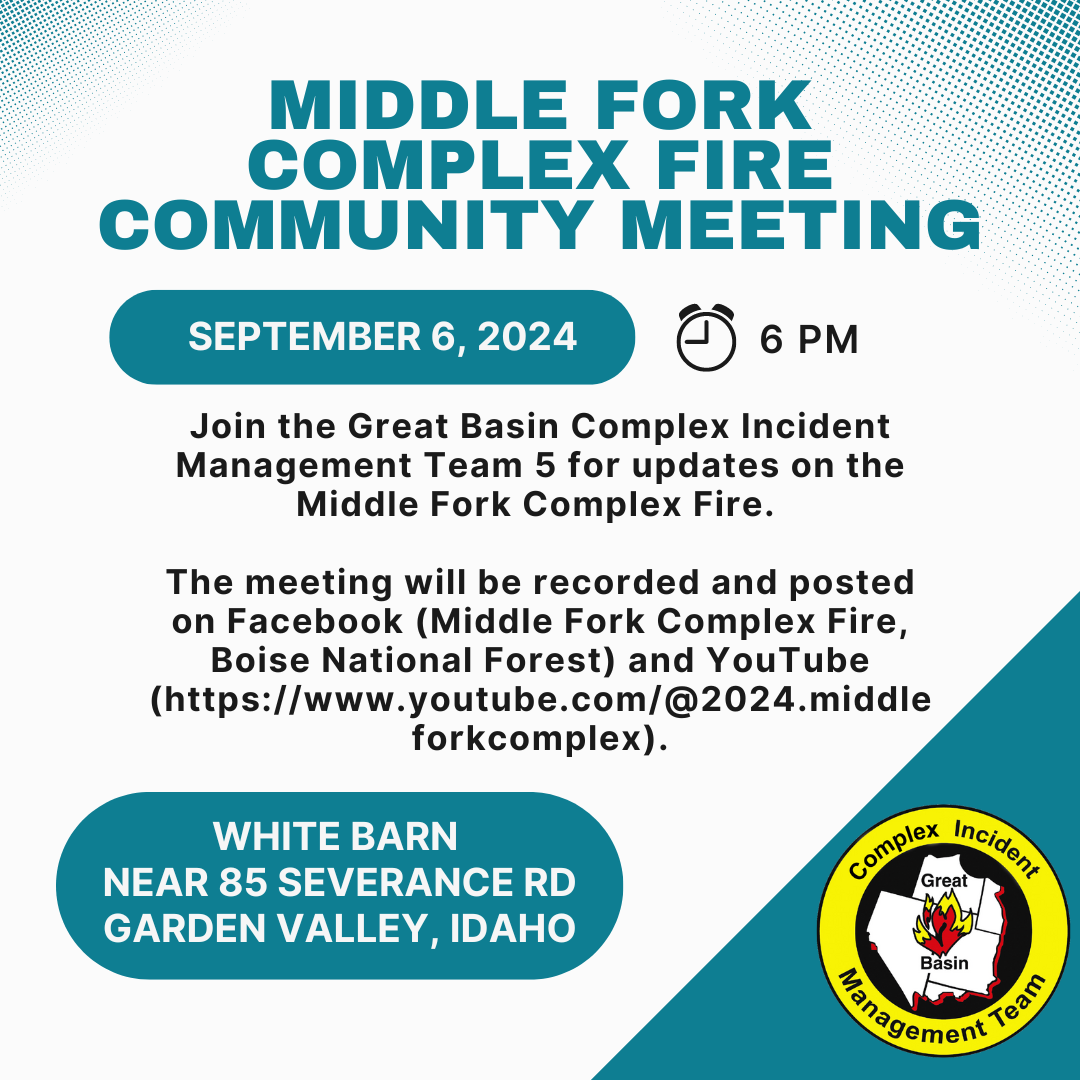
Community Meeting on September 6 2024 09 05 2024
Related Incident:
Publication Type: Announcement
Join the Great Basin Complex Incident Management Team 5 for updates on the Middle Fork Complex Fire on Friday, September 6th. The meeting will take place at 6 pm at the white barn building near 85 Severance Road, Garden Valley, Idaho. The meeting will be recorded and posted on Facebook (Middle Fork Complex Fire, Boise National Forest) and YouTube (https://www.youtube.com/@2024.middleforkcomplex).
Whisky Creek Sandstone and Blister Creek Fire Update 09 05 2024
Related Incident: Whisky Creek FireSandstone Fire
Publication Type: News
Northwest Team 12
Whisky Creek, Sandstone and Blister Creek Fires
Sept. 5, 2024
Fire Information: (541) 208-1743, 8 AM - 8 PM
For links to incident information: https://linktr.ee/whisky_creek.2024
Whisky Creek Size: 2,105 acres | Start Date: July 20 | Cause: Human | Containment: 25%
Sandstone Size: 702 acres | Start Date: August 5 | Cause: Lightning | Containment 75%
Total Resources: 381 | Hand Crews: 6 | Engines: 6 | Dozers: 2 | Heavy Equipment: 9 | Helicopters: 3
The Whisky Creek, Sandstone, and Blister Creek Fires are located in steep and rugged terrain on the Mt. Hood National Forest where rolling debris and fire-weakened trees challenge firefighting efforts. A Red Flag Warning is in effect through this evening for gusty offshore winds and low relative humidity. An Excessive Heat Warning is forecasted for Friday and Saturday.
Whisky Creek:
Fire managers flew over the fire and observed minor fire growth in the east fork of Herman Creek yesterday. Excess hose was pulled from Tomlike Mountain and the northeast side of the fire. Crews repaired hand line and a temporary helicopter landing spot. Grading operations continued along Forest Service Road (FSR) 2810. Incident aircraft supported the Williams Mine Fire to the north with water drops and reconnaissance flight.
Crews will continue to pull excess hose from Green Point Mountain today and are initiating repair on a dozer line. Helicopter crewmembers will begin constructing external cargo loads of supplies and equipment to be hoisted out via long-line. Grading and cleaning culverts along FSR 2810 will continue. Additional hose will be retained near Wahtum Lake as a precautionary measure.
Sandstone and Blister Creek:
Firefighters checked a hotspot on the Blister Creek Fire and saw no movement of the fire yesterday. Heavy equipment continued road clean-up along FSR 7105 and finished chipping along FSR 7010 on the 150 spur. Crews pulled hose from secured sections of the line that have had no heat for numerous days. A grader arrived to begin repairing the roads due to increased wear from fire traffic. Today fire crews are repairing dozer line, continuing clean-up, and monitoring and patrolling for hotspots.
Weather: Temperatures will be in the mid-to-upper 80s across both fire areas today. Winds will be easterly 10-12 mph, gusting to 15 mph.
Closures: Area closures will remain in the Mt. Hood National Forest, Columbia River Gorge National Scenic Area, and Hood River County. Please respect area closure orders for your safety as well as the safety of our firefighters. Closure information can be found at https://linktr.ee/whisky_creek.2024.
Safety: The public plays an important role in preventing the next wildfire; please use caution with all potential ignition sources. For prevention tips visit: https://keeporegongreen.org. The TFR remains in effect for both fires: https://tinyurl.com/2s49yrj4. Fire restrictions are in place within the Mt. Hood National Forest. More information can be found at: https://www.fs.usda.gov/main/mthood/fire.
Middle Fork Complex Daily Update for Thursday 09 05 2024
Related Incident:
Publication Type: News
The Middle Fork Complex is 57,836 acres with 28% completion. There are currently 781 personnel assigned to the fire, including 16 hand crews, 36 engines, and 4 helicopters. This morning, Great Basin Team 5 assumed command of the Middle Fork Complex. The weather today will shift as a high pressure system moves in increasing the temperatures. Lingering smoke will reduce visibility and limit aircraft use until the temperature inversion lifts and smoke begins to clear in the afternoon. Relative humidities are expected to be lower in the coming days.
On the northwest side of the Bulldog Fire crews continue to construct indirect fireline from Rattlesnake Trail to Lodgepole Campground. Crews are holding and monitoring the fire along the 698 Road corridor. They continue to implement structure protection and install water pumps and hoses in the Silver Creek Lodge area. Crews continue to construct indirect fireline from the Nellie Fire to the Southwest corner of the Bulldog Fire.
On the southwest portion of the Nellie Fire crews continue to hold and mop-up dozer and handline from Anderson Creek to Highway 17. They are backhauling hose and pumps that are no longer needed and preparing to begin wildfire suppression repair. Crews continue to implement structure and infrastructure protection in the Deadwood Reservoir area. They are implementing direct and indirect line tactics and conducting firing operations as needed and as conditions allow.
Hand crews are constructing direct fireline to the east of the Nellie Fire using the 591 Road to tie into the 2016 Pioneer burn scar. Dozer line will be constructed on the western side of the fire, south of Deadwood Reservoir, to help secure fire edge into the Rattlesnake burn scar. They continue to hold and mop-up previous firing operations in the Deadwood Dam area. The fire is making little progress through the Pioneer burn scar on the east side of the Nellie Fire. On the south end of the Nellie fire crews are using direct and indirect tactics to keep the fire north of Highway 17. They are holding and mopping up dozer line along Highway 17 to Anderson Creek.
There will be a community meeting on Friday at 6 p.m. at the White Barn Building, near 85 Severance Road, Garden Valley, Idaho. The Incident Commander, key team members, and Boise National Forest representatives will be there to provide updates on the fire and answer any questions. A link to the recording will be posted on Inciweb.
Boise National Forest Closure Order Number 0402-06-60 remains in effect. An interactive forest closure map is available on the Boise National Forest Alerts & Closures website, https://www.fs.usda.gov/alerts/boise/alerts-notices
Highway 21 is closed from the Sourdough Lodge in Lowman to Stanley (MP 84 to 130) due to wildfire activity. Only local traffic is allowed between the Sourdough Lodge and Warm Springs Airstrip. For more information, visit the Idaho Department of Transportation website, https://511.idaho.gov/
Wildfires are a No Drone Zone. If you fly, we can’t. Every time a drone is spotted near the fire all aircraft are grounded until we can be sure the drone is clear of this area. Visit Know Before You Fly, http://knowbeforeyoufly.org. A Temporary Flight Restriction (TFR) is in effect in the fire area.
Fire Information: 208-992-3045 (8am – 8pm)
Email: 2024.middleforkcomplex@ firenet.gov
Facebook: https://www.facebook.com/people/Middle-Fork-Complex-Fire-Boise-National-Forest/61565022204468
Cottage GroveLane1 Fire Update 09 05 2024
Related Incident: Lane 1 Fire
Publication Type: News
Lane 1 Fire Information
Email: 2024.Lane1@firenet.gov
Fire Information: (541) 649-2399 voice/text
Thursday, Sept. 5, 2024
Warm, dry weather has increased fire activity on the Lane 1 Fire. Interior pockets of unburned vegetation flared up Wednesday evening in several areas. A fire crew, engine and water tender remained on the line as their shift ended Wednesday evening as the area west of Shane Saddle started to put up smoke. No action was taken as the fire remained within the perimeter with no threat to containment lines. Fire activity increased near an old cabin at a mine site in a green island southeast of Cat Mountain. Firefighters cut a handline around the site and conducted a small firing operation to remove fuels around the cabin.
Thursday is expected to be the hottest day this week with the National Weather Service issuing an Excessive Heat Warning for Thursday and Friday. Temperatures are forecast to be 20-degrees hotter than normal for this time of year. Patrols will monitor the fire for any increases in fire activity through the weekend when temperatures are expected to return to seasonal norms.
Nighttime operations have ended but the public still needs to be aware of an increase in heavy equipment traffic on Brice Creek Road. Brice Creek Road remains closed between Champion Creek Road and Grass Creek Road as trucks enter the road from the fire area.
All roads starting from Brice Creek Road leading into the forest closure areas remain closed. These include but are not limited to:
- Alder Creek, BLM 22-1-12
- Adams Creek, 2200-734 NFSR
- Adams Mountain, 2241 NFSR
- Cat Creek, 2263 NFSR
- Champion Creek, 2473 NFSR
- Noonday, 2212 NFSR
- Grass Creek, 2213 NFSR
Hunting season has opened in Oregon. Hunters need to be aware of closed areas before they take to the field. For an interactive map of Oregon Wildfire Response & Recovery go to: https://wildfire.oregon.gov/
Many of the roads, trails and general forest areas within the Umpqua National Forest are closed to provide for public and firefighter safety. For more information and a map of the closed areas go to: https://www.fs.usda.gov/alerts/umpqua/alerts-notices
Portions of the Bureau of Land Management, Northwest Oregon District, managed public lands, roads, sites, and trails are closed to all forms of public access. For more information and a map showing the closure go to: https://www.blm.gov/.../docs/2024-07/orwa-fpo-nwo-072024.pdf
Williams Mine Fire Update 09 05 2024
Related Incident: Williams Mine Fire-GPNF
Publication Type: News
Williams Mine Fire Update for Thursday, September 5, 2024
Hot, dry weather combined with winds from the east created conditions for increased fire activity on the Williams Mine Fire. Yesterday several interior areas showed visible smoke for the first time in over a week. These are being monitored and extinguished if needed. Most are far interior and not threatening any control lines.
A small plume developed Wednesday where the fire made a push to the west from Morrison Creek toward Crofton Ridge. Overnight fire activity remained high due to little relative humidity recovery, with the glow of the fire visible from Trout Lake and other areas to the south. This active burning was inside the Mt. Adams Wilderness in the burn scar of a previous fire. The fire is expected to burn actively again today with hot, dry weather and winds from the east. Aircraft will be used to cool the fire as needed to keep it in check.
Except for the first few days of rapid wind-driven growth, most of the Williams Mine Fire has been a ground fire. It has been creeping across the forest floor, consuming the down logs, brush, duff layer, and other fuels that have accumulated on or near the surface of the ground. Many green trees can survive this lower-intensity fire. Historically, ground fires would have cleaned up the surface fuels periodically. With aggressive fire control over the last century, these fuels have accumulated and can lead to high-intensity, destructive fires like the 2012 Cascade Creek and 2015 Cougar Creek fires.
The Mt. Adams Ranger District is planning several prescribed fires in an effort to mimic the natural cycle of fires and reduce the amount of ground fuels in the forest. These fires are usually completed in the fall, after temperatures have dropped and the rainy season is approaching. The Williams Mine Fire burned part of a planned prescribed fire unit by FS Rd 80, with good results. The fire intensity stayed low enough to minimize damage to the green trees, while consuming much of the ground fuels. Prescribed fire is expected to be used in the adjacent forest near FS Rd 80 and FS Rd 8020, with some of the fire control lines from Williams Mine Fire serving as control lines for the prescribed burning.
Today’s acreage is lower than what was previously reported due to improved mapping.
SAFETY AND CLOSURES:
The Confederated Tribes and Bands of the Yakama Nation, Tract D Recreation Area is currently closed, please see Yakama Tract D Road Closure for more information. FS Rd 23 south of FS Rd 90 is still CLOSED to the public due to fire suppression activity. The revised closure for the Mt. Adams Wilderness and FS Rd 23 closure can be found at Williams Mine Fire: Area and Road Closure. The Pacific Crest Trail (PCT) is closed from the PCT's intersection with FS Rd 23 to Potato Hill. The current area closure spans the entire Mt. Adams Wilderness.
Fish Creek Fire Update Thursday September 5 2024 09 05 2024
Related Incident:
Publication Type: News
Thursday, September 5, 2024
Northern Rockies Team 1, Incident Commander Brent Olson
Location: 7 miles SW of Togwotee Pass
Start Date: Friday, August 16, 2024
Cause: Lightning
Size: 18,734 acres
Percent complete: 59%
Resources: 449 Total Personnel: 8 Hand Crews; 14 Engines; 1 Dozer; 18 Heavy Equipment; 5 Helicopters
KEY MESSAGES:
Yesterday, firefighting resources continued to suppress spot fires northeast of Highway 26 ranging in size from very small to 1/10th of an acre. Crews have been successful in these suppression efforts and none of the spot fires have become established or grown. Engines and crews patrolled the highway corridor to keep holding the fire edge along the highway.
We continue to catch up on the fire size mapping because cloud cover prevented an overnight infrared camera flight a couple of days ago. The fire has increased in size by 822 acres over the past day.
The Wyoming Department of Transportation (WYDOT) continues to have U.S. Highway 26 closed for public and firefighter safety. Firefighters are working along the highway in several locations while thick smoke blankets the roadway. This creates a dangerous driving environment for the public and firefighting resources. For firefighter and public safety, we ask for your patience during this time while the fire has directly impacted Highway 26. Currently, there is no estimated time for when the highway might reopen but it is evaluated each morning.
CURRENT STATUS:
Yesterday, firing operations continued along Highway 26 south to Forest Road 537 and north to the communications site near Togwotee Pass due east of Two Ocean Mountain. These firing operations were implemented to burn wildland fuels between the highway (an indirect control line) and the fire’s flaming front. When successful, the main fire will slow or stop advancing since the fire’s fuel has been removed. The fire made a push towards the highway two days ago with significant intensity resulting in the need to use firing operations. All these actions are being done on the northeast corner of the fire to protect the identified values at risk including the Highway 26 corridor, Brooks Lake, Pinnacle and Breccia Drives. Structure protection crews tested the pumps, hose and sprinklers continued to patrol and tested the pumps, hose and sprinklers set up for implementing protection plans for the Brooks Lake Lodge and Pinnacle areas if needed. Night operations continued to monitor the fire activity, patrolled for spot fires, and stood ready to respond if fire threatened the critical values at risk overnight.
Today, fire crews will continue to hold the fires edge at Highway 26 as well as monitor for spot fires east of the highway. Firefighters will respond and helicopter water bucket drops will be used where needed to respond to spot fires or hot spots along or east of Highway 26. If conditions allow, aerial firing operations will be used to build depth in the area where hand firing operations were used yesterday moving west from the highway towards the base of Two Ocean Mountain and the uncontrolled fire edge. While the northeastern corner remains the operational priority because of several identified critical values at risk identified as a part of the confine/point protection strategy, work continues on other parts of the fire. Crews and equipment will finish working on the Flagstaff Road as an indirect control line and then move to the western side where the Flagstaff-Spread Creek Road has been identified as an indirect control line and needs to be improved using hand crews and equipment. Structure protection crews will patrol the Brooks Lake Lodge and Pinnacle areas and test the pumps, hose, and sprinklers to make sure they are ready to protect structures if needed.
Weather and Fire Behavior:
Today will be the start of a warming and drying trend that will last into the weekend as high pressure builds over the area. Expect mostly clear skies, with humidity dropping below 30 percent this afternoon. Prevailing winds will generally be out of the northwest, though another shift to easterly winds is expected in the evening.
Expect a steady increase in fire behavior as fuels dry out, especially on the northeast portion of the fire where little precipitation was received. This includes surface fire in heavy dead and down fuels as well as single tree or group tree torching. Previously ignited areas that burned “patchy” or without depth have the probability to become active today. We anticipate these areas to pick up in fire behavior with the potential for torching and spotting. Given the condition of the fuels, downwind spotting is likely from any torching trees. Spotting distance is expected out to 1 mile. If spotting occurs, the probability of success is high to contain them quickly with aerial and ground resources.
AIR QUALITY AND SMOKE:
Air quality, smoke conditions and forecasts can be found at https://www.airnow.gov/.
Closures and Evacuations:
A revised joint Closure Order for the fire area has been issued by the Bridger-Teton and Shoshone National Forests for public and firefighter safety. Please do not enter the closure area or use the Forest Roads that are closed. The Fish Creek Area, Roads, and Trails Closure Order (map) has been established for public and firefighter safety in the fire area. Full details can also be found at https://www.fs.usda.gov/alerts/btnf/alerts-notices.
Fremont County: Brooks Lake, Pinnacle Drive and Breccia Drive areas are currently under a Level 3 Evacuation notice. A Level 3 Evacuation means “Go” to evacuate. Residents must evacuate immediately. See the alert notice on the Fremont County Fire Protection District Facebook page.
Teton County: The Teton County Division of Emergency Management utilizes a Ready, Set, Go www.tetoncountywy.gov/1846/Ready-Set-GO system for evacuation messaging. All residents should be in the Ready status by preparing for evacuations and becoming fire adapted.
US HWY 26/287 is currently closed and continues to experience smoke and sometimes limited visibility. Wyoming Department of Transportation (WYDOT) is working closely with Fremont County Emergency Management and fire officials for the safety of motorists and firefighters. Drivers are encouraged to visit https://www.wyoroad.info/ prior to traveling on US HWY 26/287 for road status and information, or download the Wyoming 511 app at https://www.wyoroad.info/511/WY511Mobile.html to monitor for any changes due to fire activity.