
Tiger Island Fire Daily Report 83123
Related Incident: Tiger Island Fire
Publication Type: News
Louisiana Statewide Burn Ban: The state of Louisiana has declared a statewide burn ban to include any open flame outdoors. The message from the State Fire Marshal’s Office is “don’t burn anything” until further notice. Citations and arrests ARE happening across this state in partnership with local and state law enforcement agencies.
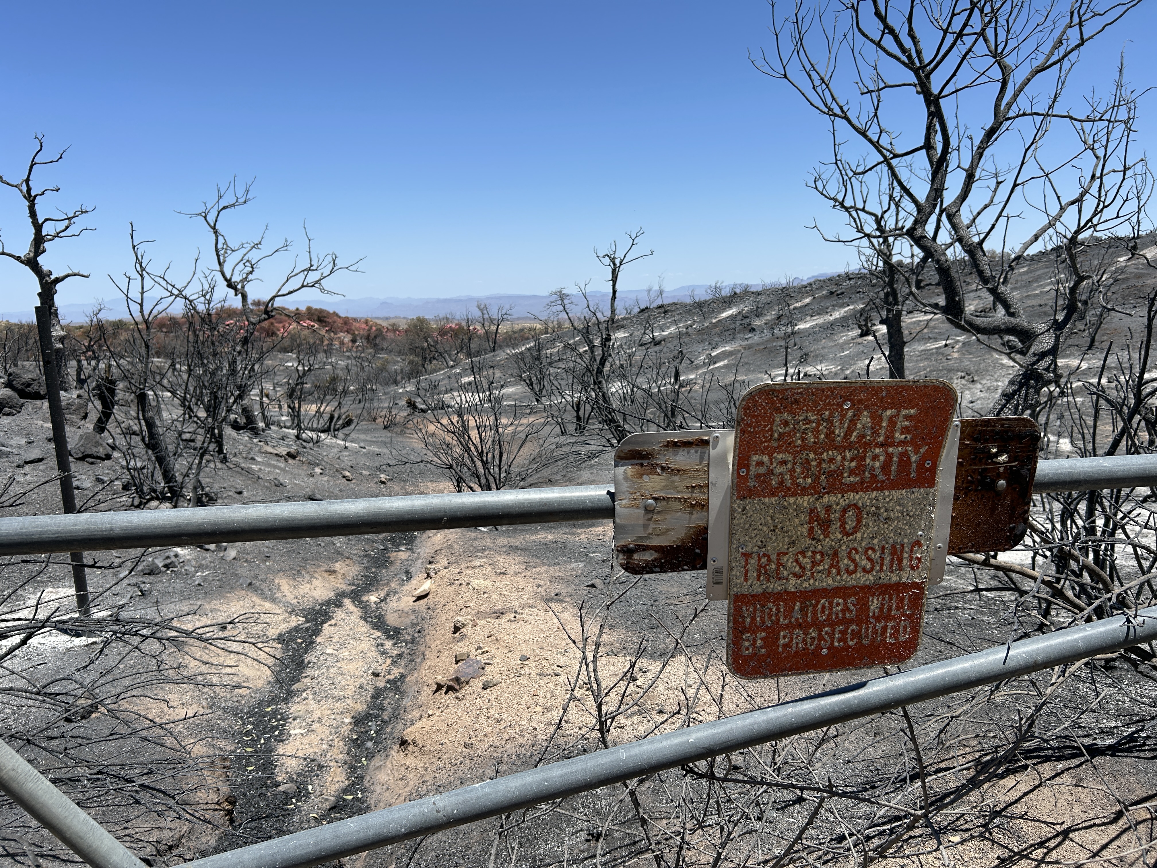
Tiger Island Fire: The Tiger Island Fire was first reported on Tuesday, August 22nd. The fire is located east of Merryville, south of Hwy 190, SW of DeRidder and North of Singer. The fire is burning in pine plantations of multiple ages. Access to portions of the fire area is difficult. Fuel loads in these pine plantations are high. Heavy residual fuels because of Hurricane Laura in 2020 exist and contribute to extreme fire behavior.
Acreage: 31,342 acres Containment: 50%
Personnel and Equipment: 347 total personnel; 8 Helicopters, 2 fixed-wing aircraft, 15 Type-6 Engines, 6 Type-2 Tractor Plow Units, 16 Dozers, and 5 Ambulances. Additional support is being provided by the National Guard, Parish authorities, the Governor’s Office of Homeland Security and Emergency Preparedness, the Louisiana State Fire Marshal Team, Beauregard Sherriff’s office, and the Office of Emergency Preparedness. The National Guard is supporting with Black Hawk helicopters and 4 dozers and the fire response is using Large Air Tankers, Scoopers, and Air Attacks.
Operations: Wednesday’s operations reported increased fire activity near Hoosier creek on the western side of the fire and near Shin Road on the northwestern edge of the fire perimeter. Crews focused on these areas that were retaining heat and continued to establish dozer line and conduct mop up to ensure containment. Along the northern perimeter, dozers were able to connect containment line into a creek, while crews also identified a contingency line to the north of the dozer line. On the northeastern and eastern perimeters, the National Guard dozers have established containment lines giving access to engines to conduct patrol and mop up operations. The structure protection group continues to coordinate with local parishes on water usage in all areas of the fire. They also continue to assess fire hydrants and ensure structure protection resources are in place if needed.
Weather and Fire Behavior: A Red Flag Warning is in effect from 10:00 a.m. until 8:00 p.m. for hot, very dry conditions with wind gusts up to 17 mph. Temperatures will continue to be in the mid to high 90s, and humidity levels will remain in the low 20s. Due to the unseasonably low humidity, the air temperature and heat index are identical, similar to conditions normally seen in west Texas, not Louisiana. Fuels remain critically dry and, combined with gusty winds, have the potential to produce extreme fire behavior.
Air Quality: Increasing smoke in localized areas of the fire could occur due to hotter and drier weather. Expect some smoke on roads adjacent to the fire, especially in the Merryville area. If we have active fire behavior with fire progression, or new starts, there could be high levels of smoke for short durations in the vicinity of the fire. For near time air quality information see EPA's Fire and Smoke Map: https://fire.airnow.gov/
Temporary Flight Restriction: A Temporary Flight Restriction (TFR) remains in place over the fire area; information is at Federal Aviation Administration website. This is necessary to protect aerial operations. If there are intrusions into the Temporary Flight Restrictions, we must ground all aircraft.
Evacuations: Updates on evacuations and shelters can be found on the Beauregard Parish Sheriff’s Office Facebook Page at https://www.facebook.com/beauregardsheriff.
Forsythe II Closure Order Update 05 22 2025
Related Incident: Forsythe II Prescribed Burn
Publication Type: Closures
The purpose of this Order is to protect public health and safety during the Forsythe II Prescribed Burn. This Order shall be in effect June 8, 2025, at 11:59 PM.
Banana Lake Fire Update 06 03 2025
Related Incident: Banana Lake Fire
Publication Type: News
Banana Lake Fire
June 3, 2024
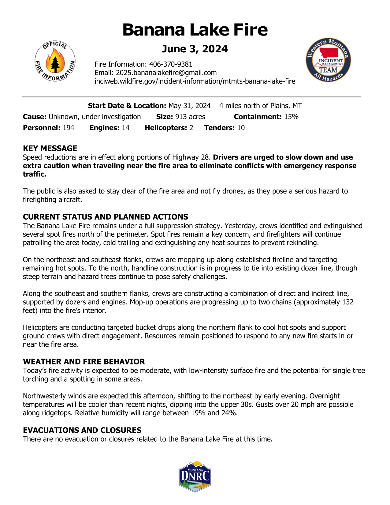
Start Date & Location: May 31, 2024 4 miles north of Plains, MT
Cause: Unknown, under investigation Size: 913 acres Containment: 15%
Personnel: 194 Engines: 14 Helicopters: 2 Tenders: 10
KEY MESSAGE
Speed reductions are in effect along portions of Highway 28. Drivers are urged to slow down and use extra caution when traveling near the fire area to eliminate conflicts with emergency response traffic.
The public is also asked to stay clear of the fire area and not fly drones, as they pose a serious hazard to firefighting aircraft.
CURRENT STATUS AND PLANNED ACTIONS
The Banana Lake Fire remains under a full suppression strategy. Yesterday, crews identified and extinguished several spot fires north of the perimeter. Spot fires remain a key concern, and firefighters will continue patrolling the area today, cold trailing and extinguishing any heat sources to prevent rekindling.
On the northeast and southeast flanks, crews are mopping up along established fireline and targeting remaining hot spots. To the north, handline construction is in progress to tie into existing dozer line, though steep terrain and hazard trees continue to pose safety challenges.
Along the southeast and southern flanks, crews are constructing a combination of direct and indirect line, supported by dozers and engines. Mop-up operations are progressing up to two chains (approximately 132 feet) into the fire’s interior.
Helicopters are conducting targeted bucket drops along the northern flank to cool hot spots and support ground crews with direct engagement. Resources remain positioned to respond to any new fire starts in or near the fire area.
WEATHER AND FIRE BEHAVIOR
Today’s fire activity is expected to be moderate, with low-intensity surface fire and the potential for single tree torching and a spotting in some areas.
Northwesterly winds are expected this afternoon, shifting to the northeast by early evening. Overnight temperatures will be cooler than recent nights, dipping into the upper 30s. Gusts over 20 mph are possible along ridgetops. Relative humidity will range between 19% and 24%.
EVACUATIONS AND CLOSURES
There are no evacuation or closures related to the Banana Lake Fire at this time.
Daily Update Horse River Jenkins Creek Fires 06 03 2025
Related Incident: Jenkins Creek FireHorse River Fire
Publication Type: News
A National Incident Management Organization (NIMO) Team is managing the Jenkins Creek and Horse River fires under a full suppression strategy. Ensuring public and firefighter safety remain a primary priority.
The Jenkins Creek Fire received only trace of rain yesterday and no lightning occurred over the fire. In contrast, the Horse River Fire received up to one-quarter inch of rain with lightning.
Crews on the Jenkins Creek Fire located and suppressed three sources of heat within the northern half of the fire. Crews in the Boundary Waters Canoe Area Wilderness located two sources of heat within the Horse River Fire yesterday and successfully secured these areas of heat.
Jenkins Creek Fire Quick Facts
Size: 16,091 acres Containment:94% Personnel:204
Light rain occurred over the northern half of the fire, but was likely insufficient to increase fuel moisture enough to significantly moderate fire behavior. Unmanned Aerial System (UAS/drone) missions to improve mapping of the Jenkins Creek Fire perimeter and to locate residual areas of heat will continue today. Winds in the late afternoon yesterday precluded the use of aircraft. No additional sources of heat were detected in the southern half of the fire. A culvert was replaced yesterday as part of the effort to repair roads impacted by suppression efforts. Grading of the 113 and 120 roads has been completed, grading of the 420 Road will continue today. Trees weakened by bug-kill, the fire, and yesterday’s winds, will require crews to exercise caution today as they return to the fire. We refer to falling trees and limbs as ‘hit-by-hazards’ and are a persistent risk to crews on the fire. The on-going focus of today’s operations will be to patrol, monitor, and secure those areas of heat that the UAS crews have identified over the last several days.
Horse River Fire Quick Facts
Size: 13 acres Containment: 0% Personnel: 24
The Horse River Fire was relatively quiet yesterday. Yesterday, the Wildland Fire Modules working in the Boundary Waters Canoe Area Wilderness located and suppressed two areas of heat on the Horse River Fire. The crews will continue to improve the mapping of the fire’s perimeter. The plan for today’s operation will be to continue to methodically work their way across the body of the fire, locating any residual heat and working those areas to thoroughly extinguish any remaining heat on the fire. Crews will continue to map the perimeter of the fire.
Fire Weather & Behavior: Though we received rain in the early evening hours yesterday, anticipated thunderstorm activity was light. No lightning strikes occurred over the Jenkins Creek Fire last night. The Horse Creek Fire received up to one-quarter of an inch of rain accompanied by lightning. Today’s weather will be mild, with temperatures only approaching 70 degrees, light winds with gusts to 15 mph in the afternoon, and humidity ranging between 35 – 40%. The cooler temperature are likely to moderate fire behavior. Though we will see another drying trend beginning tomorrow, the outlook is for a continued period of moderate weather that should allow crews to make additional progress in suppressing the Jenkins Creek and Horse River fires.
Driving Hazards: Driving is a crucial part of wildland fire suppression, frequently requiring firefighters to navigate unimproved roads with various pieces of equipment. Distracted driving is the primary source of vehicle accidents for all of us, firefighters and the public alike. The dominant source of distraction is mind wandering. As we let our thoughts steer our attention away from the road we’re traveling, we are all likely putting ourselves and others at risk. Emergency vehicles added to local roads are an additional distraction. Please, stay alert, don’t get hurt.
Daily Update For Horse River and Jenkins Creek Fires 06 02 2025
Related Incident: Jenkins Creek FireHorse River Fire
Publication Type: News
A National Incident Management Organization (NIMO) Team is managing the Jenkins Creek and Horse River fires under a full suppression strategy. Ensuring public and firefighter safety remain a primary priority.
Crews in the Boundary Waters Canoe Area Wilderness have provided better mapping of the perimeter of the Horse River Fire. The fire is now estimated to be 13 acres in size.
Work of the crews on both the Jenkins Creek and Horse River fires will be tested by the weather that we will experience today. We will see higher temperatures that approach the mid-80s, humidity between 25 – 30%, and winds gusting between 25 – 30 mph. These are near red flag warning conditions that can produce extreme fire weather and fire behavior.
Jenkins Creek Fire Quick Facts
Size: 16,091 acres Containment:94% Personnel:212
An additional Wildland Fire Module, equipped with another Unmanned Aerial System (UAS/drone), will assist in mapping of the perimeter of the Jenkins Creek Fire. The existing UAS crew will continue their missions, flying at night, to identify remaining residual heat within the perimeter of the fire. Yesterday, helicopter water drops occurred in the northwest area of the fire. Crews will revisit this area, and the area of fire previously worked in the vicinity of Laird Creek, to make sure they are secure. No additional sources of heat were detected yesterday in the southern area of the fire. Multiple sources of heat were worked in the northern half of the fire. Hazard tree removal in the area of the Cadotte Campground has been paused for today in anticipation of predicted fire weather conditions. Infrared drone flights to detect residual heat sources will continue to be used to strategically direct crews to identified heat sources. Anticipating the possibility of active fire behavior with the change in weather, the primary focus of today’s operations will be to patrol, monitor, and secure those areas of heat that the crews have been working over the last several days.
Horse River Fire Quick Facts
Size: 13 acres Containment: 0% Personnel: 23
The two Wildland Fire Modules working in the Boundary Waters Canoe Area Wilderness will continue to directly engage the Horse River Fire. The crews are also providing improved mapping of the fire. As they hike along the perimeter of the fire, they are capturing GPS coordinates of the fire perimeter which provides a more accurate picture of the fire. The crews will continue to methodically work their way across an environment that is not only remote, but difficult to traverse, continuing to locate and suppress sources of heat on the fire.
Fire Weather & Behavior: Overnight temperatures were approximately 10 degrees warmer than what we’ve experienced in the last week. We will see a noticeable change in fire weather conditions today. Temperatures will reach the mid-80s, winds will approach 25 to 30 mph, relative humidities will be between 25 and 30%. These are near red flag warning conditions. The possibility of thunderstorms begins this evening and is likely to continue throughout the night. These storms are likely to bring rain, but will also bring strong wind gusts that are likely to result in windthrow of fire damaged trees and tree limbs. These storms may bring lightning as well.
Northland Alert: Fire season is still ahead of us. It might be appropriate to think of enrolling in the St. Louis County Northland Alert program if you already haven’t. This system allows you to receive emergency notifications in a variety of formats that include phone notifications, text messages, or email. You’ll find information for Northland Alert here: https://sheriff-slcgis.hub.arcgis.com/pages/northland-alert.
Banana Lake Fire Update 06 02 2025
Related Incident: Banana Lake Fire
Publication Type: News
Banana Lake Fire Update
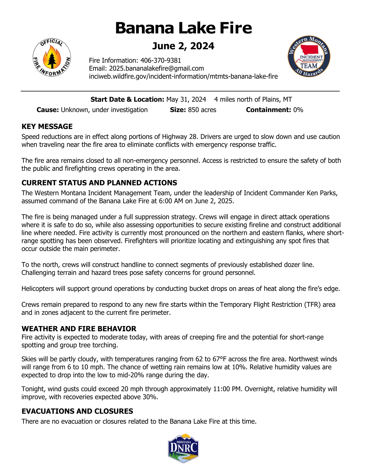
Start Date & Location: May 31, 2024 4 miles north of Plains, MT
Cause: Unknown, under investigation Size: 850 acres Containment: 0%
KEY MESSAGE
Speed reductions are in effect along portions of Highway 28. Drivers are urged to slow down and use caution when traveling near the fire area to eliminate conflicts with emergency response traffic.
The fire area remains closed to all non-emergency personnel. Access is restricted to ensure the safety of both the public and firefighting crews operating in the area.
CURRENT STATUS AND PLANNED ACTIONS
The Western Montana Incident Management Team, under the leadership of Incident Commander Ken Parks, assumed command of the Banana Lake Fire at 6:00 AM on June 2, 2025.
The fire is being managed under a full suppression strategy. Crews will engage in direct attack operations where it is safe to do so, while also assessing opportunities to secure existing fireline and construct additional line where needed. Fire activity is currently most pronounced on the northern and eastern flanks, where short-range spotting has been observed. Firefighters will prioritize locating and extinguishing any spot fires that occur outside the main perimeter.
To the north, crews will construct handline to connect segments of previously established dozer line. Challenging terrain and hazard trees pose safety concerns for ground personnel.
Helicopters will support ground operations by conducting bucket drops on areas of heat along the fire’s edge.
Crews remain prepared to respond to any new fire starts within the Temporary Flight Restriction (TFR) area and in zones adjacent to the current fire perimeter.
WEATHER AND FIRE BEHAVIOR
Fire activity is expected to moderate today, with areas of creeping fire and the potential for short-range spotting and group tree torching.
Skies will be partly cloudy, with temperatures ranging from 62 to 67°F across the fire area. Northwest winds will range from 6 to 10 mph. The chance of wetting rain remains low at 10%. Relative humidity values are expected to drop into the low to mid-20% range during the day.
Tonight, wind gusts could exceed 20 mph through approximately 11:00 PM. Overnight, relative humidity will improve, with recoveries expected above 30%.
EVACUATIONS AND CLOSURES
There are no evacuation or closures related to the Banana Lake Fire at this time.
Paradise Fire update for June 2 2025 06 02 2025
Related Incident: Paradise Fire
Publication Type: News
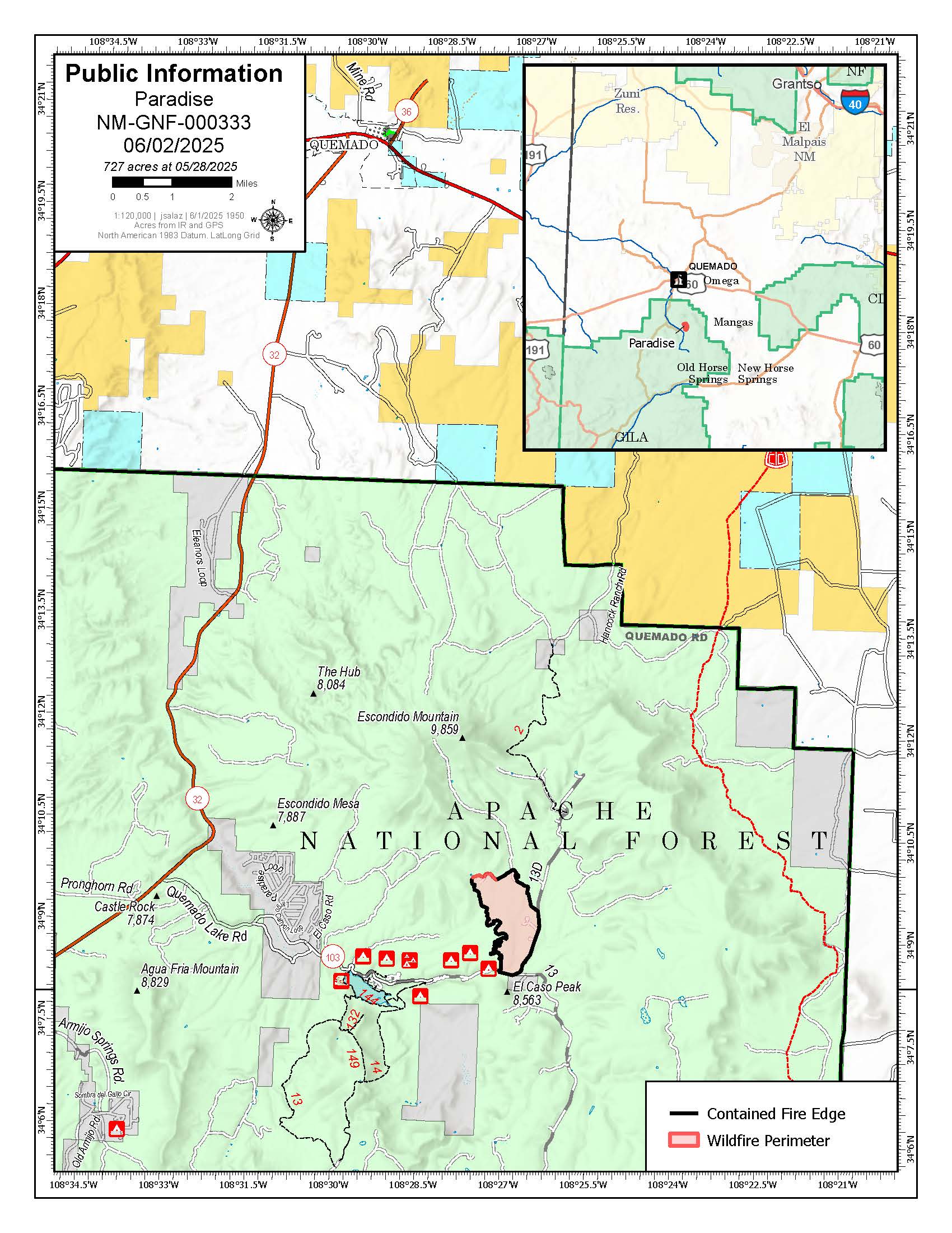
Acres: 727
Start Date: Monday, May 26, 2025
Location: 13 miles south of Quemado, NM Personnel: 115
Containment: 92%
Cause: Human-caused, under investigation
Summary: The Paradise Fire north of Quemado Lake is now 92% contained at 727 acres.
Yesterday, the Burned Area Emergency Response team began assessing the impacts of the fire to determine possible treatment needs with the aim of stabilizing and preventing degradation of natural and cultural resources.
Today, the Gila Las Cruces Type 3 Incident Management Team stands ready for initial attack on any new starts that may result from passing thunderstorms. Tuesday morning, command of the Paradise Fire will transfer to a smaller Type 4 organization, composed of local firefighting resources. This will be the final daily update on the Paradise Fire unless conditions change significantly.
Quemado Lake is open for public use, and on Tuesday, Road 13D/Baca Road will also open to the public. Visitors should use caution for their own safety as well as the protection of firefighters.
Weather: The high temperature today is expected to be in the upper 60s. Showers and then thunderstorms are likely.
Safety: It will still be important to stay diligent and travel cautiously in the fire area and around fire personnel.
Smoke: Local air quality ratings are good. For real-time smoke conditions, visit: https://fire.airnow.gov/.
Fire Restrictions: Stage 2 Fire Restrictions are in place on the Gila National Forest. For full details, visit https://www.fs.usda.gov/r03/gila/alerts/stage-2-fire-restrictions.
For more information:
Public Information Officer: Email Maribeth.Pecotte@usda.govor 575-388-8211, 8am - 8pm
Incident Information: https://inciweb.wildfire.gov/incident-information/nmgnf-paradise-fire
Facebook: www.facebook.com/GilaNForest
Banana Lake Fire Update 06 01 2025
Related Incident: Banana Lake Fire
Publication Type: News
Location: 4 miles north of Plains, MT
Start Date: 5/31/2025
Cause: Unknown; Size: 850 acres
Completion/Containment: 0%
Resources on scene: 17 Engines; 2 Helicopters; 2 Type 2 Hand Crews; 1 Interagency Hotshot Crew; 1 10-Person Module; 3 Dozers; 1 Skidgen; and 3 Water Tenders
Key Message
There are currently no evacuation orders in place for the fire.
Current Status
Yesterday, May 31, at 4:25 p.m. a fire was reported near Banana Lake, 4 miles north of Plains, MT. DNRC Plains Unit and local government resources responded. The fire is located between Locust Hill and Highway 28. Resources worked through the night doing structure protection. The fire saw moderate behavior overnight.
Today June 1, multiple resources have arrived on scene and will be working to construct containment line around the fire. The fire is currently 850 acres. Fire behavior is moderate and burning in open timber with frequent torching and spotting during the heat of the day. The fire is still currently under investigation and smoke will be seen in the area over the next few days. Please avoid the area to allow firefighters safe access.
An IMT3 (Incident Management Type 3 Team) has been ordered and will arrive tonight for in-briefing tomorrow morning.
Weather and Fire Behavior
Clear and sunny skies are expected with west winds varying between 5-15 mph. Daily temperatures will be in the mid to upper 70s with minimum humidity at 18-28 percent. No precipitation is forecasted.
EVACUATIONS AND Closures
There are currently no evacuation or closure orders in effect.
Settings - change map background and toggle additional layers
Filter - control incident types displayed on map.
Zoom to your location
Reset map zoom and position
Could not determine your location.
Show Legend
 Wildfire
 Prescribed Fire
 Burned Area
Response
Burned Area
Response Other
Other
Banana Lake Fire
Unit Information
Incident Contacts
During the Cody Fire a structure group was deployed to help assess future needs for the Oracle residents 06 01 2025
Related Incident: Cody Fire
Publication Type: News
Our top priorities are firefighter and public safety. When wildfires threaten our communities, every second and every resource counts. Fire crews use a process called “structure triage” to quickly decide which homes can be safely defended. By assessing fire behavior, available resources, surrounding vegetation, and structure conditions, tough calls are made, sometimes with minutes to spare. Even if your home isn’t directly threatened, it’s critical to ensure your house is Firewise and to follow all evacuation orders.
During the Cody Fire, a structure group was deployed to help assess future needs for the Oracle residents. Firefighters from the Southwest Area Incident Management Team 4 went from home to home assessing the current status. These evaluations help communities and land managers know where work needs to be done to help reduce the risk to property.
Residents present during evaluations can expect to hear numbers or words being used as this process takes place. Categories for structure triage can be assigned numbers or abbreviations for quick identification and communication. For example, a system might use 1, 2, 3, or letters like D-SA, D-PH, ND-PL, ND-RDB, to represent different levels of defensibility.
Defensible - Standalone: Safe zone nearby, minimal threat. These homes can often stand on their own with minimal support.
Defensible - Prep & Hold: Firefighters stay and protect these homes during the fire front because they are at risk, but defendable.
Non-Defensible - Prep & Leave: No safety zone, moderate risk. Firefighters do what they can quickly, then retreat before it gets too dangerous.
Non-Defensible - Rescue Drive-by: No safety zone and serious risk. Firefighters focus on evacuating anyone inside and then must leave.
By making your home Defensible – Standalone, you not only reduce the risk for your property, but also for those around you.
Stay safe, stay prepared, and thank you for supporting our crews on the frontlines by being Firewise.