
Single Publication
Pioneer Fire evacuation levels changing 06-14-2024
Publication Type: Announcement - 06/14/2024 - 12:30
From Chelan County Emergency Management:
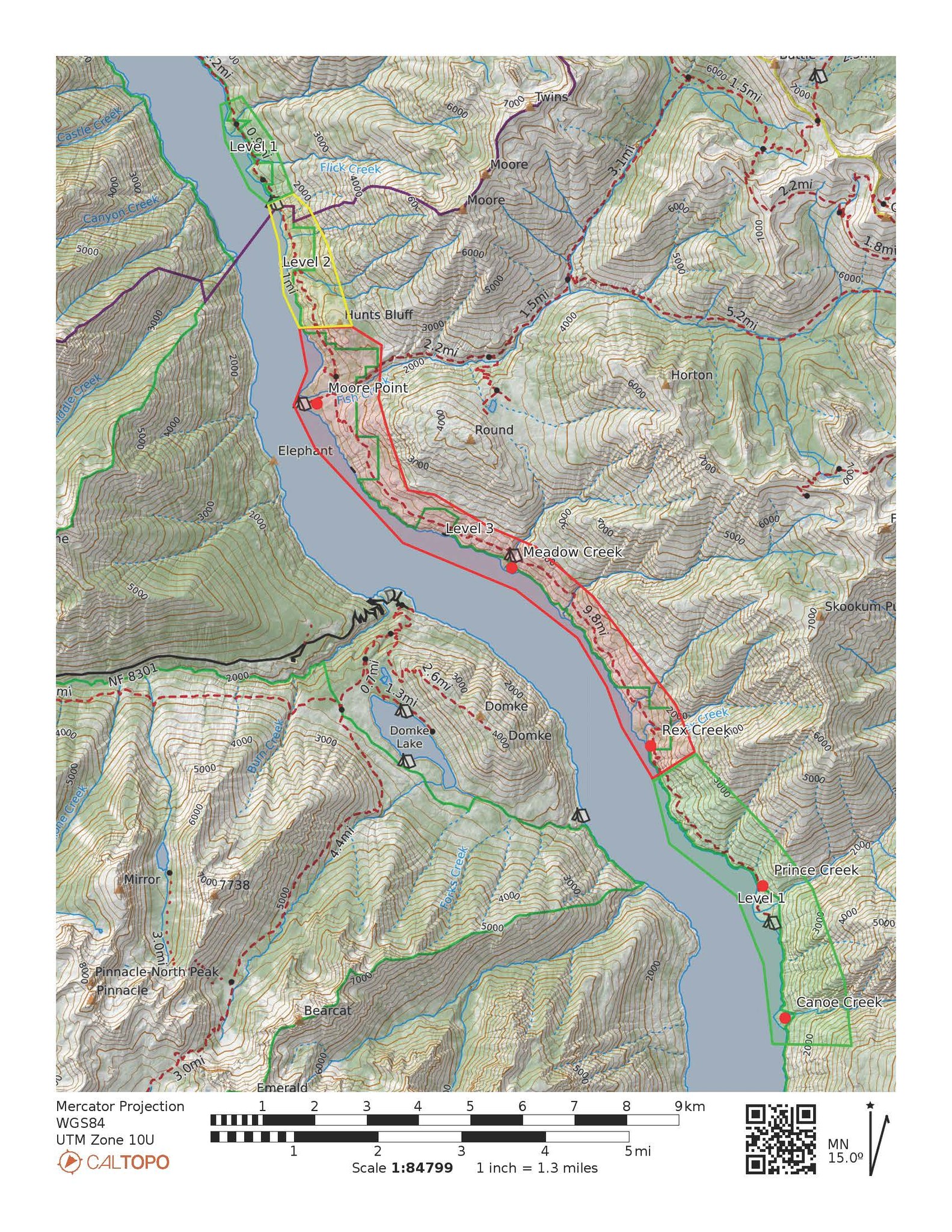
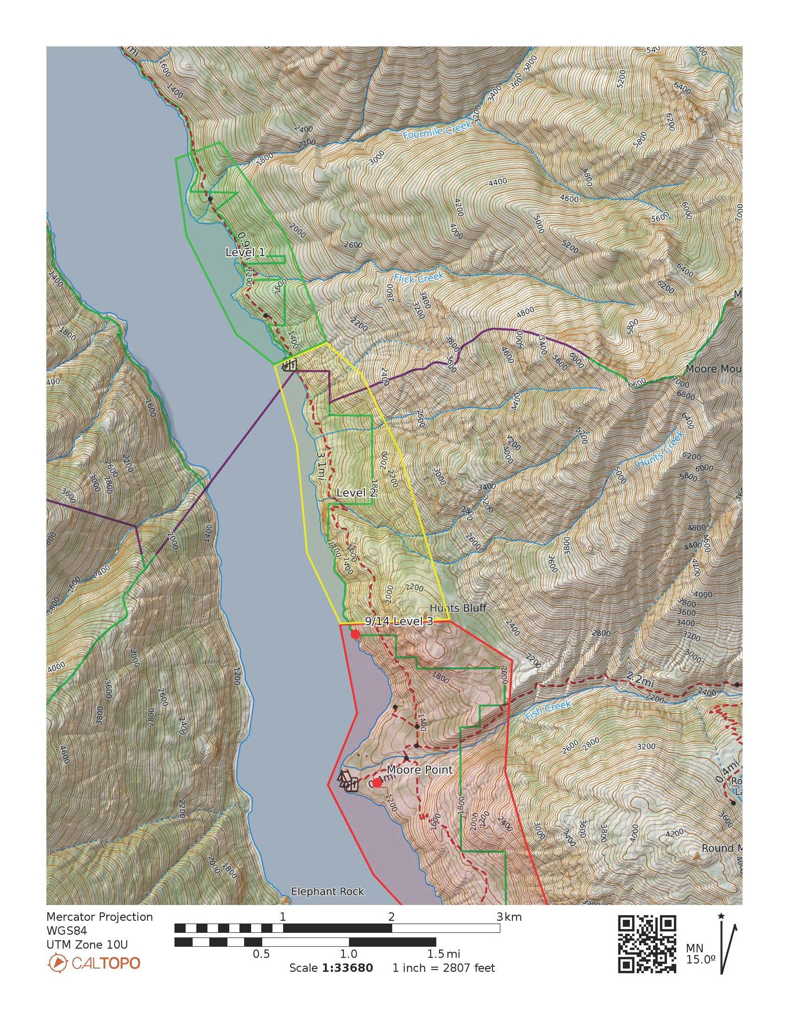
PIONEER FIRE EVACUATION LEVEL UPDATES: Evacuation levels are expanded on the Pioneer Fire, which is burning on the north shore of upper Lake Chelan. Below we have attached a map of the evacuation levels as well as a close-up map of those evacuation levels up river.
Level 3: Rex Creek to just north of Moore Point, Level 3, in red, means leave the area immediately, or stay out of this area.
Level 2: Just North of Moore Point to and including Flick Creek Campground. Level 2, in yellow, means prepare yourself so you are able to leave the area immediately.
Level 1 (up lake): Flick Creek Campground to and including the Fourmile Creek camping area. Level 1, in green, means closely monitor the wildfire activity in your area.
Level 1 (down lake): Rex Creek to and including Canoe Creek.
The Chelan County Emergency Incidents Map is being updated. Monitor the map at https://chelangis.maps.arcgis.com/.../media/index.html...