
Highlighted Media
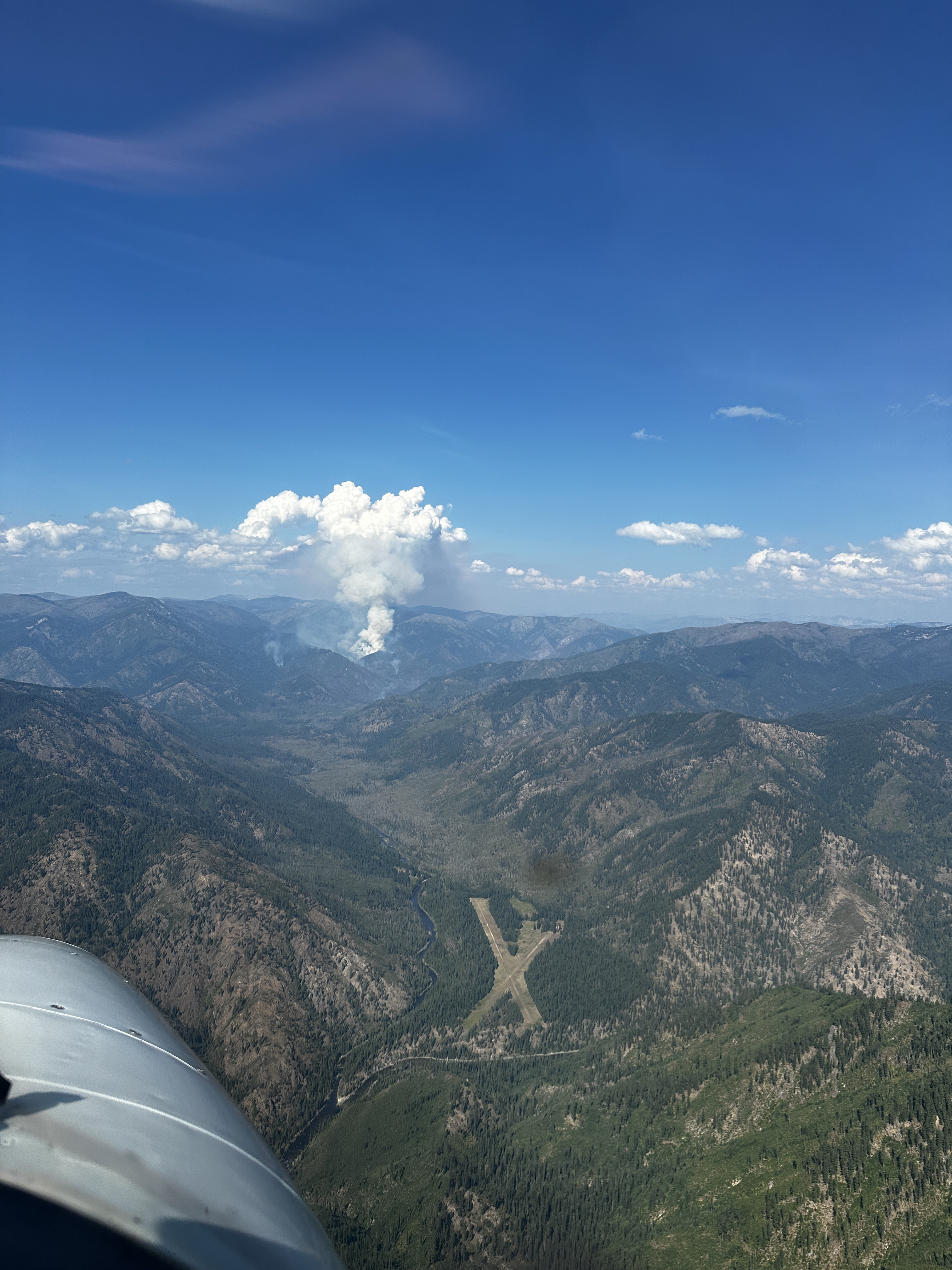
The Wye Fire putting up a sizable column of smoke on August 17, 2024. The Moose Creek Air Strip is visible, where the cleared out "X" is located.
On July 24, 2024, a lightning storm that produced an abundant amount of fire starts across the Grangeville Dispatch Area ignited the Wye Fire on the Moose Creek Ranger District. The fire is burning in a previous burn scar and is creeping and smoldering, with moderated fire behavior at times.
| Current as of | Fri, 08/30/2024 - 19:02 |
|---|---|
| Incident Type | Wildfire |
| Cause | Lightning |
| Date of Origin | |
| Location | East Moose creek Bridge to Elbow Bend impacted |
| Incident Commander | Moose Creek Ranger District Fire Management |
| Coordinates |
46° 12' 20.0628'' Latitude
-114° 49' 34.32
'' Longitude
|
| Total Personnel: | 4 |
|---|---|
| Size | 7,739 Acres |
| Planned Actions |
Firefighters are currently working on structure protection for Shissler Peak Lookout and Moose Creek Ranger Station. |
|---|---|
| Projected Incident Activity |
Fire continues to burn in a recent burn scar. The fire is creeping and smoldering, with moderated fire behavior at times. Fire activity could increase over the holiday weekend with the hotter, drier temperatures. |
| Remarks |
Trail Closures in EffectMoose Creek Ranger Station Vicinity:
Elk Summit Vicinity:
ALL TRAILS WITHIN THE SELWAY BITTERROOT WILDERNESS MAY BE SEVERELY IMPACTED BY BLOWDOWN!
Smoke may drift to the east and impact portions of the Bitterroot Valley (for more smoke information, please visit https://idsmoke.blogspot.com/. |
| Weather Concerns | Hot and dry weather will occur through the Labor Day Weekend. The next chance for precipitation will be late Monday and |
|---|